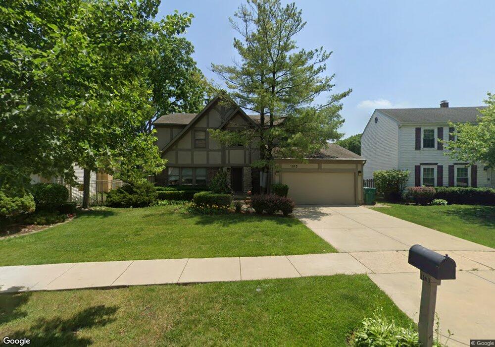
1163 Devonshire Rd Buffalo Grove, IL 60089
Prairie Park-Lake County NeighborhoodEstimated Value: $520,033 - $605,000
Studio
3
Baths
2,199
Sq Ft
$263/Sq Ft
Est. Value
About This Home
This home is located at 1163 Devonshire Rd, Buffalo Grove, IL 60089 and is currently estimated at $579,008, approximately $263 per square foot. 1163 Devonshire Rd is a home located in Lake County with nearby schools including Prairie Elementary School, Twin Groves Middle School, and Adlai E Stevenson High School.
Ownership History
Date
Name
Owned For
Owner Type
Purchase Details
Closed on
Oct 6, 2015
Sold by
Copeland Neal J and Copeland Susan M
Bought by
Copeland Neal J and Copeland Susan M
Current Estimated Value
Home Financials for this Owner
Home Financials are based on the most recent Mortgage that was taken out on this home.
Original Mortgage
$397,183
Interest Rate
4%
Mortgage Type
VA
Purchase Details
Closed on
Aug 18, 2004
Sold by
Copeland Neal J and Siegel Susan M
Bought by
Copelan Neal J and Copeland Susan M
Purchase Details
Closed on
Sep 1, 1999
Sold by
Seigel Susan M and Siegel Leonard M
Bought by
Copeland Neal and Siegel Susan M
Home Financials for this Owner
Home Financials are based on the most recent Mortgage that was taken out on this home.
Original Mortgage
$208,000
Interest Rate
7.77%
Create a Home Valuation Report for This Property
The Home Valuation Report is an in-depth analysis detailing your home's value as well as a comparison with similar homes in the area
Home Values in the Area
Average Home Value in this Area
Purchase History
| Date | Buyer | Sale Price | Title Company |
|---|---|---|---|
| Copeland Neal J | -- | Title 365 Coraopolis | |
| Copelan Neal J | -- | -- | |
| Copeland Neal | -- | Greater Illinois Title Compa |
Source: Public Records
Mortgage History
| Date | Status | Borrower | Loan Amount |
|---|---|---|---|
| Closed | Copeland Neal J | $397,183 | |
| Closed | Copeland Neal | $208,000 |
Source: Public Records
Tax History
| Year | Tax Paid | Tax Assessment Tax Assessment Total Assessment is a certain percentage of the fair market value that is determined by local assessors to be the total taxable value of land and additions on the property. | Land | Improvement |
|---|---|---|---|---|
| 2024 | $13,430 | $155,716 | $33,733 | $121,983 |
| 2023 | $12,984 | $146,930 | $31,830 | $115,100 |
| 2022 | $12,984 | $135,517 | $29,357 | $106,160 |
| 2021 | $12,486 | $134,055 | $29,040 | $105,015 |
| 2020 | $12,194 | $134,512 | $29,139 | $105,373 |
| 2019 | $12,031 | $134,017 | $29,032 | $104,985 |
| 2018 | $11,670 | $134,264 | $28,693 | $105,571 |
| 2017 | $11,444 | $131,130 | $28,023 | $103,107 |
| 2016 | $11,124 | $125,567 | $26,834 | $98,733 |
| 2015 | $11,182 | $117,429 | $25,095 | $92,334 |
| 2014 | $10,244 | $105,531 | $26,952 | $78,579 |
| 2012 | $10,167 | $105,742 | $27,006 | $78,736 |
Source: Public Records
Map
Nearby Homes
- 1234 Devonshire Rd
- 1265 Devonshire Rd
- 1318 Gail Dr Unit 4
- 1361 Brandywyn Ln
- 1152 Courtland Dr Unit 406
- 327 Lasalle Ln
- 810 Silver Rock Ln
- 1380 Larchmont Dr
- 962 Thompson Blvd
- 1161 Parker Ln
- 5176 Aptakisic Rd
- 531 Lasalle Ln
- 5107 N Arlington Heights Rd
- 938 Hidden Lake Dr
- 1096 Pine Tree Cir N
- 533 Lyon Dr
- 1265 Franklin Ln Unit L1
- 1325 Fairfax Ln
- 5135 Bridlewood Ct
- 126 Autumn Ct Unit CT76021
- 1169 Devonshire Rd
- 1157 Devonshire Rd
- 1175 Devonshire Rd Unit 1
- 1151 Devonshire Rd
- 1164 Devonshire Rd
- 1154 Devonshire Rd
- 1172 Brandywyn Ln
- 1166 Brandywyn Ln
- 1174 Devonshire Rd
- 1181 Devonshire Rd
- 1145 Devonshire Rd
- 1144 Devonshire Rd
- 1130 Brandywyn Ct
- 1184 Devonshire Rd
- 1187 Devonshire Rd
- 1136 Brandywyn Ct Unit 1
- 1180 Brandywyn Ln
- 1165 Dayton Rd
- 1175 Dayton Rd
- 1160 Brandywyn Ln
Your Personal Tour Guide
Ask me questions while you tour the home.