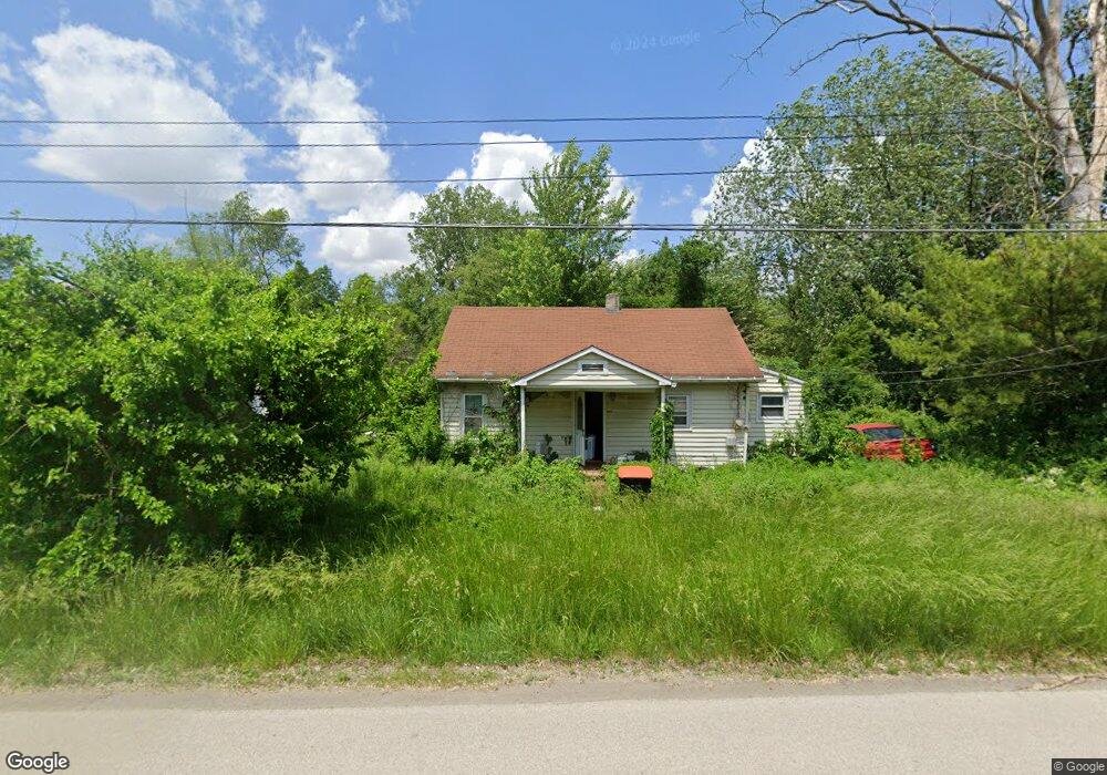
11630 Airport Hwy Swanton, OH 43558
Estimated Value: $51,000 - $140,000
2
Beds
1
Bath
668
Sq Ft
$125/Sq Ft
Est. Value
About This Home
This home is located at 11630 Airport Hwy, Swanton, OH 43558 and is currently estimated at $83,627, approximately $125 per square foot. 11630 Airport Hwy is a home located in Lucas County with nearby schools including Swanton High School, Swanton Middle School, and St. Richard School.
Ownership History
Date
Name
Owned For
Owner Type
Purchase Details
Closed on
Feb 14, 2025
Sold by
Walker Michael
Bought by
Mastin Cody R
Current Estimated Value
Create a Home Valuation Report for This Property
The Home Valuation Report is an in-depth analysis detailing your home's value as well as a comparison with similar homes in the area
Home Values in the Area
Average Home Value in this Area
Purchase History
| Date | Buyer | Sale Price | Title Company |
|---|---|---|---|
| Mastin Cody R | $25,000 | Louisville Title |
Source: Public Records
Tax History Compared to Growth
Tax History
| Year | Tax Paid | Tax Assessment Tax Assessment Total Assessment is a certain percentage of the fair market value that is determined by local assessors to be the total taxable value of land and additions on the property. | Land | Improvement |
|---|---|---|---|---|
| 2024 | $546 | $23,520 | $8,715 | $14,805 |
| 2023 | $809 | $15,925 | $2,730 | $13,195 |
| 2022 | $818 | $15,925 | $2,730 | $13,195 |
| 2021 | $848 | $15,925 | $2,730 | $13,195 |
| 2020 | $715 | $13,545 | $2,240 | $11,305 |
| 2019 | $703 | $13,545 | $2,240 | $11,305 |
| 2018 | $681 | $13,545 | $2,240 | $11,305 |
| 2017 | $623 | $11,620 | $1,540 | $10,080 |
| 2016 | $662 | $33,200 | $4,400 | $28,800 |
| 2015 | $657 | $33,200 | $4,400 | $28,800 |
| 2014 | $659 | $11,620 | $1,540 | $10,080 |
| 2013 | $659 | $11,620 | $1,540 | $10,080 |
Source: Public Records
Map
Nearby Homes
- 0 Airport Hwy Unit 225021918
- 12257 Harriet Rd
- 12922 Airport Hwy
- 10637 Old State Line Rd
- 11344 Monclova Rd
- 11260 Monclova Rd
- 12220 Monclova Rd
- 3725 Eber Rd
- 9800 Salisbury Rd
- 4303 S Berkey Southern Rd
- 9860 Maumee Western Rd
- 13645 Shaffer Rd
- 11835 Angola Rd
- 225 Kierra Ln
- 6416 Abigail Ln
- 9470 Maumee Western Rd
- 13560 Old State Line Rd
- 433 Church St
- 3111 S Crissey Rd
- 3201 S Crissey Rd
- 11640 Airport Hwy
- 11650 Airport Hwy
- 11700 Airport Hwy
- 11710 Airport Hwy
- 11744 Airport Hwy
- 11740 Airport Hwy
- 11722 Airport Hwy
- 2719 S Berkey Southern Rd
- 2771 N Berkey Southern Rd
- 2727 S Berkey Southern Rd
- 2705 S Berkey Southern Rd
- 2785 S Berkey Southern Rd
- 2657 S Berkey Southern Rd
- 2785 N Berkey Southern Rd
- 2749 S Berkey Southern Rd
- 2603 S Berkey Southern Rd
- 2641 S Berkey Southern Rd
- 2748 S Berkey Southern Rd
- 2724 S Berkey Southern Rd
- 2712 S Berkey Southern Rd