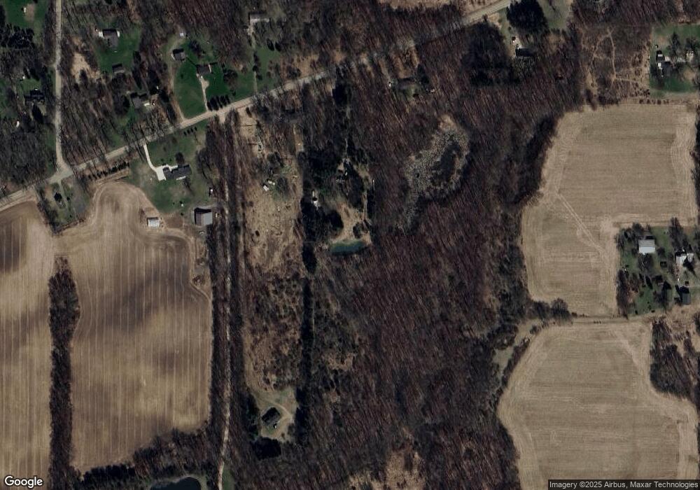
11639 Territorial Rd Munith, MI 49259
Estimated Value: $264,000 - $521,000
3
Beds
2
Baths
1,213
Sq Ft
$287/Sq Ft
Est. Value
About This Home
This home is located at 11639 Territorial Rd, Munith, MI 49259 and is currently estimated at $347,904, approximately $286 per square foot. 11639 Territorial Rd is a home located in Jackson County with nearby schools including Emma Smith Elementary School, Heritage School, and Stockbridge High School.
Ownership History
Date
Name
Owned For
Owner Type
Purchase Details
Closed on
Oct 29, 2008
Sold by
Crandall Paul and Mayer Jo R
Bought by
Crandall Paul and Mayer Jo R
Current Estimated Value
Purchase Details
Closed on
Oct 9, 2007
Sold by
Widrosky Joseph and Widrosky Worth J
Bought by
Crandall Paul and Mayer Jo R
Home Financials for this Owner
Home Financials are based on the most recent Mortgage that was taken out on this home.
Original Mortgage
$100,000
Outstanding Balance
$63,342
Interest Rate
6.49%
Mortgage Type
Purchase Money Mortgage
Estimated Equity
$284,562
Create a Home Valuation Report for This Property
The Home Valuation Report is an in-depth analysis detailing your home's value as well as a comparison with similar homes in the area
Purchase History
| Date | Buyer | Sale Price | Title Company |
|---|---|---|---|
| Crandall Paul | -- | None Available | |
| Crandall Paul | $150,000 | At |
Source: Public Records
Mortgage History
| Date | Status | Borrower | Loan Amount |
|---|---|---|---|
| Open | Crandall Paul | $100,000 |
Source: Public Records
Tax History Compared to Growth
Tax History
| Year | Tax Paid | Tax Assessment Tax Assessment Total Assessment is a certain percentage of the fair market value that is determined by local assessors to be the total taxable value of land and additions on the property. | Land | Improvement |
|---|---|---|---|---|
| 2025 | $2,668 | $138,050 | $0 | $0 |
| 2024 | $10 | $131,900 | $0 | $0 |
| 2023 | $974 | $123,600 | $0 | $0 |
| 2022 | $2,470 | $109,150 | $0 | $0 |
| 2021 | $2,136 | $98,800 | $0 | $0 |
| 2020 | $2,110 | $82,450 | $0 | $0 |
| 2019 | $2,031 | $72,350 | $0 | $0 |
| 2018 | $1,984 | $70,350 | $0 | $0 |
| 2017 | $1,861 | $68,900 | $0 | $0 |
| 2016 | $752 | $67,300 | $20,000 | $47,300 |
| 2015 | $1,759 | $69,550 | $69,550 | $0 |
| 2014 | $1,759 | $65,750 | $65,750 | $0 |
| 2013 | -- | $65,750 | $65,750 | $0 |
Source: Public Records
Map
Nearby Homes
- 5599 S M 52
- 4845 Moechel Rd
- Lot 7 Lucas Ln
- 216 S Center St
- 0 M-52 Unit 291080
- 630 W Main St W
- 0 Harr Rd Unit 25026824
- 0000 Roberts Dr
- 4500 Chapman Rd
- 4053 Eastbridge Rd
- 0 Cassidy Rd Unit 25033809
- 4057 Eastbridge Rd
- 4059 Eastbridge Rd
- 4012 Eastbridge Rd
- 4100 N Main St
- 2598 Heeney Rd
- 15225 Waterloo Munith Rd
- 0000 Chapman Rd
- 2600 Heeney Rd
- 9800 Beeman Rd
- 11633 Territorial Rd
- 11653 Territorial Rd
- Parcel B Territorial
- 11603 Territorial Rd
- 11616 Territorial Rd
- 11620 Territorial Rd
- 11600 Territorial Rd
- 11703 Territorial Rd
- 11625 Territorial Rd
- 13087 Mayer Rd
- 13101 Mayer Rd
- 11901 Parks Rd
- 13060 Mayer Rd
- 0 Mayer Rd
- Vacant Mayer Rd
- 11990 Parks Rd
- 11581 Territorial Rd
- 11985 Territorial Rd
- 13252 Wilmore Rd
- 13252 Wilmore Rd
