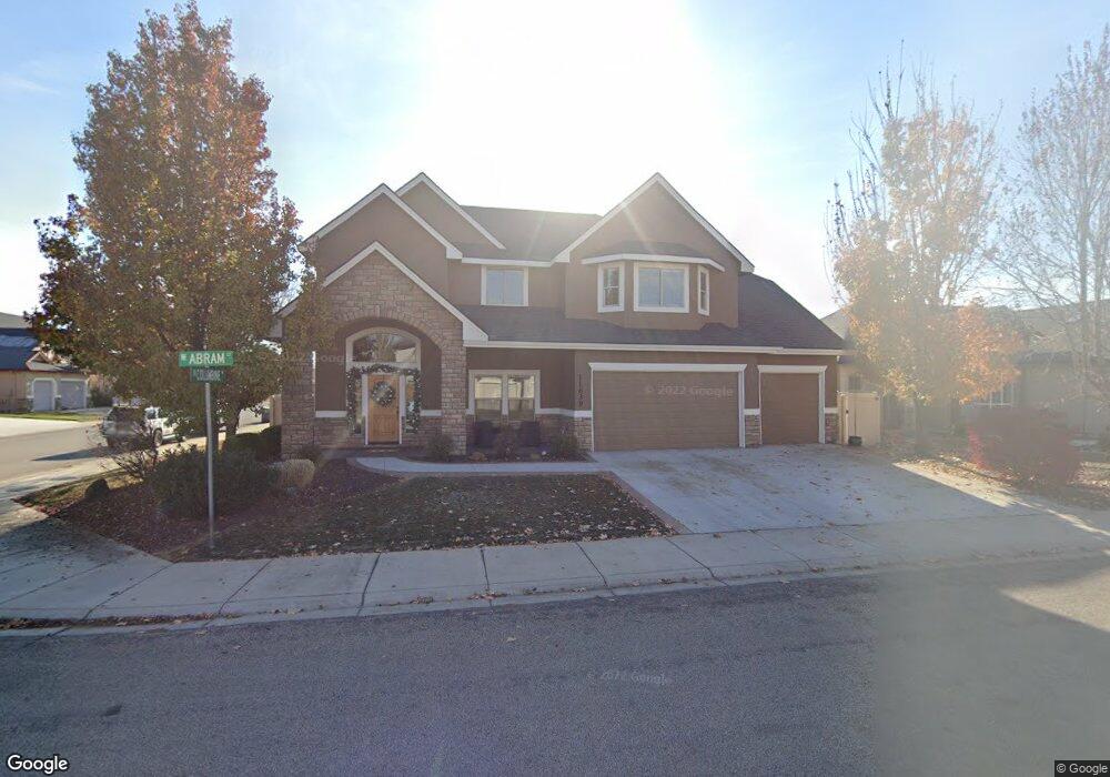
11639 W Abram Ct Boise, ID 83713
West Boise NeighborhoodEstimated Value: $561,000 - $636,000
4
Beds
3
Baths
2,667
Sq Ft
$224/Sq Ft
Est. Value
About This Home
This home is located at 11639 W Abram Ct, Boise, ID 83713 and is currently estimated at $598,557, approximately $224 per square foot. 11639 W Abram Ct is a home located in Ada County with nearby schools including Ustick Elementary School, Lewis & Clark Middle School, and Centennial High School.
Ownership History
Date
Name
Owned For
Owner Type
Purchase Details
Closed on
Feb 28, 2013
Sold by
Fessinger Fay F and Messinger Jean C
Bought by
Bailey Robert M and Bailey Mitzi M
Current Estimated Value
Home Financials for this Owner
Home Financials are based on the most recent Mortgage that was taken out on this home.
Original Mortgage
$253,400
Interest Rate
3.34%
Mortgage Type
New Conventional
Purchase Details
Closed on
Feb 27, 2013
Sold by
Desalvio John and Desalvio Bridgette
Bought by
Messinger Fay L
Home Financials for this Owner
Home Financials are based on the most recent Mortgage that was taken out on this home.
Original Mortgage
$253,400
Interest Rate
3.34%
Mortgage Type
New Conventional
Purchase Details
Closed on
Feb 18, 2009
Sold by
Federal Home Loan Mortgage Corporation
Bought by
Desalvio John and Desalvio Bridgette
Home Financials for this Owner
Home Financials are based on the most recent Mortgage that was taken out on this home.
Original Mortgage
$200,305
Interest Rate
4.92%
Mortgage Type
FHA
Purchase Details
Closed on
Feb 11, 2009
Sold by
Taylor Bean & Whitaker Mortgage Corp
Bought by
Federal Home Loan Mortgage Corp
Home Financials for this Owner
Home Financials are based on the most recent Mortgage that was taken out on this home.
Original Mortgage
$200,305
Interest Rate
4.92%
Mortgage Type
FHA
Purchase Details
Closed on
Dec 8, 2008
Sold by
Walker Jackie G
Bought by
Mortgage Electronic Registration Systems and Taylor Bean & Whitaker Mortgage Corp
Purchase Details
Closed on
Feb 4, 2008
Sold by
Walker Jackie G
Bought by
Opm Enterprises Inc
Create a Home Valuation Report for This Property
The Home Valuation Report is an in-depth analysis detailing your home's value as well as a comparison with similar homes in the area
Home Values in the Area
Average Home Value in this Area
Purchase History
| Date | Buyer | Sale Price | Title Company |
|---|---|---|---|
| Bailey Robert M | -- | Pioneer Title Company Of Ad | |
| Messinger Fay L | -- | Pioneer Title Company Of Ada | |
| Desalvio John | -- | First American Title & | |
| Federal Home Loan Mortgage Corp | -- | First American Title & | |
| Mortgage Electronic Registration Systems | $323,832 | First American Title | |
| Opm Enterprises Inc | -- | Accommodation |
Source: Public Records
Mortgage History
| Date | Status | Borrower | Loan Amount |
|---|---|---|---|
| Closed | Bailey Robert M | $253,400 | |
| Previous Owner | Desalvio John | $200,305 |
Source: Public Records
Tax History Compared to Growth
Tax History
| Year | Tax Paid | Tax Assessment Tax Assessment Total Assessment is a certain percentage of the fair market value that is determined by local assessors to be the total taxable value of land and additions on the property. | Land | Improvement |
|---|---|---|---|---|
| 2025 | $2,498 | $569,500 | -- | -- |
| 2024 | $2,964 | $502,800 | -- | -- |
| 2023 | $2,964 | $550,900 | $0 | $0 |
| 2022 | $3,170 | $594,500 | $0 | $0 |
| 2021 | $3,524 | $526,900 | $0 | $0 |
| 2020 | $2,955 | $396,500 | $0 | $0 |
| 2019 | $4,032 | $414,800 | $0 | $0 |
| 2018 | $3,507 | $346,900 | $0 | $0 |
| 2017 | $3,255 | $315,500 | $0 | $0 |
| 2016 | $3,129 | $297,000 | $0 | $0 |
| 2015 | $2,877 | $279,200 | $0 | $0 |
| 2012 | -- | $197,400 | $0 | $0 |
Source: Public Records
Map
Nearby Homes
- 11934 W Ardyce St
- 11288 W Race Ct
- 12030 W Abram St
- 11303 W Tahiti St
- 11336 W Poppy St
- 12088 W Ardyce St
- 2104 N Bryson Rd
- 11349 W Marlinwood St
- 2870 N Cloverdale Rd
- 2281 N Shaelyn Ln
- 2299 N Shaelyn Ln
- 2293 N Shaelyn Ln
- 2834 N Cloverdale Rd Unit 146
- 2814 N Cloverdale Rd
- 12148 W Clover Meadows Dr
- 1931 N Delmar St
- 11459 W Olympus Ct
- Plan 1910 at Mooseland
- Plan 2301 at Mooseland
- Plan 2800 at Mooseland
- 11667 W Abram Ct
- 2662 N
- 2609 N Columbine Ave
- 11656 W Granger St
- 2646 N Columbine Ave
- 11685 W Abram Ct
- 2662 N Columbine Ave
- 11640 W Abram Ct
- 11640 W
- 11682 W Abram Ct
- 2608 N Columbine Ave
- 11674 W Granger St
- 2680 N Columbine Ave
- 11684 W Abram Ct
- 11713 W Abram Ct
- 2712 N Columbine Ave
- 11653 W Granger St
- 11546 W Granger St
- 11702 W Granger St
- 11631 W