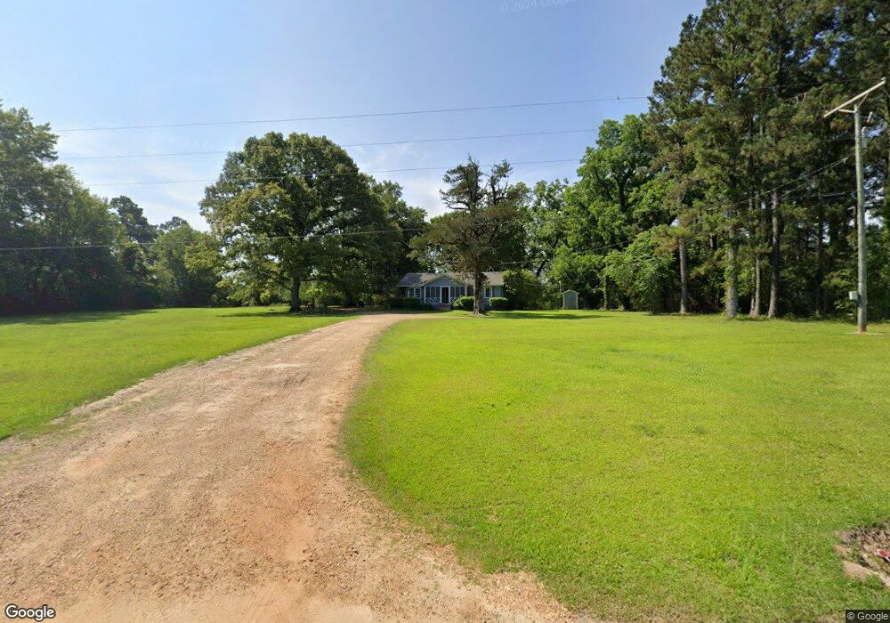
1164 Beauregard Rd Wesson, MS 39191
Estimated Value: $108,000 - $162,000
Studio
1
Bath
1,647
Sq Ft
$79/Sq Ft
Est. Value
About This Home
This home is located at 1164 Beauregard Rd, Wesson, MS 39191 and is currently estimated at $129,435, approximately $78 per square foot. 1164 Beauregard Rd is a home located in Copiah County.
Ownership History
Date
Name
Owned For
Owner Type
Purchase Details
Closed on
Jan 21, 2022
Sold by
Hart Malvin Keith and Hart Susan Desiree
Bought by
Powell Lyndsay
Current Estimated Value
Purchase Details
Closed on
Jun 11, 2021
Sold by
Martin Charles R
Bought by
Teen Alvin F and Steen Betty S
Purchase Details
Closed on
Aug 14, 2018
Sold by
Holloway Linda M
Bought by
Hart Malvin K
Home Financials for this Owner
Home Financials are based on the most recent Mortgage that was taken out on this home.
Original Mortgage
$111,111
Interest Rate
4.5%
Mortgage Type
New Conventional
Purchase Details
Closed on
Jan 2, 2008
Sold by
J & N Timber Inc
Bought by
Holloway Linda M
Home Financials for this Owner
Home Financials are based on the most recent Mortgage that was taken out on this home.
Original Mortgage
$75,832
Interest Rate
5.94%
Mortgage Type
Credit Line Revolving
Create a Home Valuation Report for This Property
The Home Valuation Report is an in-depth analysis detailing your home's value as well as a comparison with similar homes in the area
Purchase History
| Date | Buyer | Sale Price | Title Company |
|---|---|---|---|
| Powell Lyndsay | -- | None Listed On Document | |
| Teen Alvin F | -- | None Available | |
| Hart Malvin K | -- | -- | |
| Holloway Linda M | $60,000 | -- |
Source: Public Records
Mortgage History
| Date | Status | Borrower | Loan Amount |
|---|---|---|---|
| Previous Owner | Hart Malvin K | $111,111 | |
| Previous Owner | Holloway Linda M | $75,832 |
Source: Public Records
Tax History
| Year | Tax Paid | Tax Assessment Tax Assessment Total Assessment is a certain percentage of the fair market value that is determined by local assessors to be the total taxable value of land and additions on the property. | Land | Improvement |
|---|---|---|---|---|
| 2025 | $469 | $7,748 | $0 | $0 |
| 2024 | $5 | $6,676 | $0 | $0 |
| 2023 | $478 | $6,676 | $0 | $0 |
| 2022 | $487 | $6,676 | $0 | $0 |
| 2021 | $464 | $6,676 | $0 | $0 |
| 2020 | $453 | $6,248 | $0 | $0 |
| 2019 | $463 | $6,248 | $0 | $0 |
| 2018 | $936 | $8,290 | $0 | $0 |
| 2017 | $382 | $8,290 | $0 | $0 |
| 2016 | $382 | $5,461 | $0 | $0 |
| 2015 | -- | $5,461 | $0 | $0 |
| 2014 | -- | $5,461 | $0 | $0 |
Source: Public Records
Map
Nearby Homes
- 3085 Beauregard Rd
- 0 Loom St
- 4001 Stegall Rd
- 0 David Britt St
- 1001 Lumley Ln
- 0 Wells St
- 0 Sawders Ln
- 1079 Beech St
- 1119 Milltowne Dr
- 0 00 Milltowne Dr
- 0 Milltownte Dr
- 0 Anderson Rd
- 2038 Rocky Hill Rd
- 596 Mount Zion Rd
- 589 Mount Zion Rd
- 594 Mount Zion Rd
- 0 Furrs Mill Dr NE
- 4174 Anderson Rd
- 4069 Dixie Garden Rd
- 0 Broome Rd
- 1170 Beauregard Rd
- 1134 Beauregard Rd
- 1135 Beauregard Rd
- 1194 Beauregard Rd
- 1200 Beauregard Rd
- 1113 Beauregard Rd
- 1145 Beauregard Rd
- 1104 Beauregard Rd
- 1110 Beauregard Rd
- 2015 Beauregard Rd
- 2030 Beauregard Rd
- 1107 Beauregard Rd
- 1107 Beauregard Rd
- 1038 Turner St
- 2049 Bahalia Rd
- 2047 Bahalia Rd
- 2046 Beauregard Rd
- 2029 Bahalia Rd
- 1077 Beauregard Rd
- 1034 East Ave
Your Personal Tour Guide
Ask me questions while you tour the home.