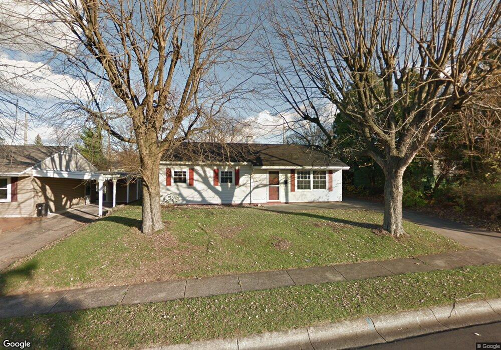
1164 Date St Fairborn, OH 45324
Estimated Value: $159,000 - $172,599
3
Beds
1
Bath
1,032
Sq Ft
$161/Sq Ft
Est. Value
About This Home
This home is located at 1164 Date St, Fairborn, OH 45324 and is currently estimated at $166,650, approximately $161 per square foot. 1164 Date St is a home located in Greene County with nearby schools including Fairborn Primary School, Fairborn Intermediate School, and Fairborn Middle School.
Ownership History
Date
Name
Owned For
Owner Type
Purchase Details
Closed on
Jan 6, 2021
Sold by
Saunders Whitney L and Wallace Melissa
Bought by
Saunders Whitney L
Current Estimated Value
Purchase Details
Closed on
May 29, 2020
Sold by
Mcdowell Kevin and Mcdowell Rebekah
Bought by
Saunders Whitney L and Wallace Melissa
Home Financials for this Owner
Home Financials are based on the most recent Mortgage that was taken out on this home.
Original Mortgage
$95,545
Outstanding Balance
$83,941
Interest Rate
3.2%
Mortgage Type
New Conventional
Estimated Equity
$82,709
Purchase Details
Closed on
Aug 28, 2018
Sold by
Mcdowell Kevin and Mcdowell Rebekah
Bought by
Hoprich Megan S
Home Financials for this Owner
Home Financials are based on the most recent Mortgage that was taken out on this home.
Original Mortgage
$68,000
Interest Rate
8.25%
Mortgage Type
Land Contract Argmt. Of Sale
Purchase Details
Closed on
Nov 29, 2017
Sold by
Laverty Trust
Bought by
Mcdowell Kavin and Mcdowell Rebekah
Purchase Details
Closed on
Oct 23, 2004
Sold by
Sielski Christopher and Sielski Lori A
Bought by
Laverty Gerald C and Spohn Joan L
Purchase Details
Closed on
Feb 1, 1999
Sold by
Lance Betty A and Glass Betty A
Bought by
Sielski Christopher and Sielski Lori A
Home Financials for this Owner
Home Financials are based on the most recent Mortgage that was taken out on this home.
Original Mortgage
$68,456
Interest Rate
6.81%
Mortgage Type
FHA
Create a Home Valuation Report for This Property
The Home Valuation Report is an in-depth analysis detailing your home's value as well as a comparison with similar homes in the area
Home Values in the Area
Average Home Value in this Area
Purchase History
| Date | Buyer | Sale Price | Title Company |
|---|---|---|---|
| Saunders Whitney L | -- | None Available | |
| Saunders Whitney L | $98,500 | None Available | |
| Hoprich Megan S | $80,000 | None Available | |
| Mcdowell Kavin | $55,000 | -- | |
| Laverty Gerald C | $74,500 | -- | |
| Sielski Christopher | $68,500 | -- |
Source: Public Records
Mortgage History
| Date | Status | Borrower | Loan Amount |
|---|---|---|---|
| Open | Saunders Whitney L | $95,545 | |
| Previous Owner | Hoprich Megan S | $68,000 | |
| Previous Owner | Sielski Christopher | $68,456 |
Source: Public Records
Tax History
| Year | Tax Paid | Tax Assessment Tax Assessment Total Assessment is a certain percentage of the fair market value that is determined by local assessors to be the total taxable value of land and additions on the property. | Land | Improvement |
|---|---|---|---|---|
| 2024 | $2,224 | $46,110 | $8,460 | $37,650 |
| 2023 | $2,208 | $46,110 | $8,460 | $37,650 |
| 2022 | $1,669 | $29,340 | $6,510 | $22,830 |
| 2021 | $1,694 | $22,310 | $6,510 | $15,800 |
| 2020 | $1,294 | $22,310 | $6,510 | $15,800 |
| 2019 | $1,228 | $21,180 | $6,480 | $14,700 |
| 2018 | $1,241 | $21,180 | $6,480 | $14,700 |
| 2017 | $903 | $21,180 | $6,480 | $14,700 |
| 2016 | $1,241 | $21,180 | $6,480 | $14,700 |
| 2015 | $1,184 | $21,180 | $6,480 | $14,700 |
| 2014 | $1,775 | $21,180 | $6,480 | $14,700 |
Source: Public Records
Map
Nearby Homes
- 1222 Hemlock Dr
- 1267 Beech St
- 1108 Lexington Ave
- 0 W Garland Ave
- 135 E Garland Ave
- 852 Princeton Ave
- 1878 Wildflower Rd
- 239-241 Euclid Ave
- 201 State St
- 256 Euclid Ave
- 38 Lindway Dr
- 1408 Mapleridge Dr
- 45 Regina Dr
- 1463 Maplegrove Dr
- 849 Flintridge Dr
- 349 Forest St
- 153 Diana Ln N
- 504 Greene St
- 315 Greene St
- Lot 4 W Dayton-Yellow Springs Rd
Your Personal Tour Guide
Ask me questions while you tour the home.