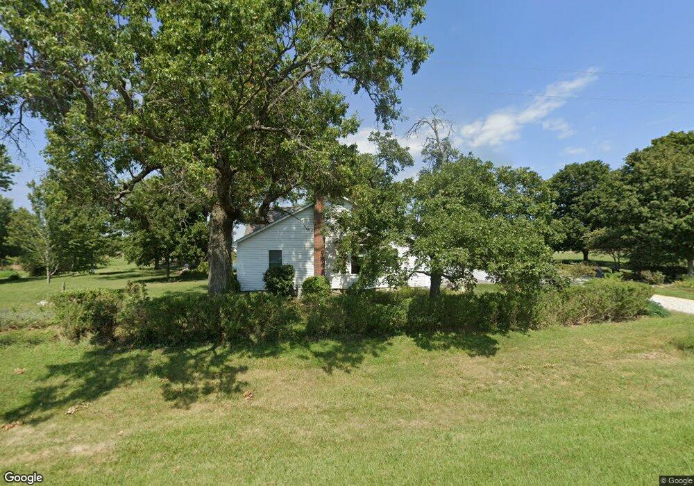
1164 N 650th Rd Baldwin City, KS 66006
Estimated Value: $304,000 - $436,000
4
Beds
2
Baths
1,688
Sq Ft
$205/Sq Ft
Est. Value
About This Home
This home is located at 1164 N 650th Rd, Baldwin City, KS 66006 and is currently estimated at $345,686, approximately $204 per square foot. 1164 N 650th Rd is a home located in Douglas County with nearby schools including Billy Mills Middle School and Lawrence High School.
Ownership History
Date
Name
Owned For
Owner Type
Purchase Details
Closed on
Mar 8, 2023
Sold by
Charles W Beeghley W and Charles Barbara L
Bought by
Reavis Trenton Layne and Reavis Esther Diane
Current Estimated Value
Home Financials for this Owner
Home Financials are based on the most recent Mortgage that was taken out on this home.
Original Mortgage
$104,789
Outstanding Balance
$101,687
Interest Rate
6.65%
Estimated Equity
$243,999
Create a Home Valuation Report for This Property
The Home Valuation Report is an in-depth analysis detailing your home's value as well as a comparison with similar homes in the area
Home Values in the Area
Average Home Value in this Area
Purchase History
| Date | Buyer | Sale Price | Title Company |
|---|---|---|---|
| Reavis Trenton Layne | -- | Security 1St Title |
Source: Public Records
Mortgage History
| Date | Status | Borrower | Loan Amount |
|---|---|---|---|
| Open | Reavis Trenton Layne | $104,789 |
Source: Public Records
Tax History Compared to Growth
Tax History
| Year | Tax Paid | Tax Assessment Tax Assessment Total Assessment is a certain percentage of the fair market value that is determined by local assessors to be the total taxable value of land and additions on the property. | Land | Improvement |
|---|---|---|---|---|
| 2025 | $2,903 | $28,854 | $3,726 | $25,128 |
| 2024 | $2,903 | $26,853 | $3,669 | $23,184 |
| 2023 | $2,880 | $25,335 | $3,554 | $21,781 |
| 2022 | $2,791 | $24,323 | $3,324 | $20,999 |
| 2021 | $2,452 | $20,643 | $3,301 | $17,342 |
| 2020 | $2,260 | $19,312 | $3,301 | $16,011 |
| 2019 | $2,156 | $18,458 | $3,255 | $15,203 |
| 2018 | $2,042 | $17,512 | $3,174 | $14,338 |
| 2017 | $1,952 | $16,618 | $3,174 | $13,444 |
| 2016 | $1,644 | $14,582 | $1,265 | $13,317 |
| 2015 | $1,674 | $14,582 | $1,265 | $13,317 |
| 2014 | $1,613 | $14,203 | $1,265 | $12,938 |
Source: Public Records
Map
Nearby Homes
- 731 E 1100 Rd
- 1369 N 550 Rd
- 772 E 1100 Rd
- Tract 1 N 680 Rd
- 10.01 Acres M/L E 1100 Rd
- 0 N 800th Rd Unit HMS2569950
- 987 N 640th Rd
- 987 N 640 Rd
- 618 E 1450 Rd
- 1409 N 650 Rd
- 693 E 1450 Rd
- 1441 N 800 Rd
- 125 Acres E 1296 Rd
- 1580 N 100 Rd
- 1560 N 100 Rd
- 124 E 1550 Rd
- 1580 N 100 Rd Unit Parcel 3
- 1560 N 100 Rd Unit Parcel 2
- 124 E 1550 Rd Unit Parcel 1
- 1246 & Parcel 4 N 1 Rd