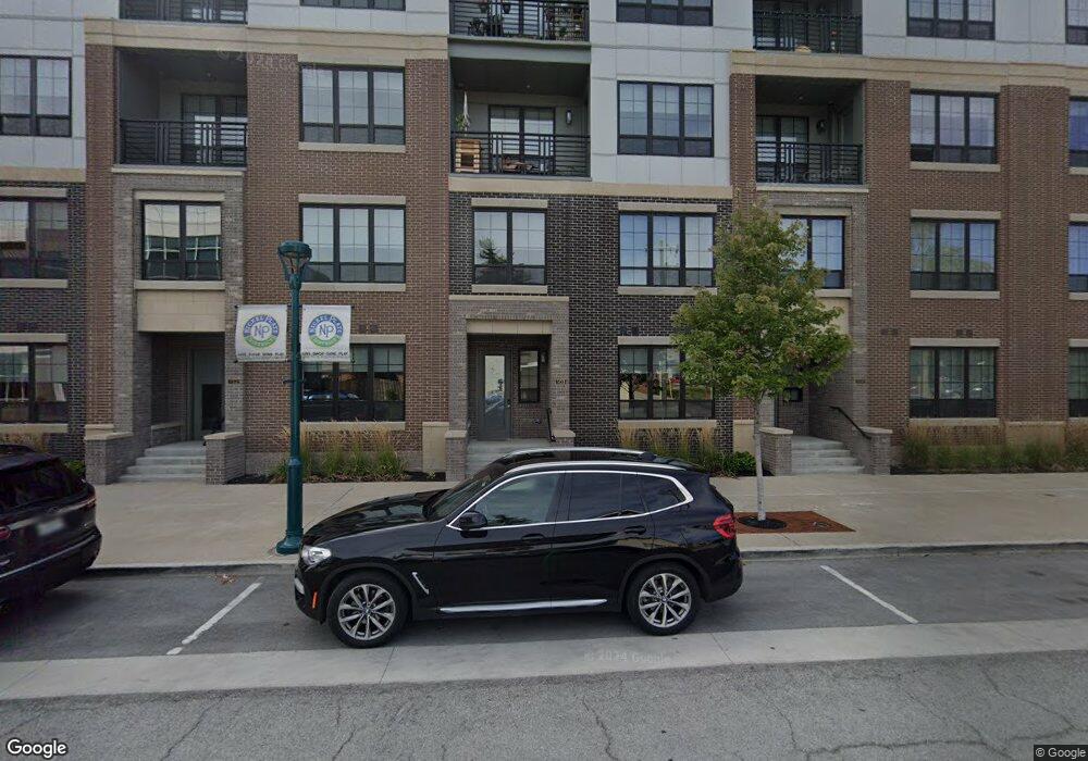
11643 Maple St Fishers, IN 46038
Estimated Value: $296,000
3
Beds
1
Bath
2,160
Sq Ft
$137/Sq Ft
Est. Value
About This Home
This home is located at 11643 Maple St, Fishers, IN 46038 and is currently priced at $296,000, approximately $137 per square foot. 11643 Maple St is a home located in Hamilton County with nearby schools including New Britton Elementary School, Riverside Junior High School, and Riverside Intermediate School.
Ownership History
Date
Name
Owned For
Owner Type
Purchase Details
Closed on
Apr 26, 2019
Sold by
The Alice Taylor Building Llc
Bought by
Nickel Plate North Associates Llc
Current Estimated Value
Purchase Details
Closed on
Oct 10, 2018
Sold by
Cage Camppus Llc
Bought by
Alice Taylor Building Llc
Purchase Details
Closed on
Aug 3, 2018
Sold by
Cook Berthel
Bought by
Cage Campus Llc
Purchase Details
Closed on
Dec 27, 2013
Sold by
Cook Berthel
Bought by
Town Of Fishers
Purchase Details
Closed on
Mar 20, 2009
Sold by
Cox Helen P
Bought by
Cook Berthel and Cook Bert
Purchase Details
Closed on
Oct 1, 2004
Sold by
Leonard David A and Leonard Maura A
Bought by
Cook Berthel
Home Financials for this Owner
Home Financials are based on the most recent Mortgage that was taken out on this home.
Original Mortgage
$166,250
Interest Rate
7.7%
Mortgage Type
Purchase Money Mortgage
Create a Home Valuation Report for This Property
The Home Valuation Report is an in-depth analysis detailing your home's value as well as a comparison with similar homes in the area
Home Values in the Area
Average Home Value in this Area
Purchase History
| Date | Buyer | Sale Price | Title Company |
|---|---|---|---|
| Nickel Plate North Associates Llc | -- | First American Title Ins Co | |
| Alice Taylor Building Llc | -- | None Available | |
| Cage Campus Llc | -- | None Available | |
| Town Of Fishers | $3,340 | None Available | |
| Cook Berthel | -- | None Available | |
| Cook Berthel | -- | -- |
Source: Public Records
Mortgage History
| Date | Status | Borrower | Loan Amount |
|---|---|---|---|
| Previous Owner | Cook Berthel | $166,250 |
Source: Public Records
Tax History Compared to Growth
Tax History
| Year | Tax Paid | Tax Assessment Tax Assessment Total Assessment is a certain percentage of the fair market value that is determined by local assessors to be the total taxable value of land and additions on the property. | Land | Improvement |
|---|---|---|---|---|
| 2020 | $3,012 | $130,300 | $130,300 | $0 |
| 2019 | -- | $195,800 | $130,300 | $65,500 |
| 2018 | -- | $195,800 | $130,300 | $65,500 |
| 2017 | -- | $198,100 | $130,300 | $67,800 |
| 2016 | -- | $96,900 | $29,100 | $67,800 |
| 2014 | -- | $96,400 | $29,100 | $67,300 |
| 2013 | -- | $96,400 | $29,100 | $67,300 |
Source: Public Records
Map
Nearby Homes
- 8778 Morgan Dr
- 8704 Morgan Dr
- 8694 Morgan Dr
- 8677 Morgan Dr
- 12036 Citywalk Dr
- 8292 Enclave Blvd
- 11455 Reagan Dr
- 8188 Bostic Ct
- 7824 Ashton Place
- 8013 Turkel Ct
- 8533 Legacy Ct
- 609 S Sunblest Blvd S
- 11709 Cameron Dr
- 12427 Trumbull Ct
- 12480 Traverse Place
- 7731 Kenetta Ct
- 8850 Tanner Dr
- 7648 Madden Ln
- 12541 Trester Ln
- 11436 Mossy Ct Unit 101
- 11655 Maple St
- 11662 Maple St
- 11662 Maple St
- 11646 Maple St
- 11603 Maple St
- 11671 Maple St
- 11671 Maple St
- 11654 Jaycee St
- 11674 Maple St
- 11608 Jaycee St
- 8700 E 116th St
- 11686 Maple St
- 11633 Lantern Rd
- 11631 Lantern Rd
- 11697 Maple St
- 11678 Moore St
- 11699 Maple St
- 8800 North St
- 11698 Maple St
- 8773 E 116th St