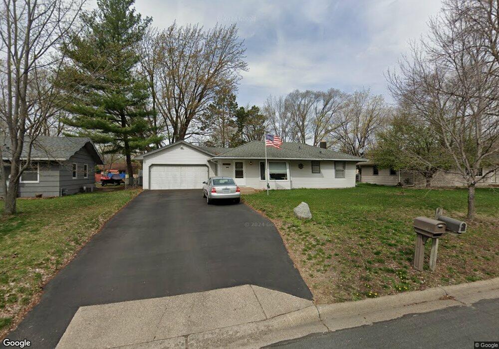
11644 Xavis St NW Coon Rapids, MN 55433
Estimated Value: $283,000 - $301,101
2
Beds
2
Baths
1,590
Sq Ft
$184/Sq Ft
Est. Value
About This Home
This home is located at 11644 Xavis St NW, Coon Rapids, MN 55433 and is currently estimated at $293,025, approximately $184 per square foot. 11644 Xavis St NW is a home located in Anoka County with nearby schools including Morris Bye Elementary School, Coon Rapids Middle School, and Coon Rapids Senior High School.
Ownership History
Date
Name
Owned For
Owner Type
Purchase Details
Closed on
May 20, 2021
Sold by
Ose Patricia A
Bought by
Citrowski Samuel Edward and Brueshaber Hannah Nadine
Current Estimated Value
Home Financials for this Owner
Home Financials are based on the most recent Mortgage that was taken out on this home.
Original Mortgage
$239,875
Outstanding Balance
$216,703
Interest Rate
2.9%
Mortgage Type
New Conventional
Estimated Equity
$76,322
Create a Home Valuation Report for This Property
The Home Valuation Report is an in-depth analysis detailing your home's value as well as a comparison with similar homes in the area
Home Values in the Area
Average Home Value in this Area
Purchase History
| Date | Buyer | Sale Price | Title Company |
|---|---|---|---|
| Citrowski Samuel Edward | $252,500 | Titlesmart Inc | |
| Citrowski Samuel Samuel | $252,500 | -- |
Source: Public Records
Mortgage History
| Date | Status | Borrower | Loan Amount |
|---|---|---|---|
| Open | Citrowski Samuel Edward | $239,875 | |
| Closed | Citrowski Samuel Samuel | $239,875 |
Source: Public Records
Tax History Compared to Growth
Tax History
| Year | Tax Paid | Tax Assessment Tax Assessment Total Assessment is a certain percentage of the fair market value that is determined by local assessors to be the total taxable value of land and additions on the property. | Land | Improvement |
|---|---|---|---|---|
| 2025 | $2,662 | $263,200 | $84,000 | $179,200 |
| 2024 | $2,662 | $263,200 | $87,000 | $176,200 |
| 2023 | $2,435 | $254,000 | $76,000 | $178,000 |
| 2022 | $2,328 | $255,600 | $67,000 | $188,600 |
| 2021 | $2,223 | $219,700 | $67,000 | $152,700 |
| 2020 | $2,167 | $206,300 | $62,000 | $144,300 |
| 2019 | $2,003 | $194,200 | $60,000 | $134,200 |
| 2018 | $1,916 | $176,500 | $0 | $0 |
| 2017 | $1,614 | $165,300 | $0 | $0 |
| 2016 | $1,615 | $138,900 | $0 | $0 |
| 2015 | -- | $138,900 | $45,000 | $93,900 |
| 2014 | -- | $121,100 | $36,500 | $84,600 |
Source: Public Records
Map
Nearby Homes
- 11809 Zion St NW
- 11835 Crocus St NW
- 11749 Crooked Lake Blvd NW
- 12019 Zion St NW
- 11409 Quinn St NW
- 11444 Hanson Blvd NW
- 3020 117th Ave NW
- 3074 121st Ave NW
- 11000 Swallow St NW
- 11361 Jay St NW
- 11350 Jay St NW
- 2500 110th Ave NW
- 11734 Marigold St NW
- 1830 121st Ln NW Unit 611
- 11036 Hanson Blvd NW Unit 20
- 2400 108th Ave NW
- 2721 109th Ave NW
- 1660 Northdale Blvd NW
- 2068 124th Ln NW
- 1727 121st Ln NW
- 11652 Xavis St NW
- 11636 Xavis St NW
- 2500 Northdale Blvd NW
- 11628 Xavis St NW
- 11643 Xavis St NW
- 11651 Xavis St NW
- 11643 Yukon St NW
- 11635 Xavis St NW
- 11651 Yukon St NW
- 11635 Yukon St NW
- 2510 Northdale Blvd NW
- 2420 Northdale Blvd NW
- 11620 Xavis St NW
- 11627 Xavis St NW
- 11619 Yukon St NW
- 11619 Xavis St NW
- 11614 Xavis St NW
- 11642 Wren St NW
- 11642 Yukon St NW
- 11650 Yukon St NW