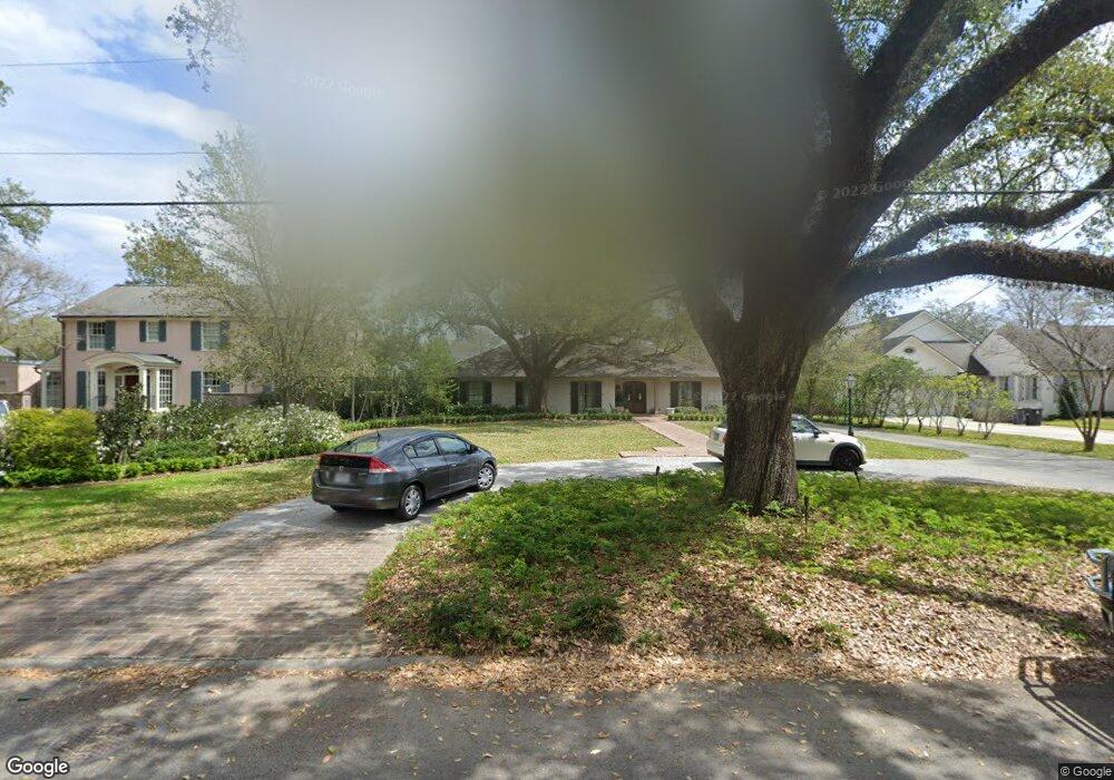
1165 Ingleside Dr Baton Rouge, LA 70806
Mid City South NeighborhoodEstimated Value: $792,000 - $843,000
3
Beds
2
Baths
3,504
Sq Ft
$231/Sq Ft
Est. Value
About This Home
This home is located at 1165 Ingleside Dr, Baton Rouge, LA 70806 and is currently estimated at $810,806, approximately $231 per square foot. 1165 Ingleside Dr is a home located in East Baton Rouge Parish with nearby schools including Bernard Terrace Elementary School, Westdale Middle School, and Tara High School.
Ownership History
Date
Name
Owned For
Owner Type
Purchase Details
Closed on
Nov 30, 2009
Sold by
Hirsch Richard
Bought by
Abraham Eric L
Current Estimated Value
Home Financials for this Owner
Home Financials are based on the most recent Mortgage that was taken out on this home.
Original Mortgage
$417,000
Outstanding Balance
$265,450
Interest Rate
4.99%
Mortgage Type
Construction
Estimated Equity
$545,356
Create a Home Valuation Report for This Property
The Home Valuation Report is an in-depth analysis detailing your home's value as well as a comparison with similar homes in the area
Home Values in the Area
Average Home Value in this Area
Purchase History
| Date | Buyer | Sale Price | Title Company |
|---|---|---|---|
| Abraham Eric L | $602,000 | -- |
Source: Public Records
Mortgage History
| Date | Status | Borrower | Loan Amount |
|---|---|---|---|
| Open | Abraham Eric L | $417,000 |
Source: Public Records
Tax History
| Year | Tax Paid | Tax Assessment Tax Assessment Total Assessment is a certain percentage of the fair market value that is determined by local assessors to be the total taxable value of land and additions on the property. | Land | Improvement |
|---|---|---|---|---|
| 2025 | $7,600 | $68,400 | $2,000 | $66,400 |
| 2024 | $7,600 | $68,400 | $2,000 | $66,400 |
| 2023 | $7,222 | $68,400 | $2,000 | $66,400 |
| 2022 | $7,333 | $68,400 | $2,000 | $66,400 |
| 2021 | $7,199 | $68,400 | $2,000 | $66,400 |
| 2020 | $7,928 | $68,400 | $2,000 | $66,400 |
| 2019 | $8,284 | $68,400 | $2,000 | $66,400 |
| 2018 | $8,182 | $68,400 | $2,000 | $66,400 |
| 2017 | $8,182 | $68,400 | $2,000 | $66,400 |
| 2016 | $6,244 | $60,200 | $2,000 | $58,200 |
| 2015 | $6,250 | $60,200 | $2,000 | $58,200 |
| 2014 | $6,227 | $60,200 | $2,000 | $58,200 |
| 2013 | -- | $60,200 | $2,000 | $58,200 |
Source: Public Records
Map
Nearby Homes
- 4528 Claycut Rd
- 4433 Claycut Rd
- 840 Wiltz Dr
- 1331 Richland Ave
- 819 Wiltz Dr
- 765 Longwood Dr
- 3919 Claycut Rd
- 730 Mouton St
- 1713 Longwood Dr
- 748 Richland Ave
- Lot 30 Capital Heights Ave Unit 30
- 632 Moore St
- Lot CH-1-B Bienville St
- 4112 Chatfield Ave
- 3544 Marie Dr Unit 3544
- 1925 Country Club Dr
- 422 Glenmore Ave
- 1958 Ingleside Dr
- 3514 Marie Dr Unit A
- 368 Wiltz Dr
- 1221 Ingleside Dr
- 1153 Ingleside Dr
- 0 Ingleside Dr Unit 201208805
- 1245 Ingleside Dr
- 1125 Ingleside Dr
- 1184 Longwood Dr
- 1166 Ingleside Dr
- 1226 Longwood Dr
- 1166 Longwood Dr
- 1222 Ingleside Dr
- 1152 Ingleside Dr
- 1267 Ingleside Dr
- 1045 Ingleside Dr
- 1250 Longwood Dr
- 1130 Longwood Dr
- 1244 Ingleside Dr
- 1124 Ingleside Dr
- 1280 Longwood Dr
- 1090 Longwood Dr
- 1274 Ingleside Dr
Your Personal Tour Guide
Ask me questions while you tour the home.