
1165 Us Highway 27 Rockwood, TN 37854
0.64
Acre
$43,750
Price per Acre
27,878
Sq Ft Lot
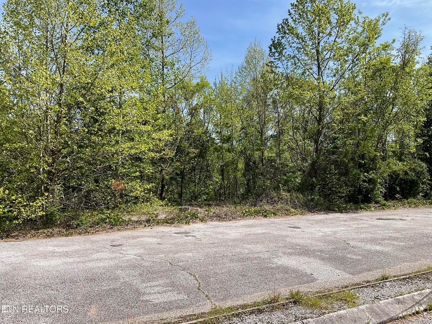
About This Lot
As of June 2024Level lot ready for you to build your business. Located on a busy 4 lane Hwy zoned commercial. Waynes Steakhouse was once located here and was a very popular place.
Property Details
Property Type
- Land
Est. Annual Taxes
- $118
Lot Details
- 0.64 Acre Lot
- Lot Dimensions are 52x470x23x464
- Property fronts a county road
- Finished Lot(s)
- Zoning described as None, Zoned Commercial
Property Views
- Mountain Views
Utilities
- Gas Available
- Phone Available
- Cable TV Available
Listing and Financial Details
- Assessor Parcel Number 064 052.01
Ownership History
Date
Name
Owned For
Owner Type
Purchase Details
Listed on
Apr 23, 2024
Closed on
Jun 21, 2024
Sold by
Smith Rex and Smith Susan
Bought by
Desmore Steven A and Desmore Vanessa
Seller's Agent
Todd Russell
Coldwell Banker Jim Henry
Buyer's Agent
Todd Russell
Coldwell Banker Jim Henry
List Price
$39,000
Sold Price
$28,000
Premium/Discount to List
-$11,000
-28.21%
Total Days on Market
48
Views
6
Current Estimated Value
Home Financials for this Owner
Home Financials are based on the most recent Mortgage that was taken out on this home.
Estimated Appreciation
$111,000
Avg. Annual Appreciation
118.50%
Purchase Details
Closed on
Jan 29, 2024
Sold by
Proffitt Cynthia F
Bought by
Smith Rex and Smith Susan
Purchase Details
Closed on
Jul 19, 2011
Sold by
Mccullough Carolyn L
Bought by
Proffitt Cynthia F
Purchase Details
Closed on
Feb 9, 2000
Sold by
Tony Kindred
Bought by
Mccullough Carol A
Purchase Details
Closed on
May 17, 1999
Bought by
Mccullough Carolyn L & Pro Ffitt Cynthia F
Purchase Details
Closed on
Oct 27, 1995
Bought by
Kindred Tony and Kindred Paula
Purchase Details
Closed on
Nov 5, 1973
Bought by
Lindsay Claramae
Map
Create a Home Valuation Report for This Property
The Home Valuation Report is an in-depth analysis detailing your home's value as well as a comparison with similar homes in the area
Similar Properties in Rockwood, TN
Home Values in the Area
Average Home Value in this Area
Purchase History
| Date | Type | Sale Price | Title Company |
|---|---|---|---|
| Warranty Deed | $28,000 | Title Insurance Company Of Ch | |
| Warranty Deed | $26,500 | Title Insurance Company Of Cha | |
| Quit Claim Deed | -- | -- | |
| Deed | $50,000 | -- | |
| Warranty Deed | $50,000 | -- | |
| Warranty Deed | $50,000 | -- | |
| Deed | -- | -- |
Source: Public Records
Property History
| Date | Event | Price | Change | Sq Ft Price |
|---|---|---|---|---|
| 06/21/2024 06/21/24 | Sold | $28,000 | -28.2% | -- |
| 06/11/2024 06/11/24 | Pending | -- | -- | -- |
| 04/23/2024 04/23/24 | For Sale | $39,000 | -- | -- |
Source: East Tennessee REALTORS® MLS
Tax History
| Year | Tax Paid | Tax Assessment Tax Assessment Total Assessment is a certain percentage of the fair market value that is determined by local assessors to be the total taxable value of land and additions on the property. | Land | Improvement |
|---|---|---|---|---|
| 2024 | $118 | $4,920 | $4,920 | $0 |
| 2023 | $118 | $4,920 | $4,920 | $0 |
| 2022 | $118 | $4,920 | $4,920 | $0 |
| 2021 | $122 | $4,920 | $4,920 | $0 |
| 2020 | $122 | $4,920 | $4,920 | $0 |
| 2019 | $187 | $6,960 | $6,960 | $0 |
| 2018 | $179 | $6,960 | $6,960 | $0 |
| 2017 | $179 | $6,960 | $6,960 | $0 |
| 2016 | $179 | $6,960 | $6,960 | $0 |
| 2015 | $179 | $6,960 | $6,960 | $0 |
| 2013 | -- | $7,480 | $7,480 | $0 |
Source: Public Records
Source: East Tennessee REALTORS® MLS
MLS Number: 1260347
APN: 064-052.01
Disclaimer: Certain information contained herein is derived from information provided by parties other than Homes.com. All information provided is deemed reliable, but is not guaranteed to be accurate and should be independently verified.
![]() IDX information is provided exclusively for personal, non-commercial use, and may not be used for any purpose other than to identify prospective properties consumers may be interested in purchasing. Information is deemed reliable but not guaranteed.
IDX information is provided exclusively for personal, non-commercial use, and may not be used for any purpose other than to identify prospective properties consumers may be interested in purchasing. Information is deemed reliable but not guaranteed.
Listing Information presented by local MLS brokerage: Ten-X, LLC dba Homes.com, local broker - Arlene Richardson - 888-952-6393.
Nearby Homes
- 215 Darrell Ln
- 218 Michael Dr
- 109 Circle Dr
- 314 Lakemont Dr
- 210 Greenwood Dr
- Lot 18 Greenwood Dr
- 1123 Abels Valley Rd
- 408 White Oak Dr
- 635 Tarwater St
- 0 Rendezvous Road Lot #22 Unit 1225744
- 0 Rendezvous Rd Lot 21&22 Unit 1225745
- 0 Rendezvous Road Lot # 21 Unit 1225743
- 0 Coffey Circle 1 25 Acres
- 0 S Gateway Ave Unit 1282244
- 739 Sherwood Dr
- 0 Hathburn Dr