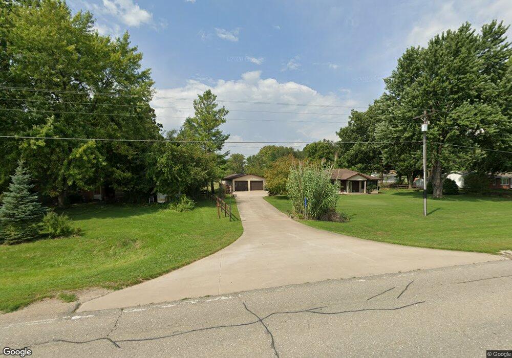
11657 Dmc Highway 99 Burlington, IA 52601
Estimated Value: $218,192 - $278,000
2
Beds
2
Baths
1,544
Sq Ft
$154/Sq Ft
Est. Value
About This Home
This home is located at 11657 Dmc Highway 99, Burlington, IA 52601 and is currently estimated at $238,298, approximately $154 per square foot. 11657 Dmc Highway 99 is a home located in Des Moines County with nearby schools including Burlington Community High School, Burlington Christian School, and Notre Dame High School.
Ownership History
Date
Name
Owned For
Owner Type
Purchase Details
Closed on
Jan 19, 2018
Sold by
Luttenegger Kim A and Luttenegger Leann K
Bought by
Evans Cody P and Evans Jennifer L
Current Estimated Value
Home Financials for this Owner
Home Financials are based on the most recent Mortgage that was taken out on this home.
Original Mortgage
$168,250
Outstanding Balance
$94,627
Interest Rate
3.95%
Mortgage Type
Purchase Money Mortgage
Estimated Equity
$143,671
Create a Home Valuation Report for This Property
The Home Valuation Report is an in-depth analysis detailing your home's value as well as a comparison with similar homes in the area
Home Values in the Area
Average Home Value in this Area
Purchase History
| Date | Buyer | Sale Price | Title Company |
|---|---|---|---|
| Evans Cody P | $177,000 | -- |
Source: Public Records
Mortgage History
| Date | Status | Borrower | Loan Amount |
|---|---|---|---|
| Open | Evans Cody P | $168,250 |
Source: Public Records
Tax History Compared to Growth
Tax History
| Year | Tax Paid | Tax Assessment Tax Assessment Total Assessment is a certain percentage of the fair market value that is determined by local assessors to be the total taxable value of land and additions on the property. | Land | Improvement |
|---|---|---|---|---|
| 2025 | $2,260 | $193,300 | $26,700 | $166,600 |
| 2024 | $2,260 | $173,000 | $26,700 | $146,300 |
| 2023 | $2,078 | $173,000 | $26,700 | $146,300 |
| 2022 | $2,132 | $158,000 | $26,700 | $131,300 |
| 2021 | $2,132 | $158,000 | $26,700 | $131,300 |
| 2020 | $2,272 | $158,000 | $26,700 | $131,300 |
| 2019 | $2,046 | $158,000 | $26,700 | $131,300 |
| 2018 | $1,670 | $134,400 | $21,100 | $113,300 |
| 2017 | $1,694 | $113,100 | $0 | $0 |
| 2016 | $1,648 | $113,100 | $0 | $0 |
| 2015 | $1,648 | $113,100 | $0 | $0 |
| 2014 | $1,680 | $107,500 | $0 | $0 |
Source: Public Records
Map
Nearby Homes
- 125 Oconnell Beach Rd
- 2706 Bittersweet Place
- 10552 Rolling Hills Dr
- 1 Golf Ct
- 10591 Rolling Hills Dr
- 2405 Bittersweet Place
- 2224 Sunnyside Ave
- 2035 Highland Ave
- 2604 Sunnyside Ave
- 2012 Osborn St
- 2728 Sunnyside Ave
- 2801 Sunnyside Ave
- 2826 Sunnyside Ave
- 1209 Virginia Ave
- 1316 Corse St
- 1137 Corse St
- 2832 Lesylvia St
- 2917 Woodland Dr
- 900 Oak St
- 11161 Iroquois Rd
- 11657 Highway 99
- 11655 Highway 99
- 11784 Highway 99
- 11728 94th Ave
- 11724 94th Ave
- 11762 94th Ave
- 9331 118th St
- 11725 94th Ave
- 11763 94th Ave
- 11763 94th Ave
- 11561 Dmc Highway 99
- 11812 Dmc Highway 99
- 9431 118th St
- 9435 118th St
- 11543 Highway 99
- 11818 Highway 99
- 11832 Sylvan Heights Rd
- 9424 118th St
- 11895 Dmc Highway 99
- 11868 Sylvan Heights Rd