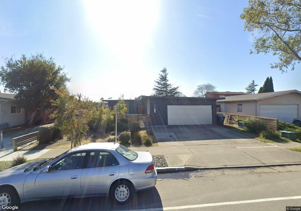
1166 Otis Dr Alameda, CA 94501
South Shore NeighborhoodEstimated Value: $1,296,893 - $1,493,000
4
Beds
2
Baths
1,451
Sq Ft
$963/Sq Ft
Est. Value
About This Home
This home is located at 1166 Otis Dr, Alameda, CA 94501 and is currently estimated at $1,396,723, approximately $962 per square foot. 1166 Otis Dr is a home located in Alameda County with nearby schools including William G. Paden Elementary School, Will C. Wood Middle School, and Encinal Junior/Senior High.
Ownership History
Date
Name
Owned For
Owner Type
Purchase Details
Closed on
Jul 24, 2017
Sold by
Dickson Rodman Russell and Dickson Grace Mizue
Bought by
Kawase Huxley Matthew Paul and Kawase Huxley Marie
Current Estimated Value
Home Financials for this Owner
Home Financials are based on the most recent Mortgage that was taken out on this home.
Original Mortgage
$694,000
Outstanding Balance
$576,913
Interest Rate
3.91%
Mortgage Type
New Conventional
Estimated Equity
$819,810
Purchase Details
Closed on
Jun 29, 2012
Sold by
Cooke James B and The Lindsay Family 2005 Trust
Bought by
Dickson Rodman Russell and Dickson Grace Mizue
Home Financials for this Owner
Home Financials are based on the most recent Mortgage that was taken out on this home.
Original Mortgage
$325,000
Interest Rate
3.74%
Mortgage Type
New Conventional
Purchase Details
Closed on
Aug 22, 2005
Sold by
Lindsay J Arthur
Bought by
Lindsay J A and Lindsay Family 2005 Living Tru
Create a Home Valuation Report for This Property
The Home Valuation Report is an in-depth analysis detailing your home's value as well as a comparison with similar homes in the area
Home Values in the Area
Average Home Value in this Area
Purchase History
| Date | Buyer | Sale Price | Title Company |
|---|---|---|---|
| Kawase Huxley Matthew Paul | $1,105,000 | First American Title Company | |
| Dickson Rodman Russell | $475,000 | First American Title Company | |
| Lindsay J A | -- | -- |
Source: Public Records
Mortgage History
| Date | Status | Borrower | Loan Amount |
|---|---|---|---|
| Open | Kawase Huxley Matthew Paul | $694,000 | |
| Previous Owner | Dickson Rodman Russell | $325,000 |
Source: Public Records
Tax History Compared to Growth
Tax History
| Year | Tax Paid | Tax Assessment Tax Assessment Total Assessment is a certain percentage of the fair market value that is determined by local assessors to be the total taxable value of land and additions on the property. | Land | Improvement |
|---|---|---|---|---|
| 2025 | $17,039 | $1,257,280 | $565,776 | $691,504 |
| 2024 | $17,039 | $1,232,627 | $554,682 | $677,945 |
| 2023 | $16,352 | $1,208,460 | $543,807 | $664,653 |
| 2022 | $15,970 | $1,184,769 | $533,146 | $651,623 |
| 2021 | $15,558 | $1,161,542 | $522,694 | $638,848 |
| 2020 | $15,363 | $1,149,641 | $517,338 | $632,303 |
| 2019 | $14,850 | $1,127,100 | $507,195 | $619,905 |
| 2018 | $14,463 | $1,105,000 | $497,250 | $607,750 |
| 2017 | $7,212 | $503,988 | $151,196 | $352,792 |
| 2016 | $7,214 | $494,108 | $148,232 | $345,876 |
| 2015 | $7,188 | $486,688 | $146,006 | $340,682 |
| 2014 | $6,823 | $477,155 | $143,146 | $334,009 |
Source: Public Records
Map
Nearby Homes
- 404 Coral Reef Rd
- 955 Shorepoint Ct Unit 110
- 955 Shorepoint Ct Unit 200
- 965 Shorepoint Ct
- 608 Fortress Isle
- 950 Shorepoint Ct Unit 100
- 1001 Shoreline Dr Unit 301
- 933 Shoreline Dr Unit 203
- 325 Kitty Hawk Rd Unit 207
- 325 Kitty Hawk Rd Unit 304
- 1941 Franciscan Way
- 1203 Benton St
- 901 San Antonio Ave
- 1812 San Antonio Ave
- 610 Grand St
- 1220 9th St
- 1301 9th St
- 2031 Otis Dr Unit H
- 2106 Otis Dr Unit D
- 1059 Santa Clara Ave
- 1160 Otis Dr
- 1200 Otis Dr
- 1161 Rosewood Way
- 1157 Rosewood Way
- 1154 Otis Dr
- 1201 Rosewood Way
- 1206 Otis Dr
- 1153 Rosewood Way
- 1205 Rosewood Way
- 1210 Otis Dr
- 1149 Rosewood Way
- 1148 Otis Dr
- 1151 Otis Dr
- 1209 Rosewood Way Unit 2
- 609 Arlington Isle
- 1143 Otis Dr
- 1216 Otis Dr
- 1142 Otis Dr
- 600 Arlington Isle
- 1137 Otis Dr