Estimated Value: $243,860 - $295,000
--
Bed
--
Bath
1,813
Sq Ft
$152/Sq Ft
Est. Value
About This Home
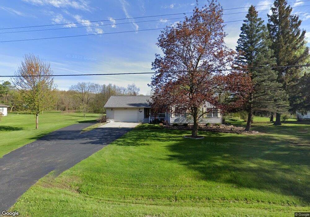
This home is located at 1166 W Reid Rd, Flint, MI 48507 and is currently estimated at $274,715, approximately $151 per square foot. 1166 W Reid Rd is a home located in Genesee County with nearby schools including Anderson Elementary School, McGrath Elementary School, and Grand Blanc West Middle School.
Ownership History
Date
Name
Owned For
Owner Type
Purchase Details
Closed on
Jan 10, 2020
Sold by
Carsten James A and Carsten Leslie J
Bought by
Carsten James B and Carsten Leslie J
Current Estimated Value
Home Financials for this Owner
Home Financials are based on the most recent Mortgage that was taken out on this home.
Original Mortgage
$107,000
Interest Rate
3.7%
Mortgage Type
New Conventional
Purchase Details
Closed on
Oct 9, 2017
Sold by
Carsten James B and Carsten Leslie J
Bought by
Carsten James B and Carsten Leslie J
Create a Home Valuation Report for This Property
The Home Valuation Report is an in-depth analysis detailing your home's value as well as a comparison with similar homes in the area
Home Values in the Area
Average Home Value in this Area
Purchase History
| Date | Buyer | Sale Price | Title Company |
|---|---|---|---|
| Carsten James B | -- | None Available | |
| Carsten James B | -- | None Available |
Source: Public Records
Mortgage History
| Date | Status | Borrower | Loan Amount |
|---|---|---|---|
| Closed | Carsten James B | $107,000 |
Source: Public Records
Tax History Compared to Growth
Tax History
| Year | Tax Paid | Tax Assessment Tax Assessment Total Assessment is a certain percentage of the fair market value that is determined by local assessors to be the total taxable value of land and additions on the property. | Land | Improvement |
|---|---|---|---|---|
| 2025 | $2,911 | $117,500 | $0 | $0 |
| 2024 | $1,780 | $108,900 | $0 | $0 |
| 2023 | $1,699 | $99,700 | $0 | $0 |
| 2022 | $2,584 | $90,800 | $0 | $0 |
| 2021 | $2,542 | $86,200 | $0 | $0 |
| 2020 | $1,567 | $80,700 | $0 | $0 |
| 2019 | $1,543 | $76,200 | $0 | $0 |
| 2018 | $2,329 | $74,200 | $0 | $0 |
| 2017 | $2,225 | $72,400 | $0 | $0 |
| 2016 | $2,206 | $67,100 | $0 | $0 |
| 2015 | $1,969 | $61,900 | $0 | $0 |
| 2014 | $1,346 | $59,700 | $0 | $0 |
| 2012 | -- | $53,900 | $53,900 | $0 |
Source: Public Records
Map
Nearby Homes
- 7191 Brittwood Ln
- 1283 Woodnoll Dr
- 1395 Windwood Ln
- 7036 Glen Oak Dr
- 6557 Rustic Ridge Trail
- 1389 Dellmont Dr
- 1195 Alton Ave
- 7400 Lawrence St
- 0 Glenmeadow Ct Unit 20251041011
- 7269 Wildflower Ct
- 7444 Rory St
- 35010 Mitchell St Unit 210
- 41003 Williams St Unit 242
- 12000 Murray St Unit 67
- 1329 Arrowwood Ln
- 1203 Froman St
- 0 Taylor Dr Unit 50159493
- 6137 Pebbleshire Dr
- 3010 Murray St Unit 18
- 1037 E Hill Rd
- 1188 W Reid Rd
- 1158 W Reid Rd
- 1206 W Reid Rd
- 1144 W Reid Rd
- 1163 W Reid Rd
- 1145 W Reid Rd
- 0 E Reid Rd Unit 30064873
- 0 E Reid Rd Unit G21265943
- 0 E Reid Rd Unit G50004072
- 0 E Reid Rd Unit G50014017
- 0 E Reid Rd Unit 2210019954
- 0 E Reid Rd
- 0 E Reid Rd Unit 2200004284
- 0 E Reid Rd Unit 3090157
- 0 E Reid Rd Unit 31373205
- 0 E Reid Rd Unit 219018962
- 1185 W Reid Rd
- 1175 W Reid Rd
- 1224 W Reid Rd
- 1135 W Reid Rd