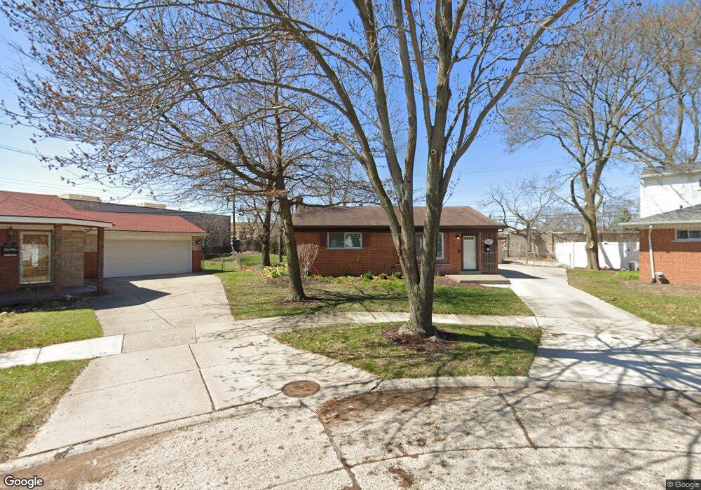
1167 Broadacre Ave Unit Bldg-Unit Clawson, MI 48017
Estimated Value: $349,000 - $373,689
3
Beds
2
Baths
1,482
Sq Ft
$244/Sq Ft
Est. Value
About This Home
This home is located at 1167 Broadacre Ave Unit Bldg-Unit, Clawson, MI 48017 and is currently estimated at $361,672, approximately $244 per square foot. 1167 Broadacre Ave Unit Bldg-Unit is a home located in Oakland County with nearby schools including Clawson High School, Japhet School, and Guardian Angels School.
Ownership History
Date
Name
Owned For
Owner Type
Purchase Details
Closed on
Feb 28, 2018
Sold by
Morgan Peter C and Morgan Penelope H
Bought by
Hudson Sarah
Current Estimated Value
Create a Home Valuation Report for This Property
The Home Valuation Report is an in-depth analysis detailing your home's value as well as a comparison with similar homes in the area
Home Values in the Area
Average Home Value in this Area
Purchase History
| Date | Buyer | Sale Price | Title Company |
|---|---|---|---|
| Hudson Sarah | $195,000 | Metro Hills Title Agency Llc |
Source: Public Records
Tax History Compared to Growth
Tax History
| Year | Tax Paid | Tax Assessment Tax Assessment Total Assessment is a certain percentage of the fair market value that is determined by local assessors to be the total taxable value of land and additions on the property. | Land | Improvement |
|---|---|---|---|---|
| 2024 | $5,885 | $151,950 | $0 | $0 |
| 2023 | $5,642 | $142,460 | $0 | $0 |
| 2022 | $5,686 | $132,130 | $0 | $0 |
| 2021 | $5,569 | $124,040 | $0 | $0 |
| 2020 | $5,396 | $116,780 | $0 | $0 |
| 2019 | $5,576 | $110,340 | $0 | $0 |
| 2018 | $3,519 | $102,870 | $0 | $0 |
| 2017 | $3,498 | $99,430 | $0 | $0 |
| 2016 | $3,539 | $93,330 | $0 | $0 |
| 2015 | -- | $85,330 | $0 | $0 |
| 2014 | -- | $74,070 | $0 | $0 |
| 2011 | -- | $68,090 | $0 | $0 |
Source: Public Records
Map
Nearby Homes
- 4909 Crooks Rd Unit C7
- 4909 Crooks Rd Unit 4
- 4921 N Crooks Rd Unit N-10
- 4921 Crooks Rd Unit M-10
- 232 S Manitou Ave
- 4952 Coventry St Unit 315
- 1823 Torquay Ave
- 496 Langley Blvd
- 406 S Webik Ave
- 846 Phillips Ave
- 515 S Webik Ave
- 4422 Rosewold Ave
- 4909 Coventry St Unit 287
- 1806 Torquay Ave
- 1936 Torquay Ave Unit 205
- 609 John M Ave
- 5011 Thorncroft Ave
- 908 W Elmwood Ave
- 4514 Thorncroft Ave
- 1928 Cresthill Ave
- 1167 Broadacre Ave
- 1171 Broadacre Ave
- 1163 Broadacre Ave
- 1241 Broadacre Ave Unit Bldg-Unit
- 1241 Broadacre Ave
- 1227 Broadacre Ave
- 1251 Broadacre Ave
- 1211 Broadacre Ave
- 1157 Broadacre Ave
- 1301 Broadacre Ave
- 1141 Broadacre Ave
- 1311 Broadacre Ave
- 1121 Broadacre Ave
- 1156 Broadacre Ave
- 1319 Broadacre Ave
- 1242 Broadacre Ave
- 1132 Broadacre Ave
- 1230 Broadacre Ave
- 1220 Broadacre Ave
- 1111 Broadacre Ave