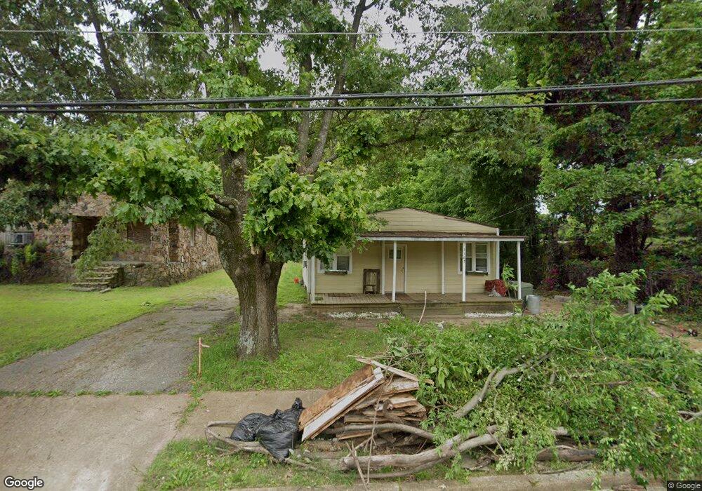
1167 Effie Rd Memphis, TN 38106
Southeast Memphis NeighborhoodEstimated Value: $48,000 - $120,000
2
Beds
2
Baths
1,316
Sq Ft
$54/Sq Ft
Est. Value
About This Home
This home is located at 1167 Effie Rd, Memphis, TN 38106 and is currently estimated at $70,480, approximately $53 per square foot. 1167 Effie Rd is a home located in Shelby County with nearby schools including Hamilton High School, Believe Memphis Academy Charter School, and Memphis College Preparatory.
Ownership History
Date
Name
Owned For
Owner Type
Purchase Details
Closed on
Apr 26, 2018
Sold by
Cooper And Son Auto Sales Inc
Bought by
Baker Princess
Current Estimated Value
Purchase Details
Closed on
Feb 19, 2009
Sold by
Citimortgage Inc
Bought by
Cooper & Son Auto Sales Inc
Purchase Details
Closed on
Aug 5, 2008
Sold by
Armstrong John E and Armstrong Marie
Bought by
Citimortgage Inc
Purchase Details
Closed on
Oct 29, 2002
Sold by
Armstrong John E
Bought by
Armstrong John E and Armstrong Beulah
Create a Home Valuation Report for This Property
The Home Valuation Report is an in-depth analysis detailing your home's value as well as a comparison with similar homes in the area
Home Values in the Area
Average Home Value in this Area
Purchase History
| Date | Buyer | Sale Price | Title Company |
|---|---|---|---|
| Baker Princess | $8,000 | None Available | |
| Cooper & Son Auto Sales Inc | $5,000 | Edco Title & Closing Service | |
| Citimortgage Inc | $19,455 | None Available | |
| Armstrong John E | -- | -- |
Source: Public Records
Tax History Compared to Growth
Tax History
| Year | Tax Paid | Tax Assessment Tax Assessment Total Assessment is a certain percentage of the fair market value that is determined by local assessors to be the total taxable value of land and additions on the property. | Land | Improvement |
|---|---|---|---|---|
| 2025 | $167 | $10,500 | $1,700 | $8,800 |
| 2024 | $167 | $4,925 | $725 | $4,200 |
| 2023 | $300 | $4,925 | $725 | $4,200 |
| 2022 | $300 | $4,925 | $725 | $4,200 |
| 2021 | $388 | $6,300 | $725 | $5,575 |
| 2020 | $491 | $6,775 | $725 | $6,050 |
| 2019 | $491 | $6,775 | $725 | $6,050 |
| 2018 | $491 | $6,775 | $725 | $6,050 |
| 2017 | $278 | $6,775 | $725 | $6,050 |
| 2016 | $281 | $6,425 | $0 | $0 |
| 2014 | $281 | $6,425 | $0 | $0 |
Source: Public Records
Map
Nearby Homes
- 2180 Elvis Presley Blvd
- 1385 Eloise Rd
- 1078 N Ball Rd
- 1408 Eloise Rd
- 2067 Corry Rd
- 2377 Warren St
- 1431 Ledger Rd
- 944 Alice Ave
- 1560 Cane Rd
- 2048 Benton St
- 1495 Compton Ave
- 1026 Shawnee Cir
- 2001 Benton St
- 760 E Mckellar Ave
- 2436 Sparks St
- 2112 Blakewood Place
- 1025 Wichita Ave
- 0 Carlton Rd
- 1490 Lockhaven Ave
- 1826 Norfolk St
- 1171 Effie Rd
- 1177 Effie Rd
- 1181 Effie Rd
- 1187 Effie Rd
- 1180 Effie Rd
- 1193 Effie Rd
- 1190 E Mallory Ave
- 1184 Effie Rd
- 1173 E Mallory Ave
- 1192 Effie Rd
- 1199 Effie Rd
- 1157 E Mallory Ave
- 1196 Effie Rd
- 0 Mallory Ave Unit RTC2809627
- 2196 Hernando Rd
- 2194 Hernando Rd
- 1207 Effie Rd
- 1200 Effie Rd
- 1179 E Mallory Ave
- 1204 E Mallory Ave