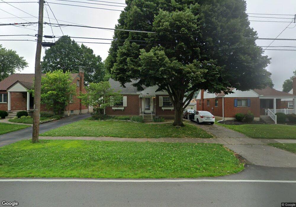
1167 Fuhrman Rd Cincinnati, OH 45215
Estimated Value: $287,000 - $324,000
4
Beds
2
Baths
1,800
Sq Ft
$165/Sq Ft
Est. Value
About This Home
This home is located at 1167 Fuhrman Rd, Cincinnati, OH 45215 and is currently estimated at $297,229, approximately $165 per square foot. 1167 Fuhrman Rd is a home located in Hamilton County with nearby schools including Reading Community High School, Saints Peter and Paul Academy, and Mount Notre Dame High School.
Ownership History
Date
Name
Owned For
Owner Type
Purchase Details
Closed on
Apr 23, 2010
Sold by
Roeseler Mark T and Roeseler Melissa
Bought by
Bomkamp Candice E
Current Estimated Value
Home Financials for this Owner
Home Financials are based on the most recent Mortgage that was taken out on this home.
Original Mortgage
$143,845
Outstanding Balance
$96,985
Interest Rate
5.25%
Mortgage Type
FHA
Estimated Equity
$200,244
Purchase Details
Closed on
Aug 31, 2001
Sold by
Taylor Miriam R Tr
Bought by
Roeseler Mark T
Home Financials for this Owner
Home Financials are based on the most recent Mortgage that was taken out on this home.
Original Mortgage
$126,450
Interest Rate
7.03%
Mortgage Type
FHA
Purchase Details
Closed on
Sep 28, 2000
Sold by
Taylor Miriam R
Bought by
Taylor Miriam R and Miriam R Taylor Trust
Create a Home Valuation Report for This Property
The Home Valuation Report is an in-depth analysis detailing your home's value as well as a comparison with similar homes in the area
Home Values in the Area
Average Home Value in this Area
Purchase History
| Date | Buyer | Sale Price | Title Company |
|---|---|---|---|
| Bomkamp Candice E | $146,500 | Land Title Agency Inc | |
| Roeseler Mark T | $127,500 | -- | |
| Taylor Miriam R | -- | -- |
Source: Public Records
Mortgage History
| Date | Status | Borrower | Loan Amount |
|---|---|---|---|
| Open | Bomkamp Candice E | $143,845 | |
| Previous Owner | Roeseler Mark T | $126,450 |
Source: Public Records
Tax History Compared to Growth
Tax History
| Year | Tax Paid | Tax Assessment Tax Assessment Total Assessment is a certain percentage of the fair market value that is determined by local assessors to be the total taxable value of land and additions on the property. | Land | Improvement |
|---|---|---|---|---|
| 2024 | $3,770 | $72,710 | $11,988 | $60,722 |
| 2023 | $3,825 | $72,710 | $11,988 | $60,722 |
| 2022 | $3,493 | $51,458 | $10,392 | $41,066 |
| 2021 | $2,918 | $51,458 | $10,392 | $41,066 |
| 2020 | $2,947 | $51,458 | $10,392 | $41,066 |
| 2019 | $2,856 | $45,536 | $9,195 | $36,341 |
| 2018 | $2,859 | $45,536 | $9,195 | $36,341 |
| 2017 | $2,696 | $45,536 | $9,195 | $36,341 |
| 2016 | $2,967 | $50,250 | $9,009 | $41,241 |
| 2015 | $2,992 | $50,250 | $9,009 | $41,241 |
| 2014 | $2,618 | $50,250 | $9,009 | $41,241 |
| 2013 | $2,653 | $51,276 | $9,195 | $42,081 |
Source: Public Records
Map
Nearby Homes
- 1194 Fuhrman Rd
- 1246 Thurnridge Dr
- 796 Kenray Ct
- 2127 Longmeadow Ln
- 1626 Krylon Dr
- 2451 Hunt Rd
- 636 Maple Dr
- 2413 Carol Dr
- L Apple Ridge Ln
- 234 Mcguire Ln
- 2598 Maple Tree Ct
- 2590 Hunt Rd
- 1684 Sanborn Dr
- 69 Orchard Knoll Dr
- 2558 Apple Ridge Ln
- 2626 Hunt Rd
- 113 Waxwing Dr
- 2920 E Galbraith Rd
- 310 E Vine St
- 0 Hill St Unit 1616370
- 1163 Fuhrman Rd
- 1171 Fuhrman Rd
- 1175 Fuhrman Rd
- 1200 Fuhrman Rd
- 1159 Fuhrman Rd
- 0 Fuhrman Rd
- 0 Fuhrman Rd
- 1166 Georgia Ln
- 1170 Georgia Ln
- 1179 Fuhrman Rd
- 1162 Georgia Ln
- 1155 Fuhrman Rd
- 1174 Georgia Ln
- 1160 Fuhrman Rd
- 1164 Fuhrman Rd
- 1183 Fuhrman Rd
- 1158 Georgia Ln
- 1178 Georgia Ln
- 1168 Fuhrman Rd
- 1156 Fuhrman Rd