Estimated Value: $285,111
Studio
--
Bath
960
Sq Ft
$297/Sq Ft
Est. Value
About This Home
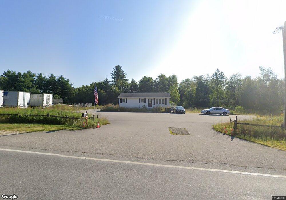
This home is located at 1167 Route 3a, Bow, NH 03304 and is currently priced at $285,111, approximately $296 per square foot. 1167 Route 3a is a home located in Merrimack County with nearby schools including Bow Elementary School, Bow Memorial School, and Bow High School.
Ownership History
Date
Name
Owned For
Owner Type
Purchase Details
Closed on
Dec 14, 2017
Sold by
638 Route 3 Realty Llc
Bought by
Seawall Realty Llc
Current Estimated Value
Home Financials for this Owner
Home Financials are based on the most recent Mortgage that was taken out on this home.
Original Mortgage
$135,000
Outstanding Balance
$112,316
Interest Rate
3.94%
Mortgage Type
Purchase Money Mortgage
Purchase Details
Closed on
Aug 31, 2007
Sold by
S & M Investments Llc
Bought by
638 Route 3 Realty
Home Financials for this Owner
Home Financials are based on the most recent Mortgage that was taken out on this home.
Original Mortgage
$143,250
Interest Rate
6.71%
Mortgage Type
Commercial
Create a Home Valuation Report for This Property
The Home Valuation Report is an in-depth analysis detailing your home's value as well as a comparison with similar homes in the area
Home Values in the Area
Average Home Value in this Area
Purchase History
| Date | Buyer | Sale Price | Title Company |
|---|---|---|---|
| Seawall Realty Llc | $175,000 | -- | |
| 638 Route 3 Realty | $286,500 | -- |
Source: Public Records
Mortgage History
| Date | Status | Borrower | Loan Amount |
|---|---|---|---|
| Open | Seawall Realty Llc | $135,000 | |
| Previous Owner | 638 Route 3 Realty | $143,250 |
Source: Public Records
Tax History
| Year | Tax Paid | Tax Assessment Tax Assessment Total Assessment is a certain percentage of the fair market value that is determined by local assessors to be the total taxable value of land and additions on the property. | Land | Improvement |
|---|---|---|---|---|
| 2024 | $10,292 | $520,300 | $391,600 | $128,700 |
| 2023 | $8,749 | $314,600 | $219,500 | $95,100 |
| 2022 | $8,343 | $314,600 | $219,500 | $95,100 |
| 2021 | $8,019 | $314,600 | $219,500 | $95,100 |
| 2020 | $7,851 | $306,900 | $219,500 | $87,400 |
| 2019 | $8,044 | $306,900 | $219,500 | $87,400 |
| 2018 | $7,901 | $284,400 | $203,600 | $80,800 |
| 2017 | $7,898 | $284,400 | $203,600 | $80,800 |
| 2016 | $7,477 | $284,400 | $203,600 | $80,800 |
| 2015 | $8,085 | $283,300 | $203,600 | $79,700 |
| 2014 | $8,360 | $283,300 | $203,600 | $79,700 |
| 2011 | $7,754 | $285,600 | $203,600 | $82,000 |
Source: Public Records
Map
Nearby Homes
- 13 Ferry Rd
- 42 Westover Ln
- 91 Whittemore Rd
- 481 Woodlawn Ridge Rd
- 214 Pembroke St
- 214 Pembroke St Unit A
- 357 Pembroke St
- 7 Morgan Dr
- 259 Pembroke St
- 99 Bow Bog Rd
- 47 Bog Rd Unit G2
- 14 High St
- 260 Church Rd
- 100 Main St Unit 108
- 100 Main St Unit 203
- 135 Main St
- 22 Bow Bog Rd
- 325 Pembroke Hill Rd
- 20 Grandview Rd
- 7 Oak St
- 1175 Route 3a
- 619 Route 3a
- 1189 Route 3a
- 1168 Route 3a
- 1143 Route 3a
- 1199 New Hampshire 3a
- 1125 Route 3a
- 617 Route 3a
- 1125 Route 3a
- 3 Robinson Rd Unit A-5
- 3 Robinson Rd
- 619 New Hampshire 3a
- 1212 Route 3a
- 1209 Route 3a
- 1214 Route 3a
- 5 Tallwood Dr
- 5 Tallwood Dr
- 1218 Route 3a
- 4 Tallwood Dr
- 7 Tallwood Dr Unit 9
Your Personal Tour Guide
Ask me questions while you tour the home.