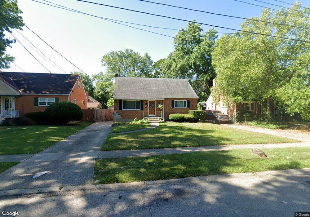
1167 Tassie Ln Cincinnati, OH 45231
Finneytown NeighborhoodEstimated Value: $208,000 - $230,000
4
Beds
1
Bath
1,322
Sq Ft
$164/Sq Ft
Est. Value
About This Home
This home is located at 1167 Tassie Ln, Cincinnati, OH 45231 and is currently estimated at $217,350, approximately $164 per square foot. 1167 Tassie Ln is a home located in Hamilton County with nearby schools including Mt Healthy High School, John Paul II Catholic School, and St. Vivian School.
Ownership History
Date
Name
Owned For
Owner Type
Purchase Details
Closed on
Mar 31, 2022
Sold by
Stephanie Mixon
Bought by
1167 Tassie Lane Llc
Current Estimated Value
Purchase Details
Closed on
Nov 16, 1993
Sold by
Dierker William C
Bought by
Mixon Mark Anthony
Home Financials for this Owner
Home Financials are based on the most recent Mortgage that was taken out on this home.
Original Mortgage
$71,842
Interest Rate
7.35%
Mortgage Type
FHA
Create a Home Valuation Report for This Property
The Home Valuation Report is an in-depth analysis detailing your home's value as well as a comparison with similar homes in the area
Home Values in the Area
Average Home Value in this Area
Purchase History
| Date | Buyer | Sale Price | Title Company |
|---|---|---|---|
| 1167 Tassie Lane Llc | $160,000 | Absolute Title | |
| 1167 Tassie Lane Llc | $160,000 | Absolute Title | |
| Mixon Mark Anthony | -- | Blue Chip Title |
Source: Public Records
Mortgage History
| Date | Status | Borrower | Loan Amount |
|---|---|---|---|
| Previous Owner | Mixon Mark Anthony | $71,842 |
Source: Public Records
Tax History Compared to Growth
Tax History
| Year | Tax Paid | Tax Assessment Tax Assessment Total Assessment is a certain percentage of the fair market value that is determined by local assessors to be the total taxable value of land and additions on the property. | Land | Improvement |
|---|---|---|---|---|
| 2024 | $3,419 | $56,000 | $5,845 | $50,155 |
| 2023 | $3,192 | $56,000 | $5,845 | $50,155 |
| 2022 | $2,710 | $35,498 | $4,911 | $30,587 |
| 2021 | $2,641 | $35,498 | $4,911 | $30,587 |
| 2020 | $2,676 | $35,498 | $4,911 | $30,587 |
| 2019 | $2,428 | $30,083 | $4,162 | $25,921 |
| 2018 | $2,441 | $30,083 | $4,162 | $25,921 |
| 2017 | $2,320 | $30,083 | $4,162 | $25,921 |
| 2016 | $2,308 | $29,488 | $4,515 | $24,973 |
| 2015 | $2,323 | $29,488 | $4,515 | $24,973 |
| 2014 | $2,312 | $29,488 | $4,515 | $24,973 |
| 2013 | $2,219 | $28,911 | $4,428 | $24,483 |
Source: Public Records
Map
Nearby Homes
- 1101 Meadowind Ct
- 8925 Monsanto Dr
- 1100 Gracewind Ct
- 1190 Sugartree Ct
- 8950 Daly Rd
- 1125 Murkett Ct
- 8831 Daly Rd
- 8693 Mockingbird Ln
- 1116 Madeleine Cir
- 8663 Mockingbird Ln
- 8772 Balboa Dr
- 8840 Grenada Dr
- 1052 Vacationland Dr
- 8627 Mockingbird Ln
- 8622 Mockingbird Ln
- 8965 Fontainebleau Terrace
- 1013 Vacationland Dr
- 8491 Daly Rd
- 8543 Foxcroft Dr
- 8584 Mockingbird Ln
- 1171 Tassie Ln
- 1161 Tassie Ln
- 1103 Dalbren Ln
- 1177 Tassie Ln
- 1168 Madeleine Cir
- 1181 Tassie Ln
- 1170 Madeleine Cir
- 1101 Dalbren Ln
- 1160 Tassie Ln
- 1166 Tassie Ln
- 1157 Tassie Ln
- 1152 Tassie Ln
- 1176 Tassie Ln
- 1172 Madeleine Cir
- 1102 Dalbren Ln
- 1187 Tassie Ln
- 1180 Tassie Ln
- 1149 Tassie Ln
- 1100 Dalbren Ln
- 1156 Tassie Ln