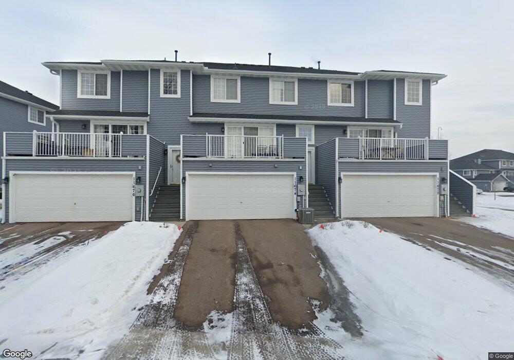
11674 Millpond Ave Unit 127 Burnsville, MN 55337
Estimated Value: $244,000 - $253,000
2
Beds
2
Baths
1,523
Sq Ft
$164/Sq Ft
Est. Value
About This Home
This home is located at 11674 Millpond Ave Unit 127, Burnsville, MN 55337 and is currently estimated at $249,127, approximately $163 per square foot. 11674 Millpond Ave Unit 127 is a home located in Dakota County with nearby schools including Burnsville High School, Gateway STEM Academy, and Sunrise International Montessori School.
Ownership History
Date
Name
Owned For
Owner Type
Purchase Details
Closed on
Jul 16, 2025
Sold by
State Of Minnesota
Bought by
City Of Burnsville
Current Estimated Value
Purchase Details
Closed on
Apr 17, 2025
Sold by
Boulder Pond Homeowners Association Inc
Bought by
Nelson Thomas L
Purchase Details
Closed on
Sep 23, 2021
Sold by
Prestegord Pamela M
Bought by
Nelson Thomas L
Home Financials for this Owner
Home Financials are based on the most recent Mortgage that was taken out on this home.
Original Mortgage
$209,000
Interest Rate
2.8%
Mortgage Type
New Conventional
Purchase Details
Closed on
Nov 9, 1998
Sold by
Delta Development Inc
Bought by
Prestegord Pamela M
Create a Home Valuation Report for This Property
The Home Valuation Report is an in-depth analysis detailing your home's value as well as a comparison with similar homes in the area
Home Values in the Area
Average Home Value in this Area
Purchase History
| Date | Buyer | Sale Price | Title Company |
|---|---|---|---|
| City Of Burnsville | -- | None Listed On Document | |
| Nelson Thomas L | $500 | None Listed On Document | |
| Nelson Thomas L | $220,000 | Burnet Title | |
| Prestegord Pamela M | $100,570 | -- | |
| Delta Development Inc | $5,000 | -- |
Source: Public Records
Mortgage History
| Date | Status | Borrower | Loan Amount |
|---|---|---|---|
| Previous Owner | Nelson Thomas L | $209,000 |
Source: Public Records
Tax History Compared to Growth
Tax History
| Year | Tax Paid | Tax Assessment Tax Assessment Total Assessment is a certain percentage of the fair market value that is determined by local assessors to be the total taxable value of land and additions on the property. | Land | Improvement |
|---|---|---|---|---|
| 2024 | $2,148 | $203,000 | $37,000 | $166,000 |
| 2023 | $2,148 | $217,800 | $37,100 | $180,700 |
| 2022 | $1,852 | $200,500 | $37,000 | $163,500 |
| 2021 | $1,780 | $188,600 | $32,200 | $156,400 |
| 2020 | $1,654 | $174,200 | $30,700 | $143,500 |
| 2019 | $1,679 | $158,500 | $29,200 | $129,300 |
| 2018 | $1,575 | $153,800 | $27,000 | $126,800 |
| 2017 | $1,537 | $142,100 | $25,000 | $117,100 |
| 2016 | $1,463 | $137,900 | $23,800 | $114,100 |
| 2015 | $1,295 | $102,607 | $18,474 | $84,133 |
| 2014 | -- | $93,996 | $16,941 | $77,055 |
| 2013 | -- | $83,314 | $14,539 | $68,775 |
Source: Public Records
Map
Nearby Homes
- 2200 Horizon Rd
- 1853 Riverwood Dr Unit 4
- 1800 Riverwood Dr Unit 110
- 1800 Riverwood Dr Unit 323
- 11900 Highland View Cir
- 11311 W River Hills Dr
- 11921 Baypoint Dr
- 3017 Mcleod St
- 2329 Explorer Ct
- 11902 River Hills Cir
- 1601 Raleigh Dr
- 2001 Woods Ln
- 1609 Riverwood Dr
- 2005 E 122nd St Unit A7
- 2005 E 122nd St Unit A14
- 2005 E 122nd St Unit A23
- 2011 E 122nd St Unit D24
- 2007 E 122nd St Unit B15
- 12232 Oak Leaf Cir
- 11036 27th Ave S
- 11676 Millpond Ave Unit 128
- 11662 Millpond Ave
- 11672 Millpond Ave
- 11660 Millpond Ave
- 11678 Millpond Ave
- 11678 Millpond Ave Unit 120
- 11664 Millpond Ave
- 11666 Millpond Ave Unit 119
- 11668 Millpond Ave
- 11658 Millpond Ave
- 11680 Millpond Ave
- 11680 Millpond Ave Unit 121
- 11656 Millpond Ave
- 11682 Millpond Ave
- 11682 Millpond Ave Unit 122
- 11670 Millpond Ave
- 11654 Millpond Ave
- 11654 Millpond Ave Unit 114
- 2217 E 117th St
- 11652 Millpond Ave