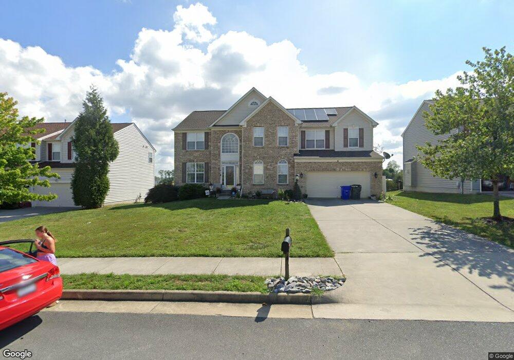
117 Ardeyth Ln Winchester, VA 22602
Estimated Value: $603,000 - $744,000
5
Beds
5
Baths
3,337
Sq Ft
$208/Sq Ft
Est. Value
About This Home
This home is located at 117 Ardeyth Ln, Winchester, VA 22602 and is currently estimated at $693,106, approximately $207 per square foot. 117 Ardeyth Ln is a home located in Frederick County with nearby schools including James Wood Middle School, Millbrook High School, and Sharon's Centre.
Ownership History
Date
Name
Owned For
Owner Type
Purchase Details
Closed on
Apr 16, 2008
Sold by
The Ryland Group
Bought by
Sosebee Thomas A
Current Estimated Value
Home Financials for this Owner
Home Financials are based on the most recent Mortgage that was taken out on this home.
Original Mortgage
$388,000
Outstanding Balance
$247,443
Interest Rate
6.1%
Mortgage Type
New Conventional
Estimated Equity
$445,663
Create a Home Valuation Report for This Property
The Home Valuation Report is an in-depth analysis detailing your home's value as well as a comparison with similar homes in the area
Home Values in the Area
Average Home Value in this Area
Purchase History
| Date | Buyer | Sale Price | Title Company |
|---|---|---|---|
| Sosebee Thomas A | $426,028 | -- |
Source: Public Records
Mortgage History
| Date | Status | Borrower | Loan Amount |
|---|---|---|---|
| Open | Sosebee Thomas A | $388,000 |
Source: Public Records
Tax History Compared to Growth
Tax History
| Year | Tax Paid | Tax Assessment Tax Assessment Total Assessment is a certain percentage of the fair market value that is determined by local assessors to be the total taxable value of land and additions on the property. | Land | Improvement |
|---|---|---|---|---|
| 2025 | $3,356 | $699,072 | $88,000 | $611,072 |
| 2024 | $1,537 | $602,900 | $72,000 | $530,900 |
| 2023 | $3,075 | $602,900 | $72,000 | $530,900 |
| 2022 | $2,928 | $480,000 | $67,000 | $413,000 |
| 2021 | $2,928 | $480,000 | $67,000 | $413,000 |
| 2020 | $2,646 | $433,700 | $67,000 | $366,700 |
| 2019 | $2,646 | $433,700 | $67,000 | $366,700 |
| 2018 | $2,458 | $403,000 | $67,000 | $336,000 |
| 2017 | $2,418 | $403,000 | $67,000 | $336,000 |
| 2016 | $2,242 | $373,600 | $54,500 | $319,100 |
| 2015 | $2,092 | $373,600 | $54,500 | $319,100 |
| 2014 | $985 | $352,000 | $54,500 | $297,500 |
Source: Public Records
Map
Nearby Homes
- 140 Mccormick Cir Unit 403
- 151 Mccormick Cir Unit 203
- 151 Mccormick Cir Unit 201
- 0 Grocery Ave Unit VAFV2015654
- 0 7 Building Lots In Shawneeland Unit VAFV2032844
- 2003 Senseny Rd
- 128 Teaberry Dr
- 106 Foxglove Dr
- 111 Pawn Ct
- Carlisle Plan at Abrams Pointe
- Somerset Plan at Abrams Pointe
- Rockford Plan at Abrams Pointe
- Avalon Plan at Abrams Pointe
- 161 Williamson Rd
- Birmingham Plan at Abrams Pointe
- Drexel Plan at Abrams Pointe
- 101 Abrams Pointe Blvd
- Melody Plan at Abrams Pointe
- 114 Harold Ct
- 203 Lynnehaven Dr
- 119 Ardeyth Ln
- 115 Ardeyth Ln
- 0 Kay Ct Unit 1006039450
- 0 Kay Ct Unit FV6906576
- 113 Ardeyth Ln
- 121 Ardeyth Ln
- 100 Kay Ct
- 114 Arthur Ln
- 101 Kay Ct
- 111 Ardeyth Ln
- 103 Kay Ct
- 109 Ardeyth Ln
- 104 Kay Ct
- 140 Mccormick Cir Unit 302
- 112 Arthur Ln
- 115 Arthur Ln
- 105 Kay Ct
- 107 Ardeyth Ln
- 118 Gabriel Ct
- 113 Arthur Ln