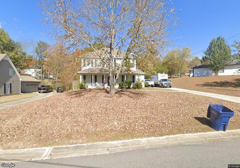
117 Berryhill Dr Alabaster, AL 35007
Estimated Value: $262,000 - $290,000
--
Bed
2
Baths
1,570
Sq Ft
$174/Sq Ft
Est. Value
About This Home
This home is located at 117 Berryhill Dr, Alabaster, AL 35007 and is currently estimated at $272,938, approximately $173 per square foot. 117 Berryhill Dr is a home located in Shelby County with nearby schools including Thompson Intermediate School, Thompson Middle School, and Thompson High School.
Ownership History
Date
Name
Owned For
Owner Type
Purchase Details
Closed on
Nov 18, 2002
Sold by
Turner Heather N and Turner Dennis
Bought by
Reid Christopher J and Reid Emily F
Current Estimated Value
Home Financials for this Owner
Home Financials are based on the most recent Mortgage that was taken out on this home.
Original Mortgage
$100,560
Interest Rate
5.95%
Purchase Details
Closed on
Jan 24, 2002
Sold by
Ford Toni A
Bought by
Thompson Heather N
Home Financials for this Owner
Home Financials are based on the most recent Mortgage that was taken out on this home.
Original Mortgage
$100,000
Interest Rate
7.16%
Create a Home Valuation Report for This Property
The Home Valuation Report is an in-depth analysis detailing your home's value as well as a comparison with similar homes in the area
Home Values in the Area
Average Home Value in this Area
Purchase History
| Date | Buyer | Sale Price | Title Company |
|---|---|---|---|
| Reid Christopher J | $125,700 | -- | |
| Thompson Heather N | $125,000 | -- |
Source: Public Records
Mortgage History
| Date | Status | Borrower | Loan Amount |
|---|---|---|---|
| Previous Owner | Reid Christopher J | $100,560 | |
| Previous Owner | Thompson Heather N | $100,000 | |
| Closed | Thompson Heather N | $25,000 | |
| Closed | Reid Christopher J | $12,570 |
Source: Public Records
Tax History Compared to Growth
Tax History
| Year | Tax Paid | Tax Assessment Tax Assessment Total Assessment is a certain percentage of the fair market value that is determined by local assessors to be the total taxable value of land and additions on the property. | Land | Improvement |
|---|---|---|---|---|
| 2024 | $1,185 | $21,940 | $0 | $0 |
| 2023 | $1,130 | $21,680 | $0 | $0 |
| 2022 | $1,007 | $19,400 | $0 | $0 |
| 2021 | $868 | $16,840 | $0 | $0 |
| 2020 | $804 | $15,640 | $0 | $0 |
| 2019 | $736 | $14,380 | $0 | $0 |
| 2017 | $702 | $13,760 | $0 | $0 |
| 2015 | $675 | $13,260 | $0 | $0 |
| 2014 | $664 | $13,060 | $0 | $0 |
Source: Public Records
Map
Nearby Homes
- 113 Palm Dr
- 280 Cedar Grove Pkwy Unit 34
- 104 Camden Cir
- 521 13th St SW Unit 521
- 217 Kensington Ln
- 309 Cedar Grove Ct
- 537 Ramsgate Dr
- 233 Norwick Forest Dr
- 204 Shalimar Cir
- 1036 7th Ave SW
- 545 Ramsgate Dr
- 549 Ramsgate Dr
- 96 Winterhaven Dr
- 304 Mayfair Cir
- 921 10th St SW
- 412 10th St SW
- 217 Mayfair Park
- 109 Kingsley Cir
- 493 Ramsgate Dr
- 155 Victoria Station
- 113 Berryhill Dr
- 215 Dolphin Ct
- 217 Dolphin Ct
- 104 Berryhill Cir
- 106 Berryhill Cir
- 116 Berryhill Dr
- 120 Berryhill Dr
- 213 Dolphin Ct
- 112 Berryhill Dr
- 219 Dolphin Ct
- 218 Dolphin Ct
- 108 Berryhill Cir
- 108 Berryhill Dr
- 224 Dolphin Ct
- 220 Dolphin Ct
- 216 Dolphin Ct
- 211 Dolphin Ct
- 129 Berryhill Dr
- 101 Berryhill Cir
- 104 Berryhill Dr