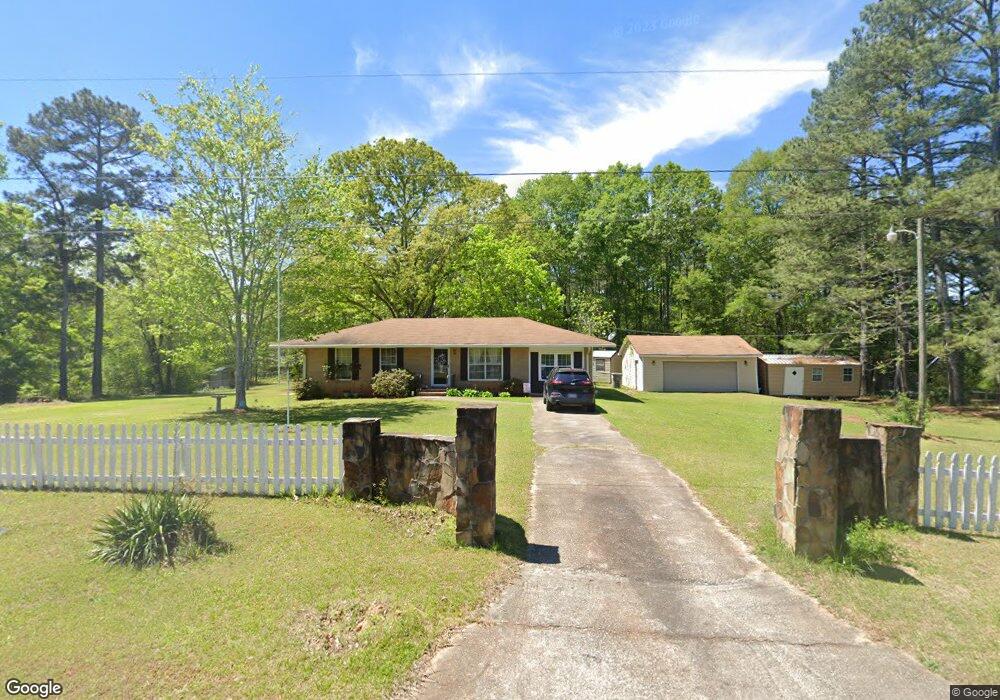
117 Carol Ln Barnesville, GA 30204
Estimated Value: $178,000 - $277,000
3
Beds
2
Baths
1,275
Sq Ft
$178/Sq Ft
Est. Value
About This Home
This home is located at 117 Carol Ln, Barnesville, GA 30204 and is currently estimated at $226,450, approximately $177 per square foot. 117 Carol Ln is a home located in Lamar County with nearby schools including Lamar County Primary School, Lamar County Elementary School, and Lamar County Middle School.
Ownership History
Date
Name
Owned For
Owner Type
Purchase Details
Closed on
Sep 23, 2016
Sold by
Kimberly E
Bought by
Nicholson Peggy Diane
Current Estimated Value
Purchase Details
Closed on
Mar 1, 1990
Sold by
Shannon Roger
Bought by
Nicholson Arthur
Create a Home Valuation Report for This Property
The Home Valuation Report is an in-depth analysis detailing your home's value as well as a comparison with similar homes in the area
Purchase History
| Date | Buyer | Sale Price | Title Company |
|---|---|---|---|
| Nicholson Peggy Diane | -- | -- | |
| Nicholson Peggy Diane | -- | -- | |
| Nicholson Arthur | $38,000 | -- |
Source: Public Records
Tax History Compared to Growth
Tax History
| Year | Tax Paid | Tax Assessment Tax Assessment Total Assessment is a certain percentage of the fair market value that is determined by local assessors to be the total taxable value of land and additions on the property. | Land | Improvement |
|---|---|---|---|---|
| 2025 | $962 | $62,018 | $5,096 | $56,922 |
| 2024 | $904 | $53,493 | $5,096 | $48,397 |
| 2023 | $864 | $49,500 | $5,096 | $44,404 |
| 2022 | $749 | $45,336 | $3,116 | $42,220 |
| 2021 | $627 | $35,007 | $3,116 | $31,891 |
| 2020 | $660 | $35,007 | $3,116 | $31,891 |
| 2019 | $662 | $35,007 | $3,116 | $31,891 |
| 2018 | $636 | $35,007 | $3,116 | $31,891 |
| 2017 | $855 | $35,007 | $3,116 | $31,891 |
| 2016 | $851 | $35,007 | $3,116 | $31,891 |
| 2015 | $850 | $35,006 | $3,116 | $31,891 |
| 2014 | $814 | $34,855 | $3,116 | $31,740 |
| 2013 | -- | $34,855 | $3,115 | $31,739 |
Source: Public Records
Map
Nearby Homes
- 818 Cannafax Rd
- 148 Berry Rd
- 150 Berry Rd
- 146 Berry Rd
- 144 Berry Rd
- 0 Perkins Rd Unit 253616
- 0 Perkins Rd Unit 10625263
- 0 Perkins Rd Unit 7692755
- 0 Perkins Rd Unit 10663247
- 916 Highway 36 W
- 0 Midway Rd Unit 10682026
- 746 Highway 18 W
- 410 Country Kitchen Rd
- 1207 Highway 36 W
- 0 Veterns Pkwy Unit 10515268
- 109 Barnesville Ave
- Parcel 2 Yatesville Rd
- 0 Highway 341 S Unit 181569
- 0 Highway 341 S Unit 10610486
- 0 Yatesville Rd Unit 10650403
- 123 Carol Ln
- 251 Rogers Cir
- 118 Carol Ln
- 265 Rogers Cir
- 124 Carol Ln
- 218 Rogers Cir
- 255 Rogers Cir
- 133 Carol Ln
- 763 Cannafax Rd
- 745 Cannafax Rd
- 273 Rogers Cir Unit 19
- 273 Rogers Cir
- 252 Rogers Cir
- 252 Rogers Cir
- 256 Rogers Cir
- 130 Carol Ln
- 222 Rogers Cir
- 106 Needleleaf Dr Unit 1
- 106 Needleleaf Dr Unit Lot 47
- 733 Cannafax Rd