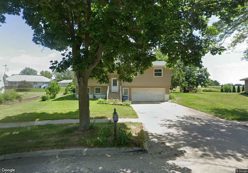
117 E 15th St West Liberty, IA 52776
Estimated Value: $207,538 - $258,000
3
Beds
2
Baths
1,430
Sq Ft
$161/Sq Ft
Est. Value
About This Home
This home is located at 117 E 15th St, West Liberty, IA 52776 and is currently estimated at $230,385, approximately $161 per square foot. 117 E 15th St is a home located in Muscatine County with nearby schools including Early Childhood Center, West Liberty Middle School, and West Liberty High School.
Ownership History
Date
Name
Owned For
Owner Type
Purchase Details
Closed on
Jan 31, 2017
Sold by
Phomachan Somnouk
Bought by
Phomachan Anong
Current Estimated Value
Purchase Details
Closed on
Oct 5, 2007
Sold by
Rocha Rolando C and Rocha Larissa L
Bought by
Phomachan Somnouk and Phomachan Anog
Home Financials for this Owner
Home Financials are based on the most recent Mortgage that was taken out on this home.
Original Mortgage
$80,000
Outstanding Balance
$50,674
Interest Rate
6.49%
Mortgage Type
New Conventional
Estimated Equity
$179,712
Create a Home Valuation Report for This Property
The Home Valuation Report is an in-depth analysis detailing your home's value as well as a comparison with similar homes in the area
Home Values in the Area
Average Home Value in this Area
Purchase History
| Date | Buyer | Sale Price | Title Company |
|---|---|---|---|
| Phomachan Anong | -- | None Available | |
| Phomachan Somnouk | $119,000 | None Available |
Source: Public Records
Mortgage History
| Date | Status | Borrower | Loan Amount |
|---|---|---|---|
| Open | Phomachan Somnouk | $80,000 |
Source: Public Records
Tax History Compared to Growth
Tax History
| Year | Tax Paid | Tax Assessment Tax Assessment Total Assessment is a certain percentage of the fair market value that is determined by local assessors to be the total taxable value of land and additions on the property. | Land | Improvement |
|---|---|---|---|---|
| 2025 | $3,310 | $186,770 | $38,090 | $148,680 |
| 2024 | $3,310 | $186,900 | $38,090 | $148,810 |
| 2023 | $3,468 | $195,559 | $38,107 | $157,452 |
| 2022 | $3,260 | $183,150 | $35,950 | $147,200 |
| 2021 | $3,260 | $167,250 | $35,950 | $131,300 |
| 2020 | $3,234 | $159,900 | $35,950 | $123,950 |
| 2019 | $3,350 | $0 | $0 | $0 |
| 2018 | $3,492 | $0 | $0 | $0 |
| 2017 | $3,320 | $144,310 | $0 | $0 |
| 2016 | $3,238 | $144,310 | $0 | $0 |
| 2015 | $3,238 | $139,690 | $0 | $0 |
| 2014 | $3,214 | $139,690 | $0 | $0 |
Source: Public Records
Map
Nearby Homes
- Lots14,15,16,18 Indigo Cir
- 0 Garfield Ave
- 138 Buysse Ln
- 201 17th St
- 132 Buysse Ln
- 134 Buysse Ln
- 114 Buysse Ln
- 401 W 16th St
- 1001 N Miller St
- 206 W Gibson St
- 600 N Columbus St
- 1033 Evans Ave
- 1033 N Evans Ave
- 401 E 3rd St
- 209 N Miller St
- Lot 2 12-78-4w
- 510 E 1st St
- 0000 TBD E A St
- 0000 Tbd E A St
- 1444 121st St