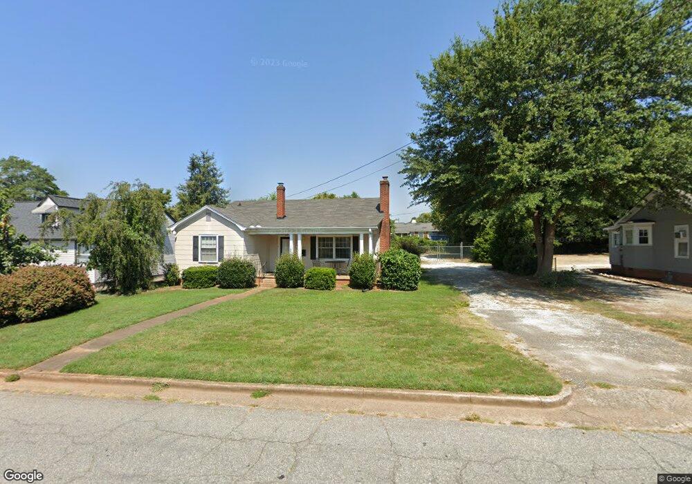
117 E Mauldin St Anderson, SC 29621
Estimated Value: $142,000 - $230,000
2
Beds
--
Bath
1,407
Sq Ft
$133/Sq Ft
Est. Value
About This Home
This home is located at 117 E Mauldin St, Anderson, SC 29621 and is currently estimated at $186,445, approximately $132 per square foot. 117 E Mauldin St is a home located in Anderson County with nearby schools including Concord Elementary School, McCants Middle School, and T.L. Hanna High School.
Ownership History
Date
Name
Owned For
Owner Type
Purchase Details
Closed on
Jan 6, 2021
Sold by
Obrien Earl B and Obrien Cynthia J
Bought by
Obrien Earl B and Obrien Cynthia J
Current Estimated Value
Purchase Details
Closed on
Nov 29, 2012
Sold by
Lewis Carol R and Markham Roberts D
Bought by
Obrien Earl B and Obrien Cynthia J
Home Financials for this Owner
Home Financials are based on the most recent Mortgage that was taken out on this home.
Original Mortgage
$85,000
Interest Rate
3.43%
Mortgage Type
New Conventional
Purchase Details
Closed on
Mar 7, 2008
Sold by
Chapman Annie L and Ashley Troyce Anne
Bought by
Sanders Pauline T
Create a Home Valuation Report for This Property
The Home Valuation Report is an in-depth analysis detailing your home's value as well as a comparison with similar homes in the area
Home Values in the Area
Average Home Value in this Area
Purchase History
| Date | Buyer | Sale Price | Title Company |
|---|---|---|---|
| Obrien Earl B | -- | None Available | |
| Obrien Earl B | $87,500 | -- | |
| Sanders Pauline T | $110,000 | None Available | |
| Sanders Pauline T | $110,000 | None Available |
Source: Public Records
Mortgage History
| Date | Status | Borrower | Loan Amount |
|---|---|---|---|
| Closed | Obrien Earl B | $85,000 |
Source: Public Records
Tax History Compared to Growth
Tax History
| Year | Tax Paid | Tax Assessment Tax Assessment Total Assessment is a certain percentage of the fair market value that is determined by local assessors to be the total taxable value of land and additions on the property. | Land | Improvement |
|---|---|---|---|---|
| 2024 | $2,313 | $5,460 | $3,110 | $2,350 |
| 2023 | $2,313 | $5,460 | $3,110 | $2,350 |
| 2022 | $2,246 | $5,460 | $3,110 | $2,350 |
| 2021 | $2,146 | $4,800 | $2,550 | $2,250 |
| 2020 | $2,124 | $4,800 | $2,550 | $2,250 |
| 2019 | $2,124 | $4,800 | $2,550 | $2,250 |
| 2018 | $2,103 | $4,800 | $2,550 | $2,250 |
| 2017 | -- | $4,800 | $2,550 | $2,250 |
| 2016 | $2,149 | $4,960 | $2,550 | $2,410 |
| 2015 | $2,163 | $4,960 | $2,550 | $2,410 |
| 2014 | $2,135 | $4,960 | $2,550 | $2,410 |
Source: Public Records
Map
Nearby Homes
- 406 Moultrie Square
- 220 Moultrie Square
- 401 Berkshire Hill
- 2010 Boulevard Heights
- 0 High Shoals Rd
- 705 E Mauldin St
- 110 Clinton Dr
- 108 Clinton Dr
- 2014 College Ave
- 116 Henry Ave
- 2506 Poplar Ln
- 122 Laurel Oak Dr
- 104 Laurel Oak Dr
- 167 Laurel Oak Dr
- 104 McGee Ct
- 2313 Poplar Ln
- 211 Cater St
- 415 Watson Ave
- 1808 Edgewood Ave
- 115 E Mauldin St
- 1813 N Boulevard
- 1811 N Boulevard
- 111 E Mauldin St
- 109 E Mauldin St
- 109 E Mauldin St
- 102 E Mauldin St
- 1722 N Main St Unit Lot 5
- 1722 N Main St
- 1634 N Main St
- 1626 N Main St
- 1638 N Main St
- 1632 N Main St Unit B
- 1632 N Main St
- 1900 N Boulevard
- 1702 N Main St
- 108 Midtown Square
- 106 Midtown Square
- 110 Mid Town Square
- 1628 N Main St