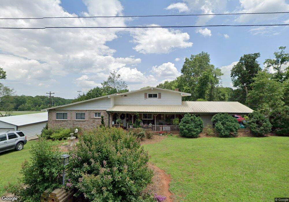
117 Forest Park Dr Denton, NC 27239
Estimated Value: $299,302 - $399,000
4
Beds
4
Baths
4,231
Sq Ft
$84/Sq Ft
Est. Value
About This Home
This home is located at 117 Forest Park Dr, Denton, NC 27239 and is currently estimated at $355,076, approximately $83 per square foot. 117 Forest Park Dr is a home located in Davidson County with nearby schools including Denton Elementary School and South Davidson Middle and High School.
Ownership History
Date
Name
Owned For
Owner Type
Purchase Details
Closed on
Nov 5, 2024
Sold by
Loflin Roger Wade
Bought by
Loflin Roger Wade and Loflin Donice Gail
Current Estimated Value
Purchase Details
Closed on
Oct 24, 2012
Sold by
Frazier Terry Scott and Frazier Rhonda K
Bought by
Loflin Roger Wade
Home Financials for this Owner
Home Financials are based on the most recent Mortgage that was taken out on this home.
Original Mortgage
$64,269
Interest Rate
3.42%
Mortgage Type
Credit Line Revolving
Purchase Details
Closed on
May 1, 1999
Purchase Details
Closed on
Aug 1, 1978
Purchase Details
Closed on
Jun 1, 1975
Create a Home Valuation Report for This Property
The Home Valuation Report is an in-depth analysis detailing your home's value as well as a comparison with similar homes in the area
Home Values in the Area
Average Home Value in this Area
Purchase History
| Date | Buyer | Sale Price | Title Company |
|---|---|---|---|
| Loflin Roger Wade | -- | None Listed On Document | |
| Loflin Roger Wade | $67,652 | None Available | |
| -- | $65,000 | -- | |
| -- | $36,000 | -- | |
| -- | $3,200 | -- |
Source: Public Records
Mortgage History
| Date | Status | Borrower | Loan Amount |
|---|---|---|---|
| Previous Owner | Loflin Roger Wade | $64,269 |
Source: Public Records
Tax History Compared to Growth
Tax History
| Year | Tax Paid | Tax Assessment Tax Assessment Total Assessment is a certain percentage of the fair market value that is determined by local assessors to be the total taxable value of land and additions on the property. | Land | Improvement |
|---|---|---|---|---|
| 2025 | $2,178 | $193,920 | $0 | $0 |
| 2024 | $1,802 | $160,520 | $0 | $0 |
| 2023 | $1,830 | $160,520 | $0 | $0 |
| 2022 | $1,802 | $160,520 | $0 | $0 |
| 2021 | $1,802 | $160,520 | $0 | $0 |
| 2020 | $1,570 | $139,850 | $0 | $0 |
| 2019 | $1,594 | $139,850 | $0 | $0 |
| 2018 | $1,594 | $139,850 | $0 | $0 |
| 2017 | $1,498 | $131,400 | $0 | $0 |
| 2016 | $1,498 | $131,400 | $0 | $0 |
| 2015 | $1,432 | $131,400 | $0 | $0 |
| 2014 | $1,424 | $130,630 | $0 | $0 |
Source: Public Records
Map
Nearby Homes
- 320 Forest Park Dr
- 278 Forest Park Dr
- 00 Bombay Rd
- 69 Lanning Dr
- 572 Bombay Rd
- 0000 Bombay Rd
- 434 E Salisbury St
- 61 Haywood St
- 219 Dot St
- 178 E Salisbury St
- 166 S Main St
- 00 3rd St
- 354 Anderson St
- 130 Garner St
- 356 Eastside Dr
- 148 Garner St
- 491 W Peacock Ave
- 165 Brown St
- 256 Forest Hill Dr
- 149 Seeley Dr
- 296 Bombay Rd
- 246 Bombay Rd
- 67 Forest Park Dr
- 355 Forest Park Dr
- 60 Forest Park Dr
- 218 Bombay Rd
- 91 Forest Park Dr
- 253 Bombay Rd
- 360 Forest Park Dr
- 225 Bombay Rd
- 88 Forest Park Dr
- 331 Forest Park Dr
- 338 Forest Park Dr
- 205 Bombay Rd
- 119 Forest Park Dr
- 340 Forest Park Dr
- 122 Forest Park Dr
- 00 Peacock Ave
- 297 Forest Park Dr
- 160 Bombay Rd