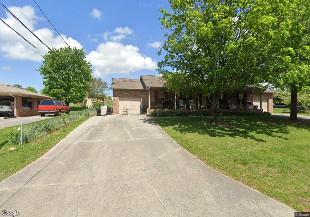
117 Fox Dr Morristown, TN 37814
Estimated Value: $319,398 - $496,000
--
Bed
2
Baths
1,683
Sq Ft
$233/Sq Ft
Est. Value
About This Home
This home is located at 117 Fox Dr, Morristown, TN 37814 and is currently estimated at $392,133, approximately $232 per square foot. 117 Fox Dr is a home located in Hamblen County with nearby schools including Alpha Elementary School, West View Middle School, and Morristown West High School.
Ownership History
Date
Name
Owned For
Owner Type
Purchase Details
Closed on
Dec 20, 1996
Bought by
Cline Gaston and Cline Patricia
Current Estimated Value
Purchase Details
Closed on
Mar 10, 1993
Bought by
Long Ruby R
Purchase Details
Closed on
Aug 14, 1992
Bought by
Miller John B and Miller June E
Purchase Details
Closed on
May 6, 1989
Bought by
Long Ruby R and Long Robert
Create a Home Valuation Report for This Property
The Home Valuation Report is an in-depth analysis detailing your home's value as well as a comparison with similar homes in the area
Home Values in the Area
Average Home Value in this Area
Purchase History
| Date | Buyer | Sale Price | Title Company |
|---|---|---|---|
| Cline Gaston | $9,500 | -- | |
| Long Ruby R | -- | -- | |
| Long Ruby R | $6,900 | -- | |
| Miller John B | $6,900 | -- | |
| Long Ruby R | -- | -- |
Source: Public Records
Tax History Compared to Growth
Tax History
| Year | Tax Paid | Tax Assessment Tax Assessment Total Assessment is a certain percentage of the fair market value that is determined by local assessors to be the total taxable value of land and additions on the property. | Land | Improvement |
|---|---|---|---|---|
| 2024 | $1,176 | $59,680 | $8,560 | $51,120 |
| 2023 | $1,176 | $59,680 | $0 | $0 |
| 2022 | $1,176 | $59,680 | $8,560 | $51,120 |
| 2021 | $1,176 | $59,680 | $8,560 | $51,120 |
| 2020 | $1,176 | $59,680 | $8,560 | $51,120 |
| 2019 | $1,097 | $51,520 | $7,840 | $43,680 |
| 2018 | $1,097 | $51,520 | $7,840 | $43,680 |
| 2017 | $1,097 | $51,520 | $7,840 | $43,680 |
| 2016 | $1,025 | $51,520 | $7,840 | $43,680 |
| 2015 | $953 | $51,520 | $7,840 | $43,680 |
| 2014 | -- | $51,520 | $7,840 | $43,680 |
| 2013 | -- | $59,240 | $0 | $0 |
Source: Public Records
Map
Nearby Homes
- 00 Fox Dr
- 430 Fox Dr
- 234 Saint Johns Rd
- 426 Willow Tree Ln
- 738 Bear Springs Rd
- 5715 Academy Dr
- 5087 Runnerstone Rd
- 5073 Runnerstone Rd
- 5203 Cub Cir
- 5043 Runnerstone Rd
- 5031 Runnerstone Rd
- 5130 Old Highway 11e
- 412 Furrow Dr
- 413 Furrow Dr
- 420 Furrow Dr
- 428 Furrow Dr
- 419 Furrow Dr
- 434 Furrow Dr
- 429 Furrow Dr
- 5044 Lost Creek Dr