Estimated Value: $136,182 - $173,000
--
Bed
2
Baths
1,224
Sq Ft
$124/Sq Ft
Est. Value
About This Home
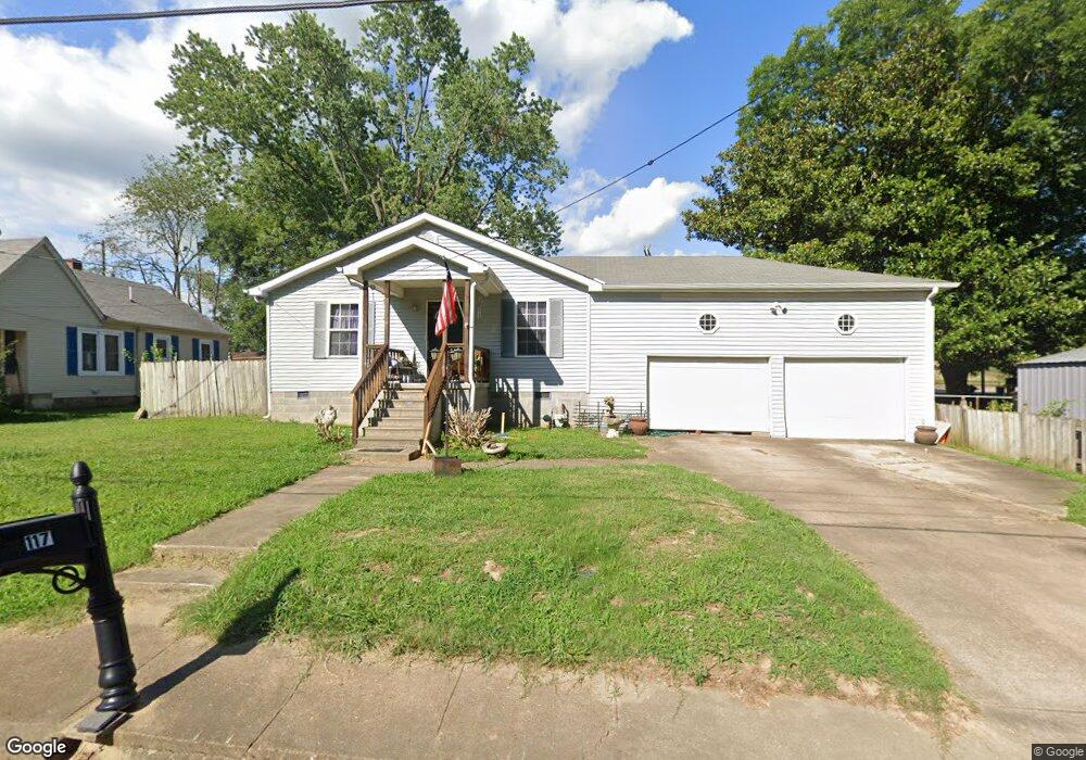
This home is located at 117 Freemont St, Dyer, TN 38330 and is currently estimated at $151,296, approximately $123 per square foot. 117 Freemont St is a home located in Gibson County with nearby schools including Dyer Elementary School and Gibson County High School.
Ownership History
Date
Name
Owned For
Owner Type
Purchase Details
Closed on
Dec 19, 2007
Sold by
Knight Marie
Bought by
Smith Janet L
Current Estimated Value
Purchase Details
Closed on
Jul 31, 1995
Sold by
Chevalia W D Evelyn
Bought by
Chevalia Donnie
Purchase Details
Closed on
Jul 11, 1994
Bought by
Knight Marie
Purchase Details
Closed on
Aug 25, 1974
Bought by
Bates Ralph Nick and Bobby Dewayne Ba
Purchase Details
Closed on
Jan 5, 1960
Bought by
Bates Nick and Bates Nell
Create a Home Valuation Report for This Property
The Home Valuation Report is an in-depth analysis detailing your home's value as well as a comparison with similar homes in the area
Home Values in the Area
Average Home Value in this Area
Purchase History
| Date | Buyer | Sale Price | Title Company |
|---|---|---|---|
| Smith Janet L | -- | -- | |
| Chevalia Donnie | $18,400 | -- | |
| Knight Marie | $26,500 | -- | |
| Bates Ralph Nick | -- | -- | |
| Bates Nick | -- | -- |
Source: Public Records
Tax History Compared to Growth
Tax History
| Year | Tax Paid | Tax Assessment Tax Assessment Total Assessment is a certain percentage of the fair market value that is determined by local assessors to be the total taxable value of land and additions on the property. | Land | Improvement |
|---|---|---|---|---|
| 2025 | $1,292 | $37,275 | $0 | $0 |
| 2024 | $1,292 | $37,275 | $2,500 | $34,775 |
| 2023 | $701 | $22,525 | $1,150 | $21,375 |
| 2022 | $686 | $22,525 | $1,150 | $21,375 |
| 2021 | $686 | $22,525 | $1,150 | $21,375 |
| 2020 | $1,121 | $22,525 | $1,150 | $21,375 |
| 2019 | $1,122 | $22,525 | $1,150 | $21,375 |
| 2018 | $1,149 | $22,750 | $1,050 | $21,700 |
| 2017 | $1,103 | $22,750 | $1,050 | $21,700 |
| 2016 | $1,103 | $22,750 | $1,050 | $21,700 |
| 2015 | $1,004 | $22,750 | $1,050 | $21,700 |
| 2014 | $997 | $22,575 | $1,050 | $21,525 |
Source: Public Records
Map
Nearby Homes
- 142 S Poplar St
- 299 E Walnut St
- 354 E Maple St
- 139 Peach St
- 205 Division St
- 217 Central St
- 342 E Walnut St
- 185 S Royal St
- 0 Royal St
- 163 Monroe St
- 208 & 210 Lee St
- 508 E College St
- 246 Thomas St
- 153 New Hope St
- 173 Orr Rd
- 707 N Main St
- 91 Currie Rd
- 148 Scattered Acres Loop
- 23 Gravettes Crossing Rd W
- Tract 1 Trenton Hwy
- 123 Freemont St
- 292 E College St
- 133 Freemont St Unit 135
- 120 Freemont St
- 284 E College St
- 124 Freemont St
- 130 Freemont St
- 134 Freemont St
- 139 Freemont St
- 276 E College St
- 138 N Poplar St
- 295 E College St
- 140 Freemont St
- 287 E College St
- 145 Freemont St
- 146 N Poplar St
- 148 Freemont St
- 285 E College St
- 151 Freemont St
- 118 S Poplar St