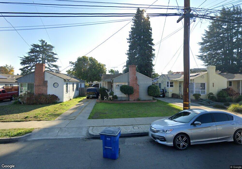
117 Harlan St San Leandro, CA 94577
Old San Leandro NeighborhoodEstimated Value: $730,000 - $815,000
2
Beds
1
Bath
1,194
Sq Ft
$643/Sq Ft
Est. Value
About This Home
This home is located at 117 Harlan St, San Leandro, CA 94577 and is currently estimated at $768,098, approximately $643 per square foot. 117 Harlan St is a home located in Alameda County with nearby schools including McKinley Elementary School, Bancroft Middle School, and San Leandro High School.
Ownership History
Date
Name
Owned For
Owner Type
Purchase Details
Closed on
Aug 8, 2012
Sold by
Rogers Sally and Rogers Sally O
Bought by
Corti Gianfranco and Corti Rosemary
Current Estimated Value
Purchase Details
Closed on
Jul 25, 2005
Sold by
Devine Lynda
Bought by
Rogers Sally
Purchase Details
Closed on
Jun 17, 1994
Sold by
Rogers Sally O
Bought by
Rogers Sally O and Devine Linda
Create a Home Valuation Report for This Property
The Home Valuation Report is an in-depth analysis detailing your home's value as well as a comparison with similar homes in the area
Home Values in the Area
Average Home Value in this Area
Purchase History
| Date | Buyer | Sale Price | Title Company |
|---|---|---|---|
| Corti Gianfranco | $250,000 | Placer Title Company | |
| Rogers Sally | -- | -- | |
| Rogers Sally O | -- | -- |
Source: Public Records
Tax History Compared to Growth
Tax History
| Year | Tax Paid | Tax Assessment Tax Assessment Total Assessment is a certain percentage of the fair market value that is determined by local assessors to be the total taxable value of land and additions on the property. | Land | Improvement |
|---|---|---|---|---|
| 2025 | $4,607 | $307,844 | $92,353 | $215,491 |
| 2024 | $4,607 | $301,810 | $90,543 | $211,267 |
| 2023 | $4,543 | $295,891 | $88,767 | $207,124 |
| 2022 | $4,417 | $290,091 | $87,027 | $203,064 |
| 2021 | $4,257 | $284,404 | $85,321 | $199,083 |
| 2020 | $4,127 | $281,490 | $84,447 | $197,043 |
| 2019 | $4,011 | $275,971 | $82,791 | $193,180 |
| 2018 | $3,893 | $270,561 | $81,168 | $189,393 |
| 2017 | $3,839 | $265,257 | $79,577 | $185,680 |
| 2016 | $3,646 | $260,057 | $78,017 | $182,040 |
| 2015 | $3,582 | $256,151 | $76,845 | $179,306 |
| 2014 | $3,550 | $251,134 | $75,340 | $175,794 |
Source: Public Records
Map
Nearby Homes
- 2062 Washington Ave
- 2077 Washington Ave Unit 114
- 2077 Washington Ave Unit 111
- 2101 Washington Ave
- 1854 Hays St
- 341 Castro St
- 65 Thornton St
- 2378 Cheshire Place
- 2460 Dundee Ct
- 1639 Washington Ave
- 2399 E 14th St Unit 143
- 2399 E 14th St Unit 66
- 2399 E 14th St Unit 159
- 2399 E 14th St Unit 24
- 2399 E 14th St Unit 112
- 1599 Hays St Unit 306
- 398 Parrott St Unit 302
- 2147 Trombas Ave
- 400 Joaquin Ave
- 736 Castro St