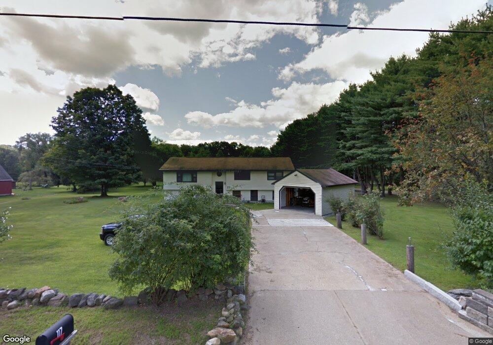
117 Lamprey Rd Belmont, NH 03220
Estimated Value: $399,256 - $484,000
3
Beds
3
Baths
2,600
Sq Ft
$172/Sq Ft
Est. Value
About This Home
This home is located at 117 Lamprey Rd, Belmont, NH 03220 and is currently estimated at $446,814, approximately $171 per square foot. 117 Lamprey Rd is a home located in Belknap County with nearby schools including Belmont Elementary School, Belmont Middle School, and Belmont High School.
Ownership History
Date
Name
Owned For
Owner Type
Purchase Details
Closed on
Jul 10, 2015
Sold by
Benner Jeffrey O and Benner Brenda L
Bought by
J & B Benner Ret
Current Estimated Value
Purchase Details
Closed on
Mar 2, 2011
Sold by
Fitts Theresa G
Bought by
Benner Jeffrey O and Benner Brenda L
Home Financials for this Owner
Home Financials are based on the most recent Mortgage that was taken out on this home.
Original Mortgage
$160,000
Interest Rate
4.76%
Mortgage Type
Purchase Money Mortgage
Create a Home Valuation Report for This Property
The Home Valuation Report is an in-depth analysis detailing your home's value as well as a comparison with similar homes in the area
Home Values in the Area
Average Home Value in this Area
Purchase History
| Date | Buyer | Sale Price | Title Company |
|---|---|---|---|
| J & B Benner Ret | -- | -- | |
| Benner Jeffrey O | $160,000 | -- |
Source: Public Records
Mortgage History
| Date | Status | Borrower | Loan Amount |
|---|---|---|---|
| Previous Owner | Benner Jeffrey O | $155,900 | |
| Previous Owner | Benner Jeffrey O | $160,000 |
Source: Public Records
Tax History Compared to Growth
Tax History
| Year | Tax Paid | Tax Assessment Tax Assessment Total Assessment is a certain percentage of the fair market value that is determined by local assessors to be the total taxable value of land and additions on the property. | Land | Improvement |
|---|---|---|---|---|
| 2024 | $5,731 | $364,100 | $85,000 | $279,100 |
| 2023 | $5,393 | $308,700 | $64,900 | $243,800 |
| 2022 | $5,263 | $275,400 | $56,600 | $218,800 |
| 2021 | $4,913 | $184,200 | $42,400 | $141,800 |
| 2020 | $4,168 | $184,200 | $42,400 | $141,800 |
| 2019 | $4,607 | $184,200 | $42,400 | $141,800 |
| 2017 | $3,811 | $148,100 | $43,700 | $104,400 |
| 2016 | $3,770 | $148,100 | $43,700 | $104,400 |
| 2015 | $4,187 | $148,100 | $43,700 | $104,400 |
| 2014 | $4,095 | $148,100 | $43,700 | $104,400 |
| 2013 | -- | $183,100 | $73,300 | $109,800 |
Source: Public Records
Map
Nearby Homes
- 11 Valley Dr
- 5 Tee Dee Dr
- 18 Highcrest Dr
- 42 Horne Rd
- 11 Highcrest Dr
- 73 Seavey Rd
- 0 Horne Rd Unit 5054405
- 66 Bean Hill Rd
- 134 Leavitt Rd
- 82 Plummer Hill Rd
- 78 Granite Ridge Dr
- 17 Granite Ridge Dr
- 24 Granite Ridge Dr
- 357 Hurricane Rd
- 218 Wild Acres Rd
- 6 Sunshine Dr
- 32 Mallards Landing Rd
- 2 3rd St
- 13 Silkwood Ave
- 26 Juniper Dr