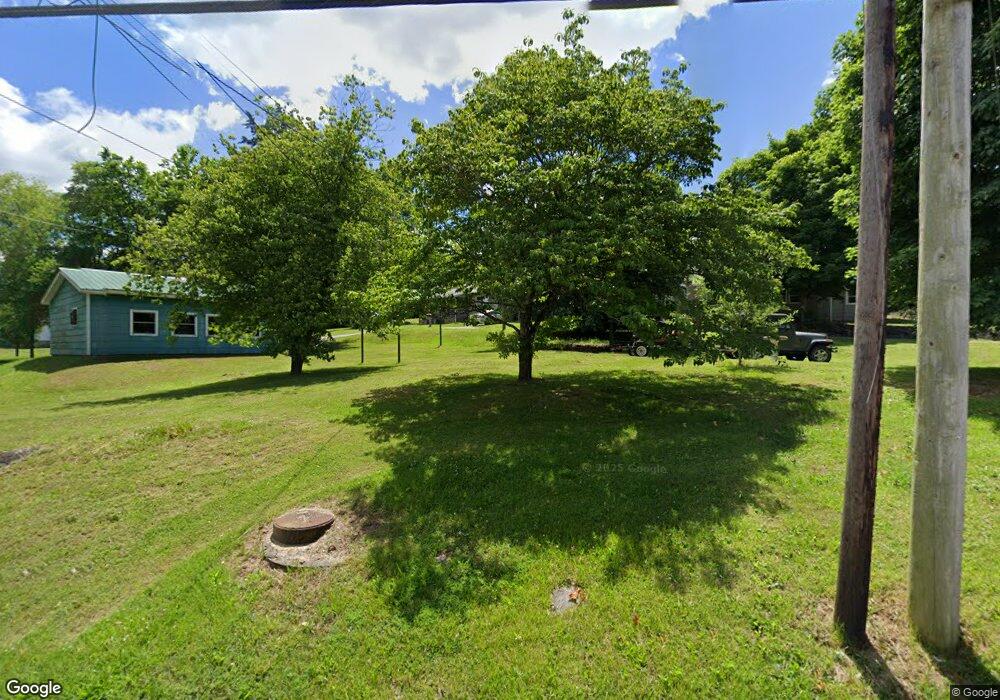
117 Maples St Rutledge, TN 37861
Estimated Value: $86,643 - $296,000
Studio
1
Bath
1,071
Sq Ft
$167/Sq Ft
Est. Value
About This Home
This home is located at 117 Maples St, Rutledge, TN 37861 and is currently estimated at $179,161, approximately $167 per square foot. 117 Maples St is a home located in Grainger County with nearby schools including Rutledge Primary School, Rutledge Elementary School, and Rutledge Middle School.
Ownership History
Date
Name
Owned For
Owner Type
Purchase Details
Closed on
Mar 7, 2023
Sold by
Roach Christopher Keith and Roach Christy L
Bought by
Roach Christopher Keith
Current Estimated Value
Purchase Details
Closed on
Nov 1, 2004
Sold by
Roach Johnny W
Bought by
Roach Christopher Keith
Purchase Details
Closed on
Feb 19, 1994
Bought by
Roach Johny and Roach Peggy
Purchase Details
Closed on
Oct 17, 1983
Bought by
Orrick Ronnie and Orrick Patsy
Purchase Details
Closed on
Jan 1, 1983
Create a Home Valuation Report for This Property
The Home Valuation Report is an in-depth analysis detailing your home's value as well as a comparison with similar homes in the area
Purchase History
| Date | Buyer | Sale Price | Title Company |
|---|---|---|---|
| Roach Christopher Keith | -- | -- | |
| Roach Christopher Keith | -- | None Listed On Document | |
| Roach Christopher Keith | -- | -- | |
| Roach Johny | $20,000 | -- | |
| Orrick Ronnie | -- | -- | |
| -- | $20,000 | -- |
Source: Public Records
Tax History
| Year | Tax Paid | Tax Assessment Tax Assessment Total Assessment is a certain percentage of the fair market value that is determined by local assessors to be the total taxable value of land and additions on the property. | Land | Improvement |
|---|---|---|---|---|
| 2025 | $284 | $12,075 | $2,100 | $9,975 |
| 2024 | $284 | $12,075 | $2,100 | $9,975 |
| 2023 | $284 | $12,075 | $2,100 | $9,975 |
| 2022 | $277 | $12,075 | $2,100 | $9,975 |
| 2021 | $277 | $12,075 | $2,100 | $9,975 |
| 2020 | $264 | $12,075 | $2,100 | $9,975 |
| 2019 | $264 | $9,425 | $1,950 | $7,475 |
| 2018 | $228 | $9,425 | $1,950 | $7,475 |
| 2017 | $228 | $9,425 | $1,950 | $7,475 |
| 2016 | $228 | $9,425 | $1,950 | $7,475 |
| 2015 | $219 | $9,425 | $1,950 | $7,475 |
| 2014 | $219 | $8,743 | $0 | $0 |
Source: Public Records
Map
Nearby Homes
- 0 Silent Ln Unit 1299563
- 131 Southside Ave
- 238 Overlook Ln
- 8445 U S 11w
- 1655 Lester Whitt Rd
- 0 Doc Hill Rd
- 979 Tennessee 92
- 979 Highway 92
- 180 Farrow Rd
- 3500 Poor Valley Rd
- 0 Cherry St
- 172 W Hills Rd
- 621 Carrol Greenlee Rd
- 0 Jarnagin Unit 1328423
- 727 Rocky Branch Rd
- Lot 64 Shiloh Springs Rd
- Lot 77 Shiloh Springs Rd
- Lot 11 Pocahontas Ln
- 132 Cedarock Ln
- 1333 Cherry St
- 123 Maples St
- 139 Maples St
- 110 Knob Rd
- 124 Knob Rd
- 274 Highway 92
- 197 Double Cave Rd
- 107 Knob Rd
- 299 Highway 92
- 222 Double Cave Rd
- 145 Easley St
- 126 Easley St
- 238 Highway 92
- 146 Easley St
- 171 Easley St
- 177 Double Cave Rd
- 178 Double Cave Rd
- 331 Highway 92
- 160 Double Cave Rd
- 119 Knob Rd
- 158 Silent Ln
