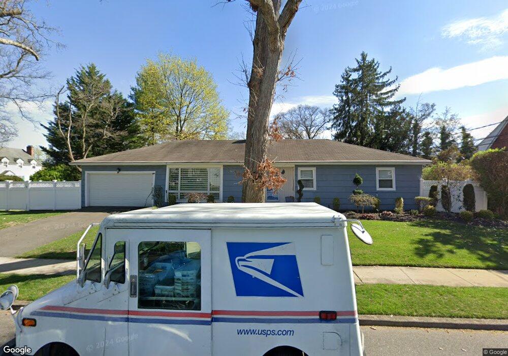
117 Maxson Ave Freeport, NY 11520
Estimated Value: $650,000 - $707,166
3
Beds
2
Baths
1,551
Sq Ft
$438/Sq Ft
Est. Value
About This Home
This home is located at 117 Maxson Ave, Freeport, NY 11520 and is currently estimated at $678,583, approximately $437 per square foot. 117 Maxson Ave is a home located in Nassau County with nearby schools including Caroline G. Atkinson Intermediate School, Columbus Avenue School, and John W Dodd Middle School.
Ownership History
Date
Name
Owned For
Owner Type
Purchase Details
Closed on
Jul 14, 2017
Sold by
Granat Nicholas A and Kellogg Christopher Gage
Bought by
Fernandez Keston and Dacosta Patrice
Current Estimated Value
Home Financials for this Owner
Home Financials are based on the most recent Mortgage that was taken out on this home.
Original Mortgage
$367,829
Outstanding Balance
$307,517
Interest Rate
4.12%
Mortgage Type
FHA
Estimated Equity
$371,066
Purchase Details
Closed on
Apr 21, 2014
Sold by
Granat Nicholas A
Bought by
The Nicholas A Granat Trust
Purchase Details
Closed on
Sep 23, 2005
Sold by
Belle Sylvester
Purchase Details
Closed on
Mar 3, 1998
Create a Home Valuation Report for This Property
The Home Valuation Report is an in-depth analysis detailing your home's value as well as a comparison with similar homes in the area
Home Values in the Area
Average Home Value in this Area
Purchase History
| Date | Buyer | Sale Price | Title Company |
|---|---|---|---|
| Fernandez Keston | $375,000 | Judicial Title | |
| The Nicholas A Granat Trust | -- | -- | |
| -- | -- | -- | |
| -- | -- | -- |
Source: Public Records
Mortgage History
| Date | Status | Borrower | Loan Amount |
|---|---|---|---|
| Open | Fernandez Keston | $367,829 |
Source: Public Records
Tax History Compared to Growth
Tax History
| Year | Tax Paid | Tax Assessment Tax Assessment Total Assessment is a certain percentage of the fair market value that is determined by local assessors to be the total taxable value of land and additions on the property. | Land | Improvement |
|---|---|---|---|---|
| 2025 | $8,862 | $411 | $167 | $244 |
| 2024 | $896 | $402 | $163 | $239 |
| 2023 | $8,987 | $411 | $167 | $244 |
| 2022 | $8,987 | $411 | $167 | $244 |
| 2021 | $13,464 | $400 | $162 | $238 |
| 2020 | $9,637 | $638 | $346 | $292 |
| 2019 | $1,058 | $638 | $346 | $292 |
| 2018 | $4,225 | $638 | $0 | $0 |
| 2017 | $4,800 | $638 | $346 | $292 |
| 2016 | $5,758 | $638 | $346 | $292 |
| 2015 | $769 | $638 | $346 | $292 |
| 2014 | $769 | $638 | $346 | $292 |
| 2013 | $718 | $638 | $346 | $292 |
Source: Public Records
Map
Nearby Homes
- 89 Delaware Ave
- 254 Lena Ave
- 36 New York Ave
- 6 New York Ave
- 21 Connecticut Ave
- 142 Maryland Ave
- 107 California Ave
- 215 N Brookside Ave
- 154 California Ave
- 139 New York Ave
- 345 W Seaman Ave
- 1 Willowbrook Ln
- 86 N Bayview Ave
- 174 Delaware Ave
- 101 Wallace St
- 27 W Woodbine Dr
- 63 Lincoln Place
- 100 Randall Ave Unit 1E
- 187 Moore Ave
- 152 Evans Ave
- 35 Delaware Ave
- 125 Maxson Ave
- 49 Delaware Ave
- 32 Maryland Ave
- 31 Delaware Ave
- 42 Delaware Ave
- 30 Maryland Ave
- 36 Delaware Ave
- 50 Maryland Ave
- 27 Delaware Ave
- 55 Delaware Ave
- 50 Delaware Ave
- 32 Delaware Ave
- 26 Maryland Ave
- 58 Maryland Ave
- 26 Delaware Ave
- 25 Delaware Ave
- 20 Maryland Ave
- 56 Delaware Ave
- 61 Delaware Ave