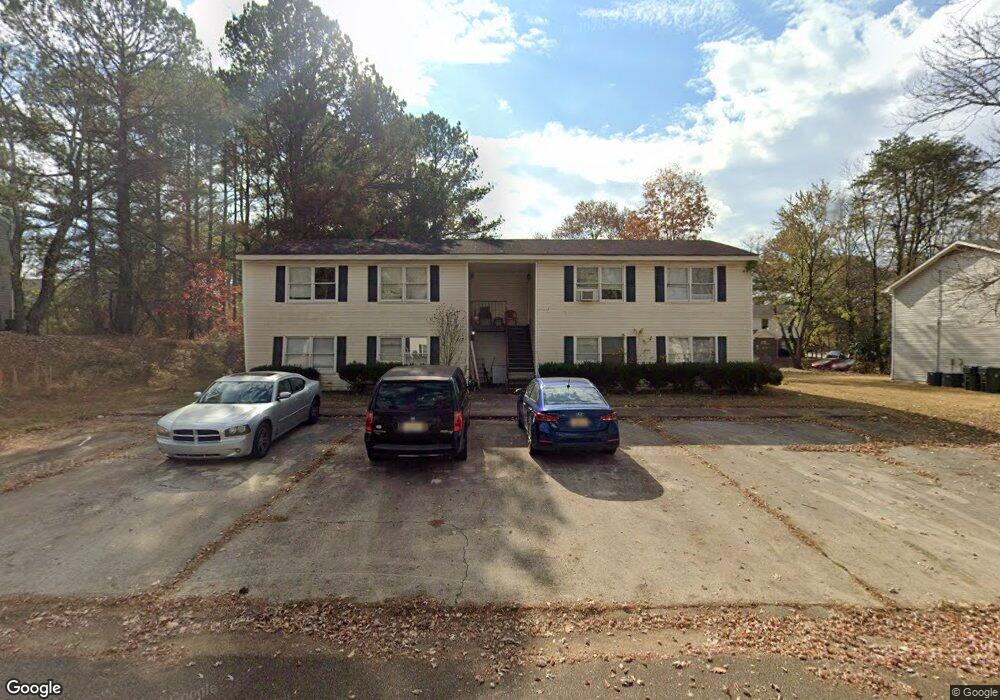
117 Michael Ave Madison, AL 35758
Estimated Value: $338,000 - $422,000
Studio
1
Bath
--
Sq Ft
13,939
Sq Ft Lot
About This Home
This home is located at 117 Michael Ave, Madison, AL 35758 and is currently estimated at $389,916. 117 Michael Ave is a home located in Madison County with nearby schools including Columbia Elementary School, Liberty Middle School, and James Clemens High School.
Ownership History
Date
Name
Owned For
Owner Type
Purchase Details
Closed on
Feb 6, 2024
Sold by
Cole Carol W
Bought by
C & C Property Llc
Current Estimated Value
Purchase Details
Closed on
Jul 2, 2008
Sold by
Parham Melvin
Bought by
Cole Vivian P and Cole Ii Neal W
Home Financials for this Owner
Home Financials are based on the most recent Mortgage that was taken out on this home.
Original Mortgage
$143,000
Interest Rate
5.96%
Mortgage Type
New Conventional
Purchase Details
Closed on
May 25, 2007
Sold by
Madison Heights Apartments Llc
Bought by
Parham Melvin M
Home Financials for this Owner
Home Financials are based on the most recent Mortgage that was taken out on this home.
Original Mortgage
$179,910
Interest Rate
6.12%
Mortgage Type
New Conventional
Create a Home Valuation Report for This Property
The Home Valuation Report is an in-depth analysis detailing your home's value as well as a comparison with similar homes in the area
Home Values in the Area
Average Home Value in this Area
Purchase History
| Date | Buyer | Sale Price | Title Company |
|---|---|---|---|
| C & C Property Llc | -- | None Listed On Document | |
| Cole Vivian P | -- | -- | |
| Parham Melvin M | -- | -- |
Source: Public Records
Mortgage History
| Date | Status | Borrower | Loan Amount |
|---|---|---|---|
| Previous Owner | Cole Vivian P | $143,000 | |
| Previous Owner | Parham Melvin M | $179,910 |
Source: Public Records
Tax History
| Year | Tax Paid | Tax Assessment Tax Assessment Total Assessment is a certain percentage of the fair market value that is determined by local assessors to be the total taxable value of land and additions on the property. | Land | Improvement |
|---|---|---|---|---|
| 2025 | $4,113 | $58,940 | $17,000 | $41,940 |
| 2024 | $4,113 | $56,940 | $17,000 | $39,940 |
| 2023 | $3,974 | $56,940 | $17,000 | $39,940 |
| 2022 | $3,170 | $45,380 | $17,000 | $28,380 |
| 2021 | $1,469 | $20,900 | $4,500 | $16,400 |
| 2020 | $1,434 | $10,200 | $2,000 | $8,200 |
| 2019 | $1,189 | $10,200 | $2,000 | $8,200 |
| 2018 | $979 | $16,740 | $0 | $0 |
| 2017 | $979 | $16,740 | $0 | $0 |
| 2016 | $979 | $16,740 | $0 | $0 |
| 2015 | $979 | $16,740 | $0 | $0 |
| 2014 | $956 | $16,620 | $0 | $0 |
Source: Public Records
Map
Nearby Homes
- 2006 Liberty Dr
- 186 Liberty Dr
- 2106 Liberty Dr
- 101 Mickelo Ln
- 105 Markum Ln
- 103 Bambi Ln
- 108 Philadelphia Dr
- 102 Claytor Ln
- 469 Gillespie Rd
- 210 Pin Oak Dr
- 5296 Wall Triana Hwy
- 297 Big Oak Ln
- 103 Wigon Cir
- 11 Acres Hughes Rd
- 106 Teal Park Ln
- 103 Lanthorn Cir
- 101 Mountain View Ln
- 469 1/2 Gillespie Rd
- 141 Bellingham Dr
- 142 Brass Oak Dr
- 119 Michael Ave
- 115 Michael Ave
- 107 Michael Ave Unit A
- 107 Michael Ave
- 109 Michael Ave
- 109 Michael Ave
- 109 Michael Ave Unit B
- 124 Michael Ave Unit A
- 124 Michael Ave Unit B
- 124 Michael Ave Unit C
- 124 Michael Ave Unit D
- 124 Michael Ave
- 126 Michael Ave Unit A
- 126 Michael Ave
- 122 Michael Ave Unit C
- 122 Michael Ave Unit A
- 122 Michael Ave
- 121 Michael Ave
- 113 Michael Ave
- 103 Michael Ave
Your Personal Tour Guide
Ask me questions while you tour the home.