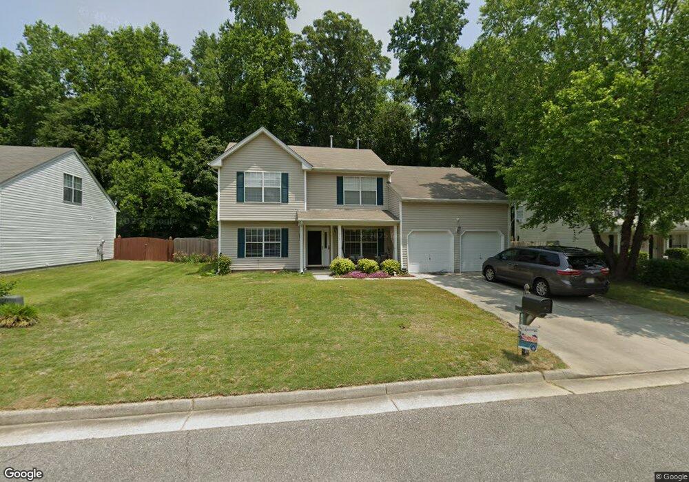
117 Misty Ridge Ln Suffolk, VA 23434
Holy Neck NeighborhoodEstimated Value: $401,000 - $425,000
4
Beds
3
Baths
2,254
Sq Ft
$183/Sq Ft
Est. Value
About This Home
This home is located at 117 Misty Ridge Ln, Suffolk, VA 23434 and is currently estimated at $412,728, approximately $183 per square foot. 117 Misty Ridge Ln is a home located in Suffolk City with nearby schools including Hillpoint Elementary School, King's Fork Middle School, and King's Fork High School.
Ownership History
Date
Name
Owned For
Owner Type
Purchase Details
Closed on
Feb 26, 2019
Sold by
Beesing Donald W and Beesing Meredith L
Bought by
Loving Renee
Current Estimated Value
Home Financials for this Owner
Home Financials are based on the most recent Mortgage that was taken out on this home.
Original Mortgage
$244,098
Outstanding Balance
$214,604
Interest Rate
4.4%
Mortgage Type
FHA
Estimated Equity
$198,124
Create a Home Valuation Report for This Property
The Home Valuation Report is an in-depth analysis detailing your home's value as well as a comparison with similar homes in the area
Home Values in the Area
Average Home Value in this Area
Purchase History
| Date | Buyer | Sale Price | Title Company |
|---|---|---|---|
| Loving Renee | $269,900 | True North Title |
Source: Public Records
Mortgage History
| Date | Status | Borrower | Loan Amount |
|---|---|---|---|
| Open | Loving Renee | $244,098 |
Source: Public Records
Tax History Compared to Growth
Tax History
| Year | Tax Paid | Tax Assessment Tax Assessment Total Assessment is a certain percentage of the fair market value that is determined by local assessors to be the total taxable value of land and additions on the property. | Land | Improvement |
|---|---|---|---|---|
| 2024 | $4,606 | $379,300 | $85,000 | $294,300 |
| 2023 | $4,452 | $371,100 | $85,000 | $286,100 |
| 2022 | $3,588 | $329,200 | $85,000 | $244,200 |
| 2021 | $3,023 | $272,300 | $64,300 | $208,000 |
| 2020 | $2,968 | $267,400 | $64,300 | $203,100 |
| 2019 | $2,968 | $267,400 | $64,300 | $203,100 |
| 2018 | $2,941 | $268,200 | $64,300 | $203,900 |
| 2017 | $2,870 | $268,200 | $64,300 | $203,900 |
| 2016 | $2,791 | $260,800 | $64,300 | $196,500 |
| 2015 | $1,332 | $246,200 | $64,300 | $181,900 |
| 2014 | $1,332 | $246,200 | $64,300 | $181,900 |
Source: Public Records
Map
Nearby Homes
- 310 Waterwood Way
- 220 Waterwood Way
- 210 Waterwood Way
- 221 Waterwood Way
- 200 Seasons Cir Unit 703
- 110 Jordan Ave
- 103 Jordan Ave
- 1206 Peachtree Dr
- 311 Festival Ct
- 213 Fallawater Way
- 105 Dutchland Trail
- 307 Shore Dr
- 825 Normandy Dr
- 104 Benham Ct
- 236 Abingdon Cir
- 106 Pippin Dr
- 240 Fallawater Way
- 106 Elmington Way
- 1000 Regal Rd Unit A
- 1236 Willowbrook Dr
- 115 Misty Ridge Ln
- 113 Misty Ridge Ln
- 121 Misty Ridge Ln
- 130 Riverwood Trace
- 301 Arbor Bluff Cove
- 111 Misty Ridge Ln
- 132 Riverwood Trace
- 116 Misty Ridge Ln
- 128 Riverwood Trace
- 134 Riverwood Trace
- 123 Misty Ridge Ln
- 109 Misty Ridge Ln
- 118 Misty Ridge Ln
- 126 Riverwood Trace
- 1050 Memorial Ave
- 110 Misty Ridge Ln
- 136 Riverwood Trace
- 303 Arbor Bluff Cove
- 112 Misty Ridge Ln
- 108 Misty Ridge Ln
