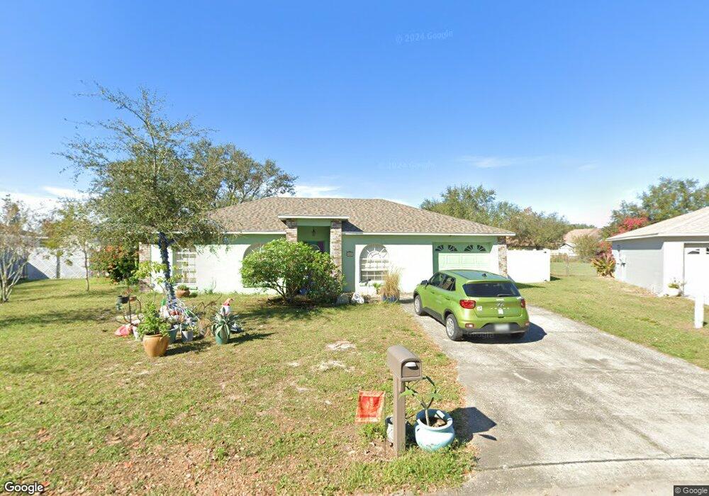
117 Mohawk Cir Auburndale, FL 33823
Estimated Value: $245,522 - $274,000
3
Beds
2
Baths
1,480
Sq Ft
$176/Sq Ft
Est. Value
About This Home
This home is located at 117 Mohawk Cir, Auburndale, FL 33823 and is currently estimated at $260,631, approximately $176 per square foot. 117 Mohawk Cir is a home located in Polk County with nearby schools including Walter Caldwell Elementary School, Auburndale Senior High School, and Jewett School of the Arts.
Ownership History
Date
Name
Owned For
Owner Type
Purchase Details
Closed on
Jan 20, 2015
Sold by
Simpson Stephanie Michelle
Bought by
Hill Rhett M
Current Estimated Value
Home Financials for this Owner
Home Financials are based on the most recent Mortgage that was taken out on this home.
Original Mortgage
$103,098
Outstanding Balance
$80,146
Interest Rate
4.25%
Mortgage Type
FHA
Estimated Equity
$180,485
Purchase Details
Closed on
Mar 10, 2014
Sold by
Simpson Stephanie and Simpson Steven L
Bought by
Simpson Stephanie Michelle
Purchase Details
Closed on
Dec 29, 1995
Sold by
Signature Homes Of Central Florida
Bought by
Simpson Steven L
Home Financials for this Owner
Home Financials are based on the most recent Mortgage that was taken out on this home.
Original Mortgage
$67,000
Interest Rate
7.29%
Mortgage Type
New Conventional
Create a Home Valuation Report for This Property
The Home Valuation Report is an in-depth analysis detailing your home's value as well as a comparison with similar homes in the area
Home Values in the Area
Average Home Value in this Area
Purchase History
| Date | Buyer | Sale Price | Title Company |
|---|---|---|---|
| Hill Rhett M | $105,000 | Hillsborough Title Inc | |
| Simpson Stephanie Michelle | -- | None Available | |
| Simpson Steven L | $12,500 | -- |
Source: Public Records
Mortgage History
| Date | Status | Borrower | Loan Amount |
|---|---|---|---|
| Open | Hill Rhett M | $103,098 | |
| Previous Owner | Simpson Steven L | $65,500 | |
| Previous Owner | Simpson Steven L | $10,000 | |
| Previous Owner | Simpson Steven L | $67,000 |
Source: Public Records
Tax History
| Year | Tax Paid | Tax Assessment Tax Assessment Total Assessment is a certain percentage of the fair market value that is determined by local assessors to be the total taxable value of land and additions on the property. | Land | Improvement |
|---|---|---|---|---|
| 2025 | $1,131 | $114,224 | -- | -- |
| 2024 | $1,091 | $111,005 | -- | -- |
| 2023 | $1,091 | $107,772 | $0 | $0 |
| 2022 | $1,050 | $104,633 | $0 | $0 |
| 2021 | $1,035 | $101,585 | $0 | $0 |
| 2020 | $1,019 | $100,182 | $0 | $0 |
| 2018 | $984 | $96,104 | $0 | $0 |
| 2017 | $952 | $94,127 | $0 | $0 |
| 2016 | $937 | $92,191 | $0 | $0 |
Source: Public Records
Map
Nearby Homes
- 144 Costa Loop
- 159 Auburn Grove Blvd
- Bluebell Plan at The Reserve at Van Oaks
- Hibiscus Plan at The Reserve at Van Oaks
- Foxglove Plan at The Reserve at Van Oaks
- Gardenia Plan at The Reserve at Van Oaks
- 214 Eagle Point Loop
- 163 Auburn Grove Blvd
- 122 Costa Loop
- 1122 Oak Valley Dr
- 506 Auburn Grove Terrace
- 1705 Forest Run Ln
- 132 Magneta Loop
- 506 Alleria Ct
- 113 Costa Loop
- 412 Diamond Ridge Dr
- 130 Bergen Cir
- 1643 Bark Ridge Dr
- 1647 Bark Ridge Dr
- 1646 Bark Ridge Dr
- 115 Mohawk Cir
- 119 Mohawk Cir
- 110 Cherokee Dr
- 112 Cherokee Dr
- 108 Cherokee Dr
- 108 Mohawk Cir
- 113 Mohawk Cir
- 121 Mohawk Cir
- 114 Cherokee Dr
- 106 Cherokee Dr
- 106 Mohawk Cir
- 110 Mohawk Cir
- 123 Mohawk Cir
- 104 Cherokee Dr
- 116 Cherokee Dr
- 111 Mohawk Cir
- 104 Mohawk Cir
- 125 Mohawk Cir
- 102 Cherokee Dr
- 111 Cherokee Dr