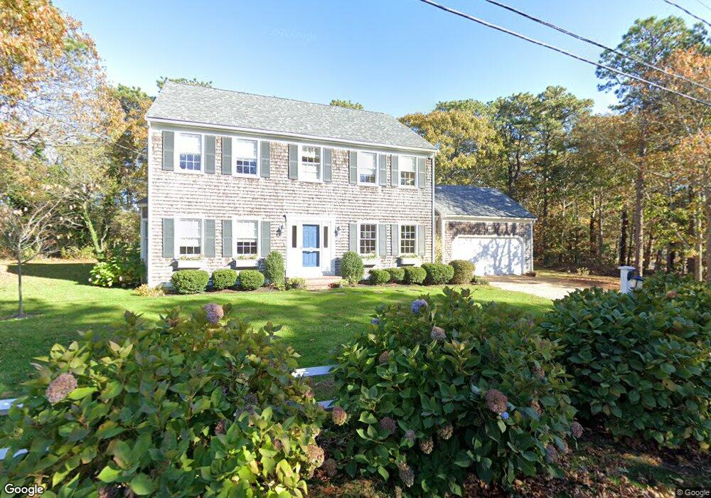
117 Munroe Ave Vineyard Haven, MA 02568
Oak Bluffs NeighborhoodEstimated Value: $1,925,009
4
Beds
2
Baths
2,542
Sq Ft
$757/Sq Ft
Est. Value
About This Home
This home is located at 117 Munroe Ave, Vineyard Haven, MA 02568 and is currently estimated at $1,925,009, approximately $757 per square foot. 117 Munroe Ave is a home with nearby schools including Oak Bluffs Elementary School and Martha's Vineyard Regional High School.
Ownership History
Date
Name
Owned For
Owner Type
Purchase Details
Closed on
May 15, 2002
Sold by
Sewell Robert A and Sewell Sandra C
Bought by
Callahan Edward J and Callahan Erin
Current Estimated Value
Create a Home Valuation Report for This Property
The Home Valuation Report is an in-depth analysis detailing your home's value as well as a comparison with similar homes in the area
Home Values in the Area
Average Home Value in this Area
Purchase History
| Date | Buyer | Sale Price | Title Company |
|---|---|---|---|
| Callahan Edward J | $798,000 | -- |
Source: Public Records
Mortgage History
| Date | Status | Borrower | Loan Amount |
|---|---|---|---|
| Open | Callahan Edward J | $391,271 | |
| Closed | Callahan Edward J | $417,000 | |
| Closed | Callahan Edward J | $417,000 | |
| Closed | Callahan Edward J | $554,000 |
Source: Public Records
Tax History
| Year | Tax Paid | Tax Assessment Tax Assessment Total Assessment is a certain percentage of the fair market value that is determined by local assessors to be the total taxable value of land and additions on the property. | Land | Improvement |
|---|---|---|---|---|
| 2025 | $10,276 | $2,034,900 | $927,700 | $1,107,200 |
| 2024 | $10,155 | $1,941,600 | $843,000 | $1,098,600 |
| 2023 | $8,284 | $1,568,900 | $732,900 | $836,000 |
| 2022 | $8,493 | $1,250,800 | $568,300 | $682,500 |
| 2021 | $7,650 | $1,038,000 | $431,400 | $606,600 |
| 2020 | $7,243 | $973,500 | $410,800 | $562,700 |
| 2019 | $7,267 | $945,000 | $393,200 | $551,800 |
| 2018 | $7,384 | $943,100 | $388,700 | $554,400 |
| 2017 | $7,032 | $862,800 | $378,400 | $484,400 |
| 2016 | $6,477 | $798,700 | $390,100 | $408,600 |
| 2015 | $6,110 | $767,600 | $390,100 | $377,500 |
| 2014 | $6,082 | $778,700 | $397,300 | $381,400 |
Source: Public Records
Map
Nearby Homes
- 6 Brewster Ave
- 150 E Chop Dr
- 5 Temahigan Ave Unit 4-139-0
- 12 & 14 Maple Ave
- 35 New York Ave
- 25 Hampson Ave
- 24 Towanticut Ave Unit 188
- 10 Siloam Ave
- 22 Montgomery Square
- 2 Lincoln Ave
- 24 School St
- 33 Ocean Ave
- 34 Windemere Rd
- 1 Cottage Park
- 56 Garvin St
- 38 Rogers Way
- 112 Dukes County Ave Unit 209
- 112 Dukes County Ave
- 113 Dukes County Ave Unit Multi-Family
- 26 Winthrop Ave
- 25 & 27 Lexington Ave
- 25 & 27 Lexington Ave
- 25 Lexington Ave
- 125 Munroe Ave
- 120 Munroe Ave
- 113 Munroe Ave
- 28 Atlantic Ave
- 111 Munroe Ave
- 21 Lexington Ave
- 15 Green Ave
- 15 Green Ave
- 22 Atlantic Ave
- 126 Munroe Ave
- 25 Atlantic Ave
- 25 Atlantic Ave
- 23 Atlantic Ave
- 23 Green Ave
- 25 Green Ave
- 2 Sandy Bluff Ln
- 11 Crescent Rd
Your Personal Tour Guide
Ask me questions while you tour the home.