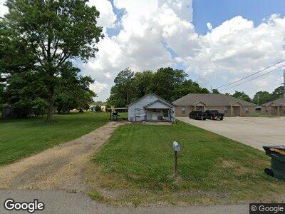
117 N Carruthers St Monette, AR 72447
Estimated Value: $99,000 - $178,000
--
Bed
--
Bath
888
Sq Ft
$153/Sq Ft
Est. Value
About This Home
This home is located at 117 N Carruthers St, Monette, AR 72447 and is currently estimated at $136,000, approximately $153 per square foot. 117 N Carruthers St is a home with nearby schools including Buffalo Is. Central Junior High School and Buffalo Island Central High School.
Ownership History
Date
Name
Owned For
Owner Type
Purchase Details
Closed on
Jul 28, 2020
Sold by
Taucher Katherine H
Bought by
Smith Andrew Leslie
Current Estimated Value
Home Financials for this Owner
Home Financials are based on the most recent Mortgage that was taken out on this home.
Original Mortgage
$246,764
Interest Rate
3.1%
Mortgage Type
Commercial
Purchase Details
Closed on
Apr 8, 2010
Sold by
Secretary Of Hud Of Washington Dc
Bought by
Melton Barry
Purchase Details
Closed on
May 28, 2008
Sold by
Moore Jerry D
Bought by
U S Bank Na
Purchase Details
Closed on
Sep 19, 2001
Bought by
Swetnam
Purchase Details
Closed on
Jun 22, 2001
Bought by
Swetnam
Purchase Details
Closed on
May 5, 1997
Bought by
Swetnam
Create a Home Valuation Report for This Property
The Home Valuation Report is an in-depth analysis detailing your home's value as well as a comparison with similar homes in the area
Home Values in the Area
Average Home Value in this Area
Purchase History
| Date | Buyer | Sale Price | Title Company |
|---|---|---|---|
| Smith Andrew Leslie | -- | Community Abstract & Title | |
| Melton Barry | -- | Professional Land Title Co O | |
| U S Bank Na | $39,644 | None Available | |
| Swetnam | -- | -- | |
| Swetnam | -- | -- | |
| Swetnam | -- | -- |
Source: Public Records
Mortgage History
| Date | Status | Borrower | Loan Amount |
|---|---|---|---|
| Open | Grk Rental Properties Llc | $440,000 | |
| Closed | Smith Andrew Leslie | $246,764 |
Source: Public Records
Tax History Compared to Growth
Tax History
| Year | Tax Paid | Tax Assessment Tax Assessment Total Assessment is a certain percentage of the fair market value that is determined by local assessors to be the total taxable value of land and additions on the property. | Land | Improvement |
|---|---|---|---|---|
| 2024 | $228 | $5,306 | $1,000 | $4,306 |
| 2023 | $281 | $5,306 | $1,000 | $4,306 |
| 2022 | $243 | $5,306 | $1,000 | $4,306 |
| 2021 | $225 | $4,150 | $1,000 | $3,150 |
| 2020 | $225 | $4,150 | $1,000 | $3,150 |
| 2019 | $225 | $4,150 | $1,000 | $3,150 |
| 2018 | $225 | $4,150 | $1,000 | $3,150 |
| 2017 | $225 | $4,150 | $1,000 | $3,150 |
| 2016 | $218 | $4,000 | $1,000 | $3,000 |
| 2015 | $172 | $4,000 | $1,000 | $3,000 |
| 2014 | $190 | $4,000 | $1,000 | $3,000 |
Source: Public Records
Map
Nearby Homes
- 117 N Carruthers St
- 109 N Carruthers St
- 116 Larrison St
- 507 N Drew Ave
- 114 N Carruthers St
- 118 Larrison St
- 120 Larrison St
- 110 Larrison St
- 112 N Carruthers St
- 103 Larrison St
- 110 N Carruthers St
- 108 Larrison St
- 106 Larrison St
- 117 Larrison St
- 113 Larrison St
- 119 Larrison St
- 0 Larrison St
- 104 Larrison St
- 109 Larrison St
- 202 E Texie Ave