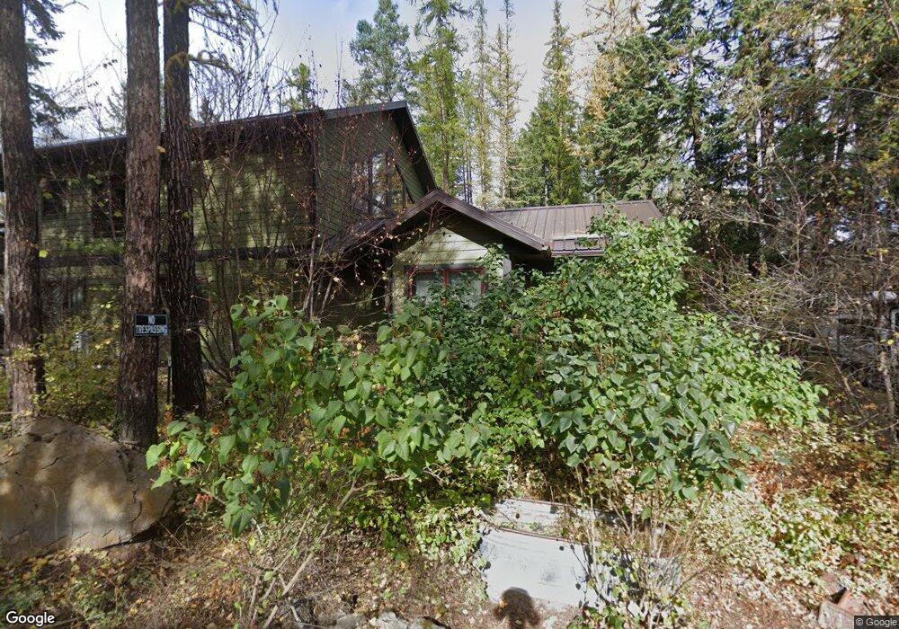
117 N Fork Trail Columbia Falls, MT 59912
Estimated Value: $765,000 - $857,000
3
Beds
2
Baths
2,556
Sq Ft
$315/Sq Ft
Est. Value
About This Home
This home is located at 117 N Fork Trail, Columbia Falls, MT 59912 and is currently estimated at $804,475, approximately $314 per square foot. 117 N Fork Trail is a home with nearby schools including Glacier Gateway Elementary School, Columbia Falls Junior High School (7-8), and Columbia Falls High School.
Ownership History
Date
Name
Owned For
Owner Type
Purchase Details
Closed on
May 28, 2021
Sold by
Hawks Adrian and Hawks Janet
Bought by
Hawks Adrian and Hawks Janet
Current Estimated Value
Home Financials for this Owner
Home Financials are based on the most recent Mortgage that was taken out on this home.
Original Mortgage
$265,000
Outstanding Balance
$239,924
Interest Rate
2.9%
Mortgage Type
New Conventional
Estimated Equity
$564,551
Purchase Details
Closed on
Mar 15, 2021
Sold by
Weide Simon Van Der
Bought by
Hawks Adrian and Hawks Janet
Purchase Details
Closed on
Dec 7, 2018
Sold by
Hawks Adrain
Bought by
Der Weide Kari Van and Der Weide Simon Van
Home Financials for this Owner
Home Financials are based on the most recent Mortgage that was taken out on this home.
Original Mortgage
$217,500
Interest Rate
4.8%
Mortgage Type
New Conventional
Purchase Details
Closed on
Apr 16, 2012
Sold by
Hawks Frances
Bought by
Hawks Adrian
Create a Home Valuation Report for This Property
The Home Valuation Report is an in-depth analysis detailing your home's value as well as a comparison with similar homes in the area
Home Values in the Area
Average Home Value in this Area
Purchase History
| Date | Buyer | Sale Price | Title Company |
|---|---|---|---|
| Hawks Adrian | -- | First American Title Company | |
| Hawks Adrian | -- | None Available | |
| Der Weide Kari Van | -- | First American Title Co | |
| Hawks Adrian | -- | None Available |
Source: Public Records
Mortgage History
| Date | Status | Borrower | Loan Amount |
|---|---|---|---|
| Open | Hawks Adrian | $265,000 | |
| Previous Owner | Der Weide Kari Van | $217,500 |
Source: Public Records
Tax History Compared to Growth
Tax History
| Year | Tax Paid | Tax Assessment Tax Assessment Total Assessment is a certain percentage of the fair market value that is determined by local assessors to be the total taxable value of land and additions on the property. | Land | Improvement |
|---|---|---|---|---|
| 2025 | $3,301 | $758,500 | $0 | $0 |
| 2024 | $3,749 | $599,900 | $0 | $0 |
| 2023 | $3,762 | $599,900 | $0 | $0 |
| 2022 | $2,804 | $352,800 | $0 | $0 |
| 2021 | $3,049 | $352,800 | $0 | $0 |
| 2020 | $3,038 | $341,000 | $0 | $0 |
| 2019 | $2,874 | $341,000 | $0 | $0 |
| 2018 | $2,438 | $278,200 | $0 | $0 |
| 2017 | $2,299 | $278,200 | $0 | $0 |
| 2016 | $2,235 | $259,500 | $0 | $0 |
| 2015 | $2,221 | $259,500 | $0 | $0 |
| 2014 | $1,948 | $136,316 | $0 | $0 |
Source: Public Records
Map
Nearby Homes
- 136 N Fork Trail
- 943 Frontage Rd
- 921 Frontage Rd
- 2225 Tamarack Ln
- 409 1st Street East N
- 324 1st Ave E
- 307 5th St E
- 221 2nd Ave W
- 519 Nucleus Ave Unit Suite 303
- 540 Nucleus Ave Unit 304
- 540 Nucleus Ave Unit 306
- 879 Saint Andrews Dr
- 850 Saint Andrews Dr Unit 1432
- 883 Saint Andrews Dr
- 533 Moose Crossing Trail
- 997 Saint Andrews Dr Unit 50 T Wk 44
- 1009 Saint Andrews Dr Unit 51T Wk 40
- 855 Saint Andrews Dr
- 128 Oakmont Loop
- 1025 Saint Andrews Dr Unit 54T Wk 34
- 1670 N Fork Rd
- 1648 N Fork Rd
- 1710 N Fork Rd
- 1690 N Fork Rd
- 1730 N Fork Rd
- 1644 N Fork Rd
- 1750 N Fork Rd
- 128 N Fork Trail
- 1655 N Fork Rd
- 1640 N Fork Rd
- 1645 N Fork Rd
- 1645 N Fork Rd
- 1625 N Fork Rd
- 1675 N Fork Rd
- 1682 N Fork Rd
- 1621 N Fork Rd
- 1495 Aluminum Dr
- 1792 N Fork Rd
- 1612 N Fork Rd
- 1778 N Fork Rd