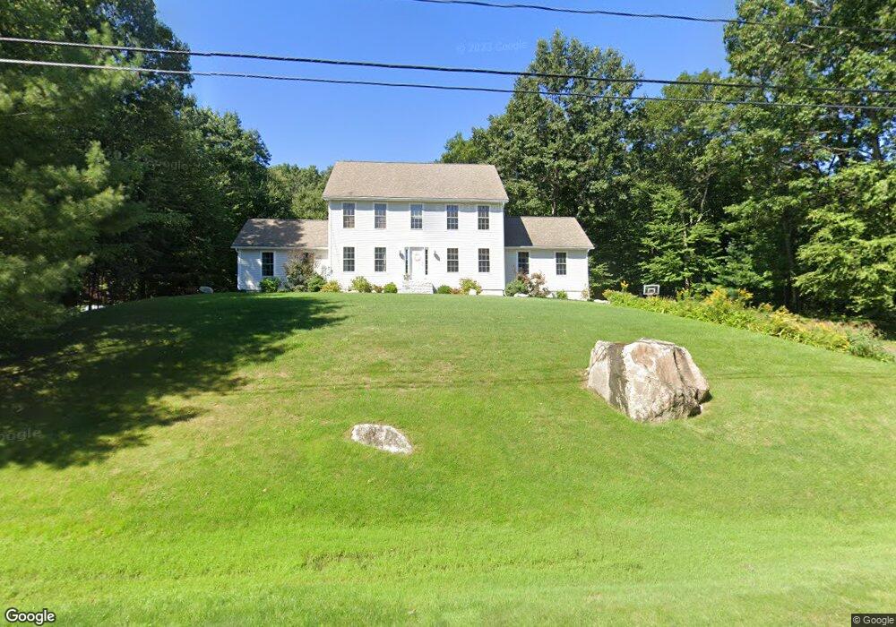
117 Peppermint St Goffstown, NH 03045
Estimated Value: $795,225 - $877,000
4
Beds
4
Baths
3,200
Sq Ft
$257/Sq Ft
Est. Value
About This Home
This home is located at 117 Peppermint St, Goffstown, NH 03045 and is currently estimated at $822,306, approximately $256 per square foot. 117 Peppermint St is a home with nearby schools including Mountain View Middle School and Goffstown High School.
Ownership History
Date
Name
Owned For
Owner Type
Purchase Details
Closed on
Aug 9, 2004
Sold by
All State Builders Inc
Bought by
Veilleux Joseph and Veilleux Elizabeth
Current Estimated Value
Home Financials for this Owner
Home Financials are based on the most recent Mortgage that was taken out on this home.
Original Mortgage
$291,522
Interest Rate
6.2%
Mortgage Type
Purchase Money Mortgage
Create a Home Valuation Report for This Property
The Home Valuation Report is an in-depth analysis detailing your home's value as well as a comparison with similar homes in the area
Home Values in the Area
Average Home Value in this Area
Purchase History
| Date | Buyer | Sale Price | Title Company |
|---|---|---|---|
| Veilleux Joseph | $364,500 | -- |
Source: Public Records
Mortgage History
| Date | Status | Borrower | Loan Amount |
|---|---|---|---|
| Open | Veilleux Joseph | $325,400 | |
| Closed | Veilleux Joseph | $291,522 |
Source: Public Records
Tax History Compared to Growth
Tax History
| Year | Tax Paid | Tax Assessment Tax Assessment Total Assessment is a certain percentage of the fair market value that is determined by local assessors to be the total taxable value of land and additions on the property. | Land | Improvement |
|---|---|---|---|---|
| 2024 | $13,531 | $662,000 | $208,800 | $453,200 |
| 2023 | $12,485 | $662,000 | $208,800 | $453,200 |
| 2022 | $11,640 | $442,400 | $137,800 | $304,600 |
| 2021 | $10,933 | $440,500 | $137,800 | $302,700 |
| 2020 | $10,933 | $440,500 | $137,800 | $302,700 |
| 2019 | $10,827 | $440,500 | $137,800 | $302,700 |
| 2018 | $8,193 | $440,500 | $137,800 | $302,700 |
| 2017 | $10,548 | $384,700 | $114,300 | $270,400 |
| 2016 | $10,168 | $384,700 | $114,300 | $270,400 |
| 2015 | $10,369 | $368,200 | $106,900 | $261,300 |
| 2014 | $9,941 | $368,200 | $106,900 | $261,300 |
Source: Public Records
Map
Nearby Homes
- 22 Peppermint St
- 115 Forestedge Way
- 163 Woodview Way Unit 2
- 328 E Dunbarton Rd
- 61 Woodview Way
- 16 Roger Rd
- 76 Donald Dr
- 243 Donald Dr
- 53 Rachael Cir
- 45 Range Rd
- 11-1 Chatel Rd
- 0 Mast Rd Unit 49 5054665
- 4 Arabian Ct Unit B
- 5 Mustang Ct
- 227 Twist Hill Rd
- 3D Dearborn Cir
- 4B Dearborn Cir
- 4 Chip St
- 3A Dearborn Cir
- 3B Dearborn Cir
- 111 Peppermint St
- 116 Peppermint St
- 118 Peppermint St
- 110 Peppermint St
- 105 Peppermint St
- 127 Peppermint St
- 124 Peppermint St
- 104 Peppermint St
- 130 Peppermint St
- 143 Peppermint St
- 101 Peppermint St
- 45 Peppermint St
- 39 Peppermint St
- 132 Peppermint St
- 98 Peppermint St
- 55 Peppermint St
- 151 Peppermint St
- 138 Peppermint St
- 37 Peppermint St
- 61 Peppermint St