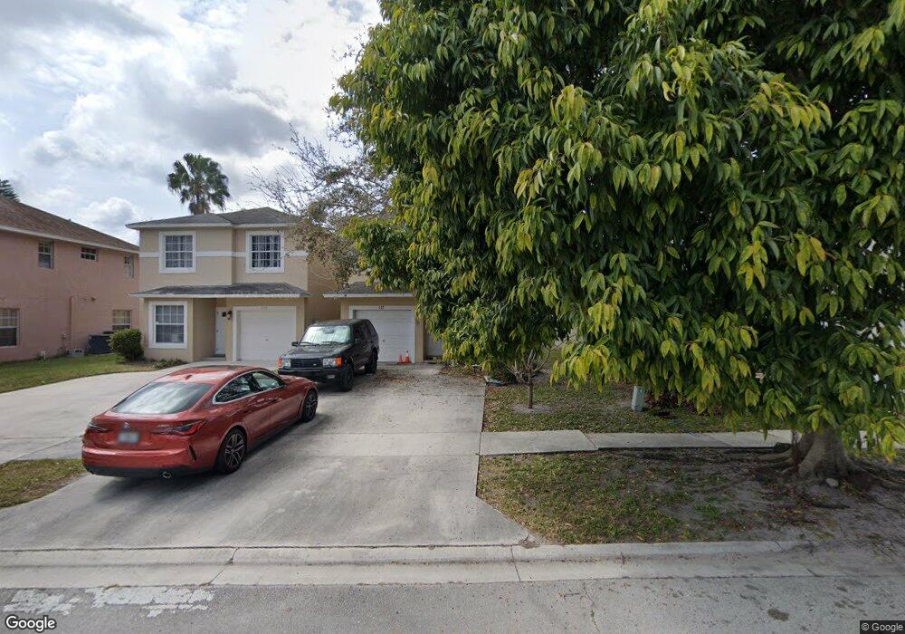
117 Pheasant Run Blvd West Palm Beach, FL 33415
Cannongate NeighborhoodEstimated Value: $334,000 - $386,000
3
Beds
3
Baths
1,202
Sq Ft
$304/Sq Ft
Est. Value
About This Home
This home is located at 117 Pheasant Run Blvd, West Palm Beach, FL 33415 and is currently estimated at $365,993, approximately $304 per square foot. 117 Pheasant Run Blvd is a home located in Palm Beach County with nearby schools including John I. Leonard High School, Melaleuca Elementary School, and Okeeheelee Middle School.
Ownership History
Date
Name
Owned For
Owner Type
Purchase Details
Closed on
Jul 28, 2006
Sold by
Borg Charles J and Borg Jeanette
Bought by
Borg Charles J and Borg Jeanette
Current Estimated Value
Purchase Details
Closed on
Jul 6, 1998
Sold by
Schickedanz Bros Palm Bch Ltd
Bought by
Borg Charles J and Borg Jeanette
Home Financials for this Owner
Home Financials are based on the most recent Mortgage that was taken out on this home.
Original Mortgage
$52,500
Outstanding Balance
$10,837
Interest Rate
7.1%
Mortgage Type
New Conventional
Estimated Equity
$355,156
Create a Home Valuation Report for This Property
The Home Valuation Report is an in-depth analysis detailing your home's value as well as a comparison with similar homes in the area
Home Values in the Area
Average Home Value in this Area
Purchase History
| Date | Buyer | Sale Price | Title Company |
|---|---|---|---|
| Borg Charles J | -- | None Available | |
| Borg Charles J | $75,000 | -- |
Source: Public Records
Mortgage History
| Date | Status | Borrower | Loan Amount |
|---|---|---|---|
| Open | Borg Charles J | $52,500 |
Source: Public Records
Tax History Compared to Growth
Tax History
| Year | Tax Paid | Tax Assessment Tax Assessment Total Assessment is a certain percentage of the fair market value that is determined by local assessors to be the total taxable value of land and additions on the property. | Land | Improvement |
|---|---|---|---|---|
| 2024 | $4,430 | $203,565 | -- | -- |
| 2023 | $4,233 | $185,059 | $124,397 | $165,386 |
| 2022 | $3,913 | $168,235 | $0 | $0 |
| 2021 | $3,612 | $222,118 | $84,960 | $137,158 |
| 2020 | $3,306 | $196,241 | $0 | $196,241 |
| 2019 | $3,034 | $171,241 | $0 | $171,241 |
| 2018 | $2,749 | $166,198 | $0 | $166,198 |
| 2017 | $2,514 | $148,230 | $0 | $0 |
| 2016 | $2,308 | $94,964 | $0 | $0 |
| 2015 | $2,161 | $86,331 | $0 | $0 |
| 2014 | $1,883 | $78,483 | $0 | $0 |
Source: Public Records
Map
Nearby Homes
- 87 Pheasant Run Blvd
- 33 Plumage Ln
- 5555 Gun Club Rd
- 5173 El Claro Cir
- 0 Tropical Ave
- 5156 Hartwick Ln
- 5344 Bosque Ln Unit 101
- 5344 Bosque Ln Unit 104
- 5288 Bosque Ln Unit 53
- 5028 Cheryl Ln
- 5271 Wallis Rd
- 5654 Papaya Rd
- 291 Guava Ave
- 550 Skylake Dr
- 5840 Banana Rd
- 379 Forest Estate Dr
- 447 Tall Pines Rd
- 411 Forest Estate Dr
- 5508 Cannon Way Unit C
- 439 Forest Estate Dr
- 111 Pheasant Run Blvd
- 123 Pheasant Run Blvd
- 105 Pheasant Run Blvd
- 129 Pheasant Run Blvd
- 135 Pheasant Run Blvd
- 99 Pheasant Run Blvd
- 141 Pheasant Run Blvd
- 110 Pheasant Run Blvd
- 93 Pheasant Run Blvd
- 104 Pheasant Run Blvd
- 116 Pheasant Run Blvd
- 102 Pheasant Run Blvd
- 122 Pheasant Run Blvd
- 147 Pheasant Run Blvd
- 134 Pheasant Run Blvd
- 98 Pheasant Run Blvd
- 140 Pheasant Run Blvd
- 159 Pheasant Run Blvd
- 116 Plumage Ln
- 128 Plumage Ln