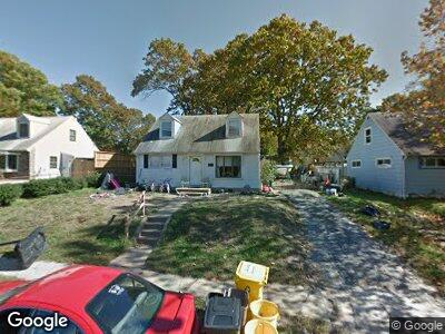
117 Ralph Rd Glen Burnie, MD 21060
Estimated Value: $324,000 - $376,000
--
Bed
1
Bath
1,790
Sq Ft
$201/Sq Ft
Est. Value
About This Home
This home is located at 117 Ralph Rd, Glen Burnie, MD 21060 and is currently estimated at $359,015, approximately $200 per square foot. 117 Ralph Rd is a home located in Anne Arundel County with nearby schools including Glendale Elementary School, Marley Middle School, and Glen Burnie High School.
Ownership History
Date
Name
Owned For
Owner Type
Purchase Details
Closed on
Jul 22, 2009
Sold by
Rockhill Patrick
Bought by
Rockhill Patrick F
Current Estimated Value
Purchase Details
Closed on
May 15, 2006
Sold by
Rockhill Patrick
Bought by
Rockhill Patrick and Chesky Loreen L
Home Financials for this Owner
Home Financials are based on the most recent Mortgage that was taken out on this home.
Original Mortgage
$175,000
Interest Rate
5.85%
Mortgage Type
Stand Alone Refi Refinance Of Original Loan
Purchase Details
Closed on
Apr 5, 2002
Sold by
Atas Charles J
Bought by
Rockhill Patrick
Create a Home Valuation Report for This Property
The Home Valuation Report is an in-depth analysis detailing your home's value as well as a comparison with similar homes in the area
Home Values in the Area
Average Home Value in this Area
Purchase History
| Date | Buyer | Sale Price | Title Company |
|---|---|---|---|
| Rockhill Patrick F | -- | -- | |
| Rockhill Patrick | -- | -- | |
| Rockhill Patrick | $134,900 | -- |
Source: Public Records
Mortgage History
| Date | Status | Borrower | Loan Amount |
|---|---|---|---|
| Previous Owner | Rockhill Patrick | $175,000 | |
| Previous Owner | Rockhill Patrick F | $36,300 | |
| Closed | Rockhill Patrick | -- |
Source: Public Records
Tax History Compared to Growth
Tax History
| Year | Tax Paid | Tax Assessment Tax Assessment Total Assessment is a certain percentage of the fair market value that is determined by local assessors to be the total taxable value of land and additions on the property. | Land | Improvement |
|---|---|---|---|---|
| 2024 | $3,220 | $267,467 | $0 | $0 |
| 2023 | $3,119 | $251,933 | $0 | $0 |
| 2022 | $2,901 | $236,400 | $113,500 | $122,900 |
| 2021 | $5,707 | $231,900 | $0 | $0 |
| 2020 | $2,765 | $227,400 | $0 | $0 |
| 2019 | $2,721 | $222,900 | $103,500 | $119,400 |
| 2018 | $2,151 | $212,133 | $0 | $0 |
| 2017 | $2,435 | $201,367 | $0 | $0 |
| 2016 | -- | $190,600 | $0 | $0 |
| 2015 | -- | $190,600 | $0 | $0 |
| 2014 | -- | $190,600 | $0 | $0 |
Source: Public Records
Map
Nearby Homes
- 1344 Howard Rd
- 124 Louise Terrace
- 2 Stevens Rd
- 1718 Lansing Rd
- 45 Chester Cir
- 1717 Lansing Rd
- 7677 Mueller Dr
- 1402 Houghton Rd
- 818 Dale Rd
- 630 Binsted Rd
- 134 Alview Terrace
- 1702 Manning Rd
- 107 Bonnie View Rd
- 19 Harvard Rd
- 302 Phelps Ave
- 129 Gerard Dr
- 510 Creek Crossing Ln
- 114 Gerard Dr
- 518 Arbor Dr
- 34 Thomas Rd