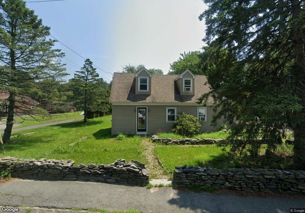
117 S Main St Assonet, MA 02702
Assonet Bay NeighborhoodEstimated Value: $355,000 - $525,000
2
Beds
1
Bath
1,350
Sq Ft
$341/Sq Ft
Est. Value
About This Home
This home is located at 117 S Main St, Assonet, MA 02702 and is currently estimated at $460,984, approximately $341 per square foot. 117 S Main St is a home located in Bristol County with nearby schools including Freetown Elementary School, George R Austin Intermediate School, and Freetown-Lakeville Middle School.
Ownership History
Date
Name
Owned For
Owner Type
Purchase Details
Closed on
Sep 9, 2013
Sold by
Darling Paul R
Bought by
Dlr Properties Llc
Current Estimated Value
Purchase Details
Closed on
Jul 30, 2010
Sold by
Darling Paul R
Bought by
Darling Michael J and Darling Paul R
Purchase Details
Closed on
Feb 20, 2009
Sold by
Darling Michael J
Bought by
Darling Paul R
Purchase Details
Closed on
Dec 9, 1988
Sold by
Sorel Mrk J
Bought by
Darling Michael J
Home Financials for this Owner
Home Financials are based on the most recent Mortgage that was taken out on this home.
Original Mortgage
$101,200
Interest Rate
10.17%
Mortgage Type
Purchase Money Mortgage
Create a Home Valuation Report for This Property
The Home Valuation Report is an in-depth analysis detailing your home's value as well as a comparison with similar homes in the area
Home Values in the Area
Average Home Value in this Area
Purchase History
| Date | Buyer | Sale Price | Title Company |
|---|---|---|---|
| Dlr Properties Llc | $120,000 | -- | |
| Darling Michael J | -- | -- | |
| Darling Paul R | -- | -- | |
| Darling Michael J | $126,500 | -- |
Source: Public Records
Mortgage History
| Date | Status | Borrower | Loan Amount |
|---|---|---|---|
| Previous Owner | Darling Michael J | $101,200 | |
| Previous Owner | Darling Michael J | $19,000 | |
| Previous Owner | Darling Michael J | $70,000 |
Source: Public Records
Tax History Compared to Growth
Tax History
| Year | Tax Paid | Tax Assessment Tax Assessment Total Assessment is a certain percentage of the fair market value that is determined by local assessors to be the total taxable value of land and additions on the property. | Land | Improvement |
|---|---|---|---|---|
| 2025 | $4,434 | $447,400 | $161,200 | $286,200 |
| 2024 | $4,441 | $425,800 | $152,100 | $273,700 |
| 2023 | $4,309 | $402,300 | $136,900 | $265,400 |
| 2022 | $4,121 | $341,700 | $116,000 | $225,700 |
| 2021 | $3,901 | $307,200 | $105,500 | $201,700 |
| 2020 | $3,850 | $295,700 | $101,500 | $194,200 |
| 2019 | $3,650 | $277,600 | $96,600 | $181,000 |
| 2018 | $3,466 | $260,400 | $96,600 | $163,800 |
| 2017 | $3,403 | $255,500 | $96,600 | $158,900 |
| 2016 | $3,246 | $248,000 | $93,800 | $154,200 |
| 2015 | $3,166 | $245,400 | $93,800 | $151,600 |
| 2014 | $3,031 | $240,400 | $91,900 | $148,500 |
Source: Public Records
Map
Nearby Homes
- 55 S Main St
- 42 High St
- 75 Narrows Rd
- 111 High St
- 5 E Public St
- 0 Lark Ln
- 5455 N Main St Unit 14B
- 5455 N Main St Unit 18A
- 5455 N Main St Unit 17A
- 5455 N Main St Unit 13A
- 4 Hadley Heights Way
- 5 Hadley Heights Way
- 22 Riverside Dr
- 37 Simpson Ln
- 5 Nottingham Way
- 1 Elm St
- 10 Mill St
- 20 Slab Bridge Rd
- 32 Ridge St
- 15 Slab Bridge Rd
- 117 S Main St Unit 1
- 115 S Main St
- 121 S Main St
- 119 S Main St
- 113 S Main St
- 118 S Main St
- 118 S Main St Unit 1
- 125 S Main St
- 125 S Main St Unit 1
- 125 S Main St Unit 2
- 111 S Main St
- 114 S Main St
- 124 S Main St
- 124 S Main St Unit B
- 112 S Main St
- 15 Copicut Rd
- 101 S Main St
- 99 S Main St
- 99 S Main St Unit 2
- 99 S Main St Unit 1