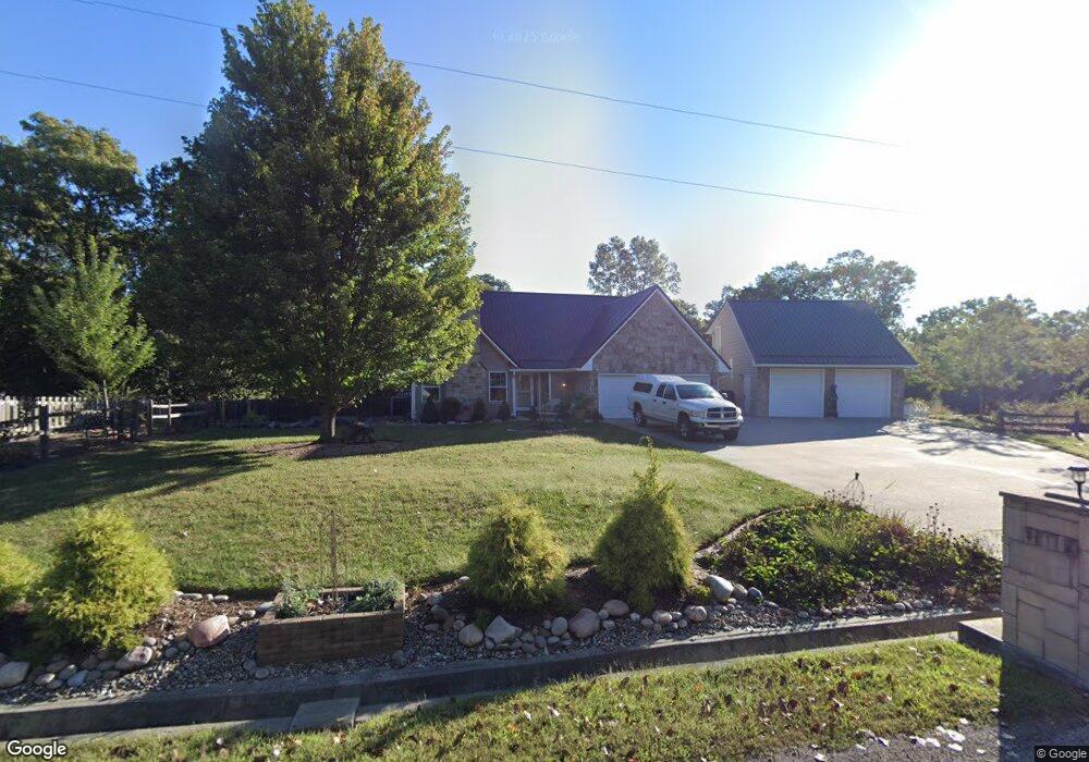
117 SE 591st Rd Warrensburg, MO 64093
Estimated Value: $335,000 - $533,000
--
Bed
--
Bath
2,866
Sq Ft
$147/Sq Ft
Est. Value
About This Home
This home is located at 117 SE 591st Rd, Warrensburg, MO 64093 and is currently estimated at $421,960, approximately $147 per square foot. 117 SE 591st Rd is a home located in Johnson County with nearby schools including Maple Grove Elementary School, Martin Warren Elementary School, and Warrensburg Middle School.
Ownership History
Date
Name
Owned For
Owner Type
Purchase Details
Closed on
Dec 22, 2020
Sold by
Comer Bradley A and Comer Michala P
Bought by
Comer Bradley A and Comer Michala P
Current Estimated Value
Home Financials for this Owner
Home Financials are based on the most recent Mortgage that was taken out on this home.
Original Mortgage
$257,800
Interest Rate
2.8%
Mortgage Type
New Conventional
Create a Home Valuation Report for This Property
The Home Valuation Report is an in-depth analysis detailing your home's value as well as a comparison with similar homes in the area
Home Values in the Area
Average Home Value in this Area
Purchase History
| Date | Buyer | Sale Price | Title Company |
|---|---|---|---|
| Comer Bradley A | -- | Wmtc |
Source: Public Records
Mortgage History
| Date | Status | Borrower | Loan Amount |
|---|---|---|---|
| Closed | Comer Bradley A | $257,800 |
Source: Public Records
Tax History Compared to Growth
Tax History
| Year | Tax Paid | Tax Assessment Tax Assessment Total Assessment is a certain percentage of the fair market value that is determined by local assessors to be the total taxable value of land and additions on the property. | Land | Improvement |
|---|---|---|---|---|
| 2024 | $3,155 | $43,323 | $0 | $0 |
| 2023 | $3,155 | $43,323 | $0 | $0 |
| 2022 | $3,046 | $41,631 | $0 | $0 |
| 2021 | $3,035 | $41,631 | $0 | $0 |
| 2020 | $2,948 | $39,934 | $0 | $0 |
| 2019 | $2,945 | $39,934 | $0 | $0 |
| 2017 | $2,802 | $39,554 | $0 | $0 |
| 2016 | $2,794 | $39,554 | $0 | $0 |
| 2015 | $2,877 | $39,554 | $0 | $0 |
| 2014 | -- | $39,554 | $0 | $0 |
Source: Public Records
Map
Nearby Homes
- 137 SE 611th Rd
- 628 SE 150th St
- 463 SE 90th Rd
- 80 SE 451st Rd
- 109 SE 421st Rd
- 176 SE 431st Rd
- 122 SE 411th Rd
- 174 SE 421st Rd
- 170 SE 411th Rd
- 365 SE 85th Rd
- 84 SE 351st Rd
- 125 NE 641st Rd
- 83 SE 381st Rd
- 1226 Pembrooke Dr
- 1503 Nottingham Dr
- 604 Angus Ln
- 900 Summit Rd
- 46 NE 231st Rd
- 210 Parkway Dr
- 611 Summit Rd
- 113 SE 591st Rd
- 113 SE 591
- 599 SE 125th Rd
- 111 SE 591st Rd
- 114 SE 591st Rd
- 601 SE 125th Rd
- 112 SE 591st Rd
- 586 SE 115th Rd
- 584 SE 115th Rd
- 603 SE 125th Rd
- 603 SE 125 Rd
- 604 SE 125th Rd
- 602 SE 120th Rd
- 642 SE 115th Rd
- 600 SE 120 (State Park Village)
- 590 SE 115th Rd
- 595 SE 110th Rd
- 589 SE 110th Rd
- 605 SE 125th Rd
- 582 SE 115 Rd