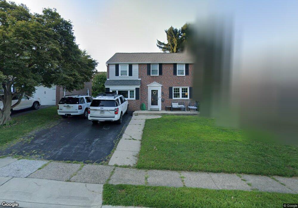
117 Signal Rd Drexel Hill, PA 19026
Estimated Value: $493,952 - $557,000
4
Beds
2
Baths
1,850
Sq Ft
$289/Sq Ft
Est. Value
About This Home
This home is located at 117 Signal Rd, Drexel Hill, PA 19026 and is currently estimated at $533,738, approximately $288 per square foot. 117 Signal Rd is a home located in Delaware County with nearby schools including Manoa Elementary School, Haverford Middle School, and Haverford Senior High School.
Ownership History
Date
Name
Owned For
Owner Type
Purchase Details
Closed on
Aug 9, 2018
Sold by
Lever Karen T and Santoro Lisa A
Bought by
Mcparland Robert Deruschi and Obrien Danielle
Current Estimated Value
Home Financials for this Owner
Home Financials are based on the most recent Mortgage that was taken out on this home.
Original Mortgage
$270,506
Outstanding Balance
$234,924
Interest Rate
4.5%
Mortgage Type
New Conventional
Estimated Equity
$298,815
Purchase Details
Closed on
May 29, 2000
Sold by
Obrien Theresa A
Bought by
Obrien Theresa A and Lever Karen T
Create a Home Valuation Report for This Property
The Home Valuation Report is an in-depth analysis detailing your home's value as well as a comparison with similar homes in the area
Home Values in the Area
Average Home Value in this Area
Purchase History
| Date | Buyer | Sale Price | Title Company |
|---|---|---|---|
| Mcparland Robert Deruschi | $290,000 | Amrock | |
| Obrien Theresa A | -- | -- |
Source: Public Records
Mortgage History
| Date | Status | Borrower | Loan Amount |
|---|---|---|---|
| Open | Mcparland Robert Deruschi | $270,506 |
Source: Public Records
Tax History Compared to Growth
Tax History
| Year | Tax Paid | Tax Assessment Tax Assessment Total Assessment is a certain percentage of the fair market value that is determined by local assessors to be the total taxable value of land and additions on the property. | Land | Improvement |
|---|---|---|---|---|
| 2025 | $7,598 | $295,490 | $93,840 | $201,650 |
| 2024 | $7,598 | $295,490 | $93,840 | $201,650 |
| 2023 | $7,382 | $295,490 | $93,840 | $201,650 |
| 2022 | $7,209 | $295,490 | $93,840 | $201,650 |
| 2021 | $11,745 | $295,490 | $93,840 | $201,650 |
| 2020 | $6,669 | $143,490 | $51,210 | $92,280 |
| 2019 | $6,546 | $143,490 | $51,210 | $92,280 |
| 2018 | $6,434 | $143,490 | $0 | $0 |
| 2017 | $6,298 | $143,490 | $0 | $0 |
| 2016 | $787 | $143,490 | $0 | $0 |
| 2015 | $787 | $143,490 | $0 | $0 |
| 2014 | $787 | $143,490 | $0 | $0 |
Source: Public Records
Map
Nearby Homes
- 2223 Steele Rd
- 104 Treaty Rd
- 181 Friendship Rd
- 5053 Sylvia Rd
- 5042 Sylvia Rd
- 505 Glendale Rd
- 5233 Arrowhead Ln
- 736 Timber Trail Ln
- 921 Addingham Ave
- 1042 Blythe Ave
- 4938 State Rd
- 920 Alexander Ave
- 1029 Belfield Ave
- 833 Anderson Ave
- 1102 Childs Ave
- 837 Alexander Ave
- 1223 Drexel Ave
- 412 N Rolling Rd
- 414 Stanfield Rd
- 6 N Lexington Ave
- 113 Signal Rd
- 121 Signal Rd
- 109 Signal Rd
- 125 Signal Rd
- 120 Flintlock Rd
- 116 Flintlock Rd
- 124 Flintlock Rd
- 112 Flintlock Rd
- 116 Signal Rd
- 129 Signal Rd
- 128 Flintlock Rd
- 112 Signal Rd
- 105 Signal Rd
- 108 Signal Rd
- 120 Signal Rd
- 108 Flintlock Rd
- 132 Flintlock Rd
- 104 Signal Rd
- 133 Signal Rd
- 124 Signal Rd