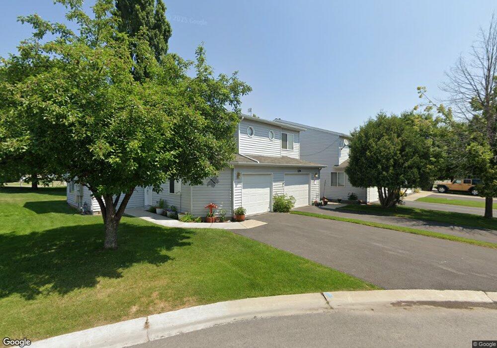
117 Sunburst Ct Kalispell, MT 59901
Estimated Value: $319,000 - $346,000
2
Beds
2
Baths
1,127
Sq Ft
$297/Sq Ft
Est. Value
About This Home
This home is located at 117 Sunburst Ct, Kalispell, MT 59901 and is currently estimated at $334,630, approximately $296 per square foot. 117 Sunburst Ct is a home located in Flathead County with nearby schools including Russell School, Kalispell Middle School, and Glacier High School.
Ownership History
Date
Name
Owned For
Owner Type
Purchase Details
Closed on
Dec 4, 2019
Sold by
Gorton Rhonda J
Bought by
Bourriiague Jacqueline K and The Rhonda Gorton Family Trut
Current Estimated Value
Purchase Details
Closed on
Jul 17, 2017
Sold by
Gorton Rhonda J and Gorton Thomas Dudley
Bought by
Gorton Rhonda J
Purchase Details
Closed on
May 15, 2015
Sold by
Bowers Rhonda J
Bought by
Gorton Rhonda J and Gorton Thomas Dudley
Purchase Details
Closed on
Jan 27, 2011
Sold by
Castner Rhonda J and Castner John Paul
Bought by
Bowers Rhonda J
Create a Home Valuation Report for This Property
The Home Valuation Report is an in-depth analysis detailing your home's value as well as a comparison with similar homes in the area
Purchase History
| Date | Buyer | Sale Price | Title Company |
|---|---|---|---|
| Bourriiague Jacqueline K | -- | None Available | |
| Gorton Rhonda J | -- | None Available | |
| Gorton Rhonda J | -- | None Available | |
| Bowers Rhonda J | -- | None Available |
Source: Public Records
Tax History
| Year | Tax Paid | Tax Assessment Tax Assessment Total Assessment is a certain percentage of the fair market value that is determined by local assessors to be the total taxable value of land and additions on the property. | Land | Improvement |
|---|---|---|---|---|
| 2025 | $1,720 | $357,900 | $0 | $0 |
| 2024 | $1,997 | $256,400 | $0 | $0 |
| 2023 | $2,273 | $256,400 | $0 | $0 |
| 2022 | $2,189 | $185,400 | $0 | $0 |
| 2021 | $1,995 | $185,400 | $0 | $0 |
| 2020 | $1,904 | $150,400 | $0 | $0 |
| 2019 | $280 | $150,400 | $0 | $0 |
| 2018 | $587 | $136,300 | $0 | $0 |
| 2017 | $1,828 | $136,300 | $0 | $0 |
| 2016 | $1,522 | $120,200 | $0 | $0 |
| 2015 | $1,524 | $120,200 | $0 | $0 |
Source: Public Records
Map
Nearby Homes
- 114 Lambert Ct
- 71 Hawthorn Ave
- 195 Two Mile Dr
- 97 Hawthorn W
- 19 Glacier St
- 221 Hawthorn Ave
- 786 5th Avenue West N
- 163 Greenbriar Dr
- 417 W Arizona St
- 106 Northern Lights Blvd
- 503 W Oregon St
- 875 & 871 2 Mile Dr
- 28 Vista Loop
- 252 Three Mile Dr
- 111 Westview Park Place
- 120 Garland St
- 249 Three Mile Dr
- 36 9th Ave W
- 17 Empire Loop
- 262 Buffalo Hill Dr
- 115 Sunburst Ct
- 119 Sunburst Ct
- 113 Sunburst Ct
- 121 Sunburst Ct
- 111 Sunburst Ct
- 116 Lambert Ct
- 112 Lambert Ct
- 123 Sunburst Ct
- 120 Lambert Ct
- 110 Lambert Ct
- 125 Sunburst Ct
- 122 Lambert Ct
- 112 Sunburst Ct
- 120 Sunburst Ct
- 124 Lambert Ct
- 130 Sunburst Ct
- 127 Sunburst Ct
- 110 Sunburst Ct
- 126 Lambert Ct
- 122 Sunburst Ct
Your Personal Tour Guide
Ask me questions while you tour the home.