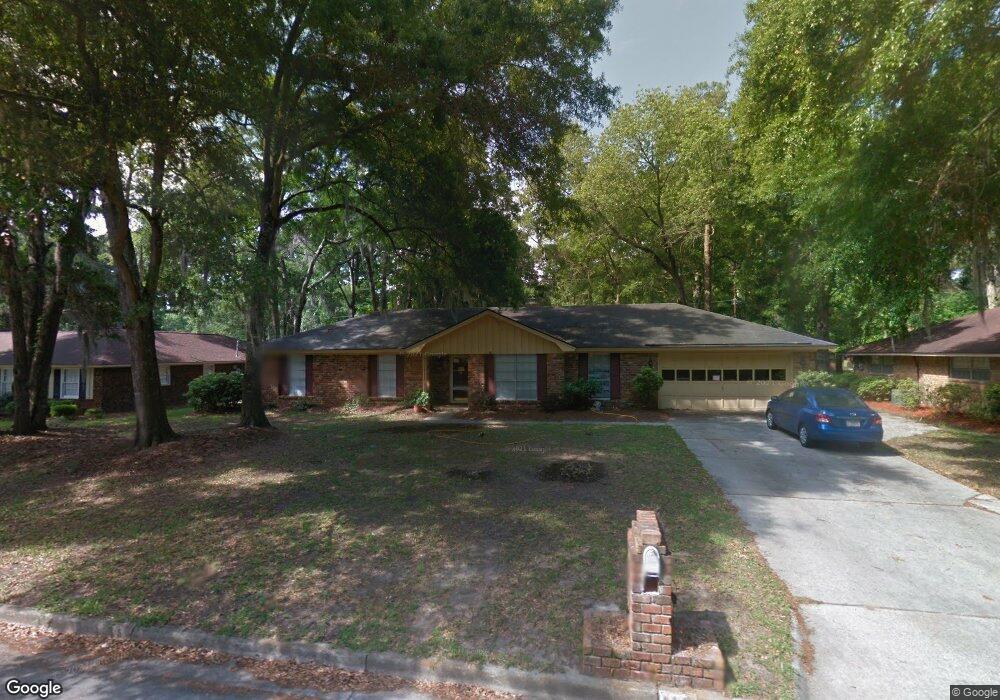
117 Talbot Rd Savannah, GA 31410
Estimated Value: $419,140 - $541,000
--
Bed
2
Baths
1,804
Sq Ft
$271/Sq Ft
Est. Value
About This Home
This home is located at 117 Talbot Rd, Savannah, GA 31410 and is currently estimated at $489,035, approximately $271 per square foot. 117 Talbot Rd is a home located in Chatham County with nearby schools including Howard Elementary School, Coastal Middle School, and Islands High School.
Ownership History
Date
Name
Owned For
Owner Type
Purchase Details
Closed on
Nov 12, 2014
Sold by
Burdette Richard Donald
Bought by
Burdette Sue Sherrill
Current Estimated Value
Create a Home Valuation Report for This Property
The Home Valuation Report is an in-depth analysis detailing your home's value as well as a comparison with similar homes in the area
Home Values in the Area
Average Home Value in this Area
Purchase History
| Date | Buyer | Sale Price | Title Company |
|---|---|---|---|
| Burdette Sue Sherrill | -- | -- |
Source: Public Records
Tax History Compared to Growth
Tax History
| Year | Tax Paid | Tax Assessment Tax Assessment Total Assessment is a certain percentage of the fair market value that is determined by local assessors to be the total taxable value of land and additions on the property. | Land | Improvement |
|---|---|---|---|---|
| 2025 | $2,438 | $143,760 | $27,720 | $116,040 |
| 2024 | $2,438 | $99,800 | $27,720 | $72,080 |
| 2023 | $1,633 | $91,320 | $27,720 | $63,600 |
| 2022 | $2,021 | $115,760 | $27,720 | $88,040 |
| 2021 | $2,123 | $94,600 | $27,720 | $66,880 |
| 2020 | $2,030 | $94,680 | $27,720 | $66,960 |
| 2019 | $2,151 | $94,680 | $27,720 | $66,960 |
| 2018 | $2,127 | $93,560 | $27,720 | $65,840 |
| 2017 | $2,032 | $85,440 | $27,720 | $57,720 |
| 2016 | $1,838 | $85,160 | $27,720 | $57,440 |
| 2015 | $79 | $87,360 | $27,720 | $59,640 |
| 2014 | $2,632 | $90,600 | $0 | $0 |
Source: Public Records
Map
Nearby Homes
- 11 Mary Musgrove Dr
- 128 Mary Musgrove Dr
- 35 Clarendon Rd
- 127 Druid Cir
- 229 Island Creek Ln
- 235 Island Creek Ln
- 209 Deerwood Rd
- 12 Cromwell Place
- 401 N Cromwell Rd Unit Q7
- 401 N Cromwell Rd Unit 2Q
- 401 N Cromwell Rd Unit F6
- 401 N Cromwell Rd Unit T-5
- 401 N Cromwell Rd Unit Q2
- 401 N Cromwell Rd Unit F-5
- 111 Carlton Rd
- 104 Saint Andrews Way
- 1024 Walthour Rd
- 1022 Walthour Rd
- 710 Leaning Oaks Dr
- 24 Crisp St
- 115 Talbot Rd
- 119 Talbot Rd
- 120 Hampshire Rd
- 118 Hampshire Rd
- 118 Talbot Rd
- 122 Hampshire Rd
- 113 Talbot Rd
- 120 Talbot Rd
- 121 Talbot Rd
- 116 Talbot Rd
- 116 Hampshire Rd
- 122 Talbot Rd
- 124 Hampshire Rd
- 114 Talbot Rd
- 111 Talbot Rd
- 114 Hampshire Rd
- 123 Talbot Rd
- 115 Steerforth Rd
- 117 Steerforth Rd
- 123 Hampshire Rd