Estimated Value: $59,568 - $108,000
4
Beds
1
Bath
1,836
Sq Ft
$50/Sq Ft
Est. Value
About This Home
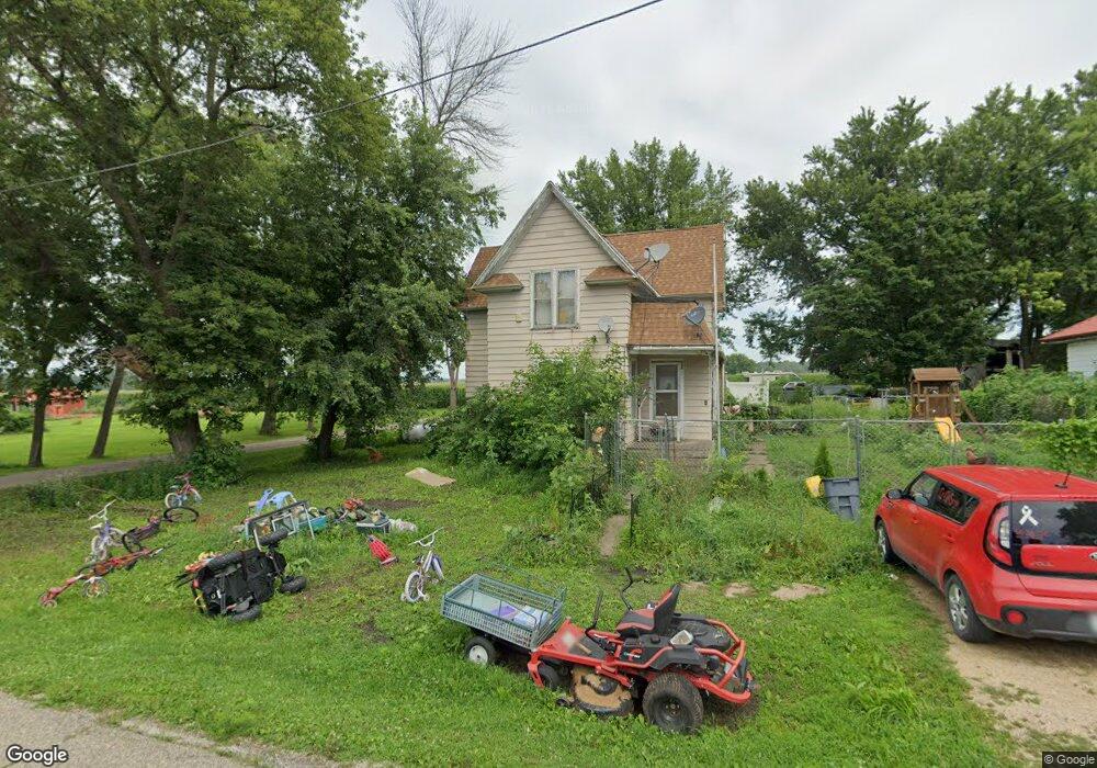
This home is located at 117 W Paul St, Ionia, IA 50645 and is currently estimated at $92,392, approximately $50 per square foot. 117 W Paul St is a home located in Chickasaw County with nearby schools including Charles City High School.
Ownership History
Date
Name
Owned For
Owner Type
Purchase Details
Closed on
Mar 11, 2009
Sold by
Powers Bobbie Jo and Stone Bobbie Jo
Bought by
Hampton Curt R
Current Estimated Value
Purchase Details
Closed on
Aug 30, 2006
Sold by
Nibaur Randy L and Nibaur Cathy A
Bought by
Hampton Curt R and Stone Bobbie Jo
Home Financials for this Owner
Home Financials are based on the most recent Mortgage that was taken out on this home.
Original Mortgage
$44,000
Interest Rate
6.77%
Mortgage Type
New Conventional
Create a Home Valuation Report for This Property
The Home Valuation Report is an in-depth analysis detailing your home's value as well as a comparison with similar homes in the area
Home Values in the Area
Average Home Value in this Area
Purchase History
| Date | Buyer | Sale Price | Title Company |
|---|---|---|---|
| Hampton Curt R | -- | None Available | |
| Hampton Curt R | $44,000 | All American Escrow & Title |
Source: Public Records
Mortgage History
| Date | Status | Borrower | Loan Amount |
|---|---|---|---|
| Previous Owner | Hampton Curt R | $44,000 |
Source: Public Records
Tax History Compared to Growth
Tax History
| Year | Tax Paid | Tax Assessment Tax Assessment Total Assessment is a certain percentage of the fair market value that is determined by local assessors to be the total taxable value of land and additions on the property. | Land | Improvement |
|---|---|---|---|---|
| 2025 | $380 | $46,900 | $2,900 | $44,000 |
| 2024 | $380 | $38,100 | $2,900 | $35,200 |
| 2023 | $426 | $38,100 | $2,900 | $35,200 |
| 2022 | $418 | $36,500 | $1,800 | $34,700 |
| 2021 | $420 | $36,500 | $1,800 | $34,700 |
| 2020 | $278 | $26,600 | $1,800 | $24,800 |
| 2019 | $252 | $24,300 | $0 | $0 |
| 2018 | $252 | $24,300 | $0 | $0 |
| 2017 | $242 | $24,300 | $0 | $0 |
| 2016 | $246 | $24,300 | $0 | $0 |
| 2015 | $238 | $24,300 | $0 | $0 |
| 2014 | $244 | $28,500 | $0 | $0 |
Source: Public Records
Map
Nearby Homes
- 2325 Beaumont Ave
- 1254 220th St Unit LotWP001
- 1914 Windfall Ave
- 0 Cheyenne Ave
- 2370 Exeter Ave
- 2996 Chestnut Place
- 2992 Cottonwood Place Unit Lot 5
- 2993 Cottonwood Place Unit Lot 3
- Lot 2 Harbor Ridge
- Lot 3 Harbor Ridge
- Lot 4 Harbor Ridge
- Lot 31 Harbor Ridge
- Lot 1 Harbor Ridge
- 2985 Cottonwood Place Unit Lot 1
- Lot 30 Harbor Ridge
- 2989 Cottonwood Place Unit Lot 2
- Lot 24 Harbor Ridge
- Lot 5 Harbor Ridge
- Lot 25 Harbor Ridge
- Lot 29 Harbor Ridge