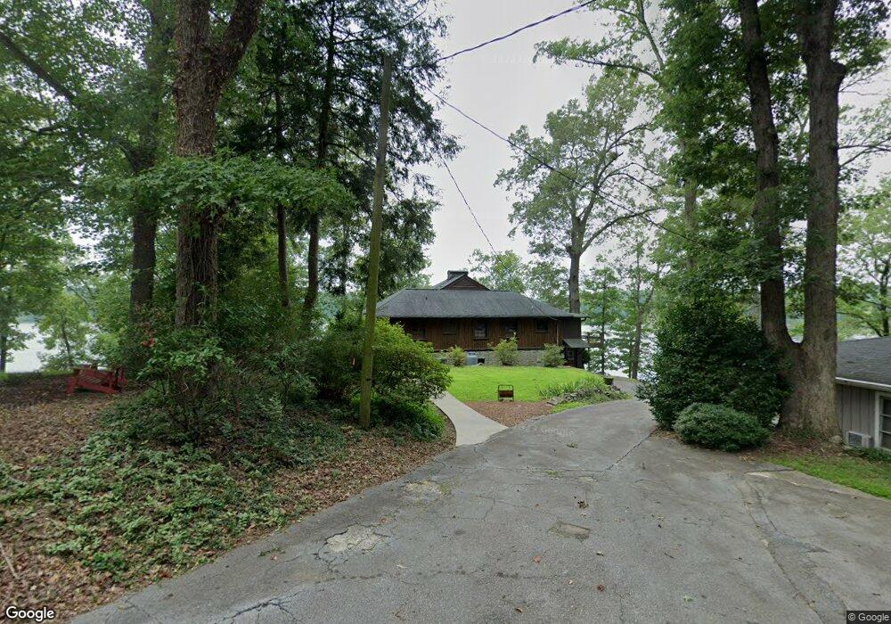
117 W Point Dr Unit 117 West Point Dr Anderson, SC 29621
Estimated Value: $491,100 - $724,000
5
Beds
3
Baths
2,325
Sq Ft
$258/Sq Ft
Est. Value
About This Home
This home is located at 117 W Point Dr Unit 117 West Point Dr, Anderson, SC 29621 and is currently estimated at $599,025, approximately $257 per square foot. 117 W Point Dr Unit 117 West Point Dr is a home located in Anderson County with nearby schools including Belton Honea Path High School.
Ownership History
Date
Name
Owned For
Owner Type
Purchase Details
Closed on
Oct 28, 2014
Sold by
Herbert Jeffrey R and Herbert James O
Bought by
Hatfield Michael M
Current Estimated Value
Home Financials for this Owner
Home Financials are based on the most recent Mortgage that was taken out on this home.
Original Mortgage
$266,400
Outstanding Balance
$206,011
Interest Rate
4.26%
Mortgage Type
New Conventional
Estimated Equity
$393,014
Purchase Details
Closed on
Oct 9, 2014
Sold by
Estate Of Richard O Herbert and Herbert Jeffrey L
Bought by
Herbert Jeffrey R and Herbert James O
Home Financials for this Owner
Home Financials are based on the most recent Mortgage that was taken out on this home.
Original Mortgage
$266,400
Outstanding Balance
$206,011
Interest Rate
4.26%
Mortgage Type
New Conventional
Estimated Equity
$393,014
Purchase Details
Closed on
Sep 5, 2008
Sold by
Booker Mel P and Booker Price F
Bought by
Herbert James O and Herbert John L
Home Financials for this Owner
Home Financials are based on the most recent Mortgage that was taken out on this home.
Original Mortgage
$225,000
Interest Rate
6.48%
Mortgage Type
Purchase Money Mortgage
Purchase Details
Closed on
May 28, 2004
Sold by
Booker Mel P
Bought by
Booker Mel P
Create a Home Valuation Report for This Property
The Home Valuation Report is an in-depth analysis detailing your home's value as well as a comparison with similar homes in the area
Home Values in the Area
Average Home Value in this Area
Purchase History
| Date | Buyer | Sale Price | Title Company |
|---|---|---|---|
| Hatfield Michael M | $333,000 | -- | |
| Herbert Jeffrey R | -- | -- | |
| Herbert James O | $225,000 | -- | |
| Booker Mel P | -- | -- |
Source: Public Records
Mortgage History
| Date | Status | Borrower | Loan Amount |
|---|---|---|---|
| Open | Hatfield Michael M | $266,400 | |
| Previous Owner | Herbert James O | $225,000 |
Source: Public Records
Tax History Compared to Growth
Tax History
| Year | Tax Paid | Tax Assessment Tax Assessment Total Assessment is a certain percentage of the fair market value that is determined by local assessors to be the total taxable value of land and additions on the property. | Land | Improvement |
|---|---|---|---|---|
| 2024 | $8,115 | $23,320 | $7,500 | $15,820 |
| 2023 | $8,115 | $23,320 | $7,500 | $15,820 |
| 2022 | $7,826 | $23,320 | $7,500 | $15,820 |
| 2021 | $6,945 | $19,410 | $6,300 | $13,110 |
| 2020 | $6,865 | $19,410 | $6,300 | $13,110 |
| 2019 | $6,865 | $19,410 | $6,300 | $13,110 |
| 2018 | $6,910 | $19,410 | $6,300 | $13,110 |
| 2017 | -- | $19,410 | $6,300 | $13,110 |
| 2016 | $6,723 | $19,050 | $6,000 | $13,050 |
| 2015 | $6,930 | $10,040 | $2,400 | $7,640 |
| 2014 | $3,685 | $10,040 | $2,400 | $7,640 |
Source: Public Records
Map
Nearby Homes
- 450 Johnson Ave
- 112 Linkside Dr
- 230 Hammond Cir
- 329 McFalls Landing
- 218 Hammond Cir
- 1905 Broadway Lake Rd
- 801 McFalls Cir
- 1111 Shirley Dr
- 118 Lakeside Dr
- 2213 Broadway Lake Rd
- 00 Shirley Dr
- 120 Guest Cir
- 0 Guest Cir
- 04 Guest Cir
- 03 Guest Cir
- 02 Guest Cir
- 01 Guest Cir
- 0 Broadway Lake Rd Unit 23383777
- Lot 8 and Lot 9 High Shoals Rd
- Lot 10 High Shoals Rd
- 117A W Point Dr
- 117B W Point Dr
- 117 W Point Dr
- 115 W Point Dr
- 115 W Point Dr Unit ANDERSON
- 113 W Point Dr
- 105 N Point Dr
- 111 W Point Dr
- 105 W Point Dr
- 1010 Lakeside Dr
- 103 N Point Dr
- 107 N Point Dr
- 109 W Point Dr
- 109 N Point Dr
- 946 Lakeside Dr
- 946 Lakeside Dr Unit 946/948 Lakeside Dri
- W W Point Dr
- 1122 Lakeside Dr
- 1118 Lakeside Dr
- 1015 Lakeside Dr Unit Lot 2A