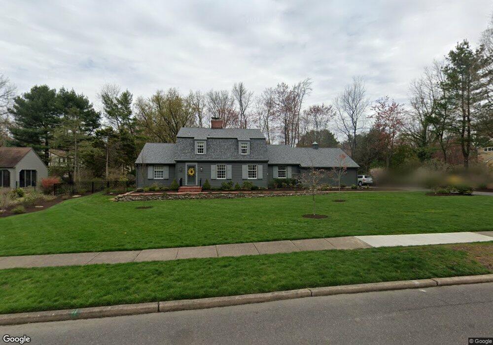
117 W Walnut Ave Moorestown, NJ 08057
Estimated Value: $884,000 - $1,171,000
--
Bed
--
Bath
2,810
Sq Ft
$369/Sq Ft
Est. Value
About This Home
This home is located at 117 W Walnut Ave, Moorestown, NJ 08057 and is currently estimated at $1,037,236, approximately $369 per square foot. 117 W Walnut Ave is a home located in Burlington County with nearby schools including George C. Baker Elementary School, Moorestown Upper Elementary School, and William Allen Middle School.
Ownership History
Date
Name
Owned For
Owner Type
Purchase Details
Closed on
Dec 17, 2024
Sold by
Biddle Joan W
Bought by
Biddle Holding Trust and Biddle
Current Estimated Value
Purchase Details
Closed on
Feb 19, 2019
Sold by
Biddle C Miller and Wilmarth Joan G
Bought by
Biddle C Miller and Biddle Joan W
Purchase Details
Closed on
Jan 30, 1992
Bought by
Biddle Biddle C and Biddle Wilmarth, J
Create a Home Valuation Report for This Property
The Home Valuation Report is an in-depth analysis detailing your home's value as well as a comparison with similar homes in the area
Home Values in the Area
Average Home Value in this Area
Purchase History
| Date | Buyer | Sale Price | Title Company |
|---|---|---|---|
| Biddle Holding Trust | -- | None Listed On Document | |
| Biddle Holding Trust | -- | None Listed On Document | |
| Biddle C Miller | -- | None Available | |
| Biddle Biddle C | $325,000 | -- |
Source: Public Records
Tax History Compared to Growth
Tax History
| Year | Tax Paid | Tax Assessment Tax Assessment Total Assessment is a certain percentage of the fair market value that is determined by local assessors to be the total taxable value of land and additions on the property. | Land | Improvement |
|---|---|---|---|---|
| 2025 | $15,689 | $553,000 | $276,000 | $277,000 |
| 2024 | $15,213 | $553,000 | $276,000 | $277,000 |
| 2023 | $15,213 | $553,000 | $276,000 | $277,000 |
| 2022 | $15,058 | $553,000 | $276,000 | $277,000 |
| 2021 | $14,859 | $553,000 | $276,000 | $277,000 |
| 2020 | $14,765 | $553,000 | $276,000 | $277,000 |
| 2019 | $14,505 | $553,000 | $276,000 | $277,000 |
| 2018 | $14,113 | $553,000 | $276,000 | $277,000 |
| 2017 | $14,234 | $553,000 | $276,000 | $277,000 |
| 2016 | $14,184 | $553,000 | $276,000 | $277,000 |
| 2015 | $14,013 | $553,000 | $276,000 | $277,000 |
| 2014 | $13,305 | $553,000 | $276,000 | $277,000 |
Source: Public Records
Map
Nearby Homes
- 543 Bethel Ave
- 493 N Church St
- 308 Farmdale Rd
- 316 Farmdale Rd
- 423 Park Blvd
- 313 Fairview Ave
- 316 W 3rd St
- 15 E 2nd St
- 50 E 3rd St
- 66 E 3rd St
- 82 E 3rd St
- 80 E 3rd St
- 531 Covington Terrace
- 129 S Church St
- 4 W Close
- 25 Oriole Way
- 133 Plum St Unit 6
- 205 E Central Ave
- 863 Golf View Rd
- 310 S Washington Ave
- 113 W Walnut Ave
- 121 W Walnut Ave
- 6 Walnut Ct
- 705 Iron Post Rd
- 116 W Walnut Ave
- 112 W Walnut Ave
- 120 W Walnut Ave
- 709 Iron Post Rd
- 5 Walnut Ct
- 109 W Walnut Ave
- 108 W Walnut Ave
- 700 Iron Post Rd
- 704 Iron Post Rd
- 4 Walnut Ct
- 104 W Walnut Ave
- 713 Iron Post Rd
- 42 Middleton Rd
- 105 W Walnut Ave
- 708 Iron Post Rd
- 129 W Spruce Ave