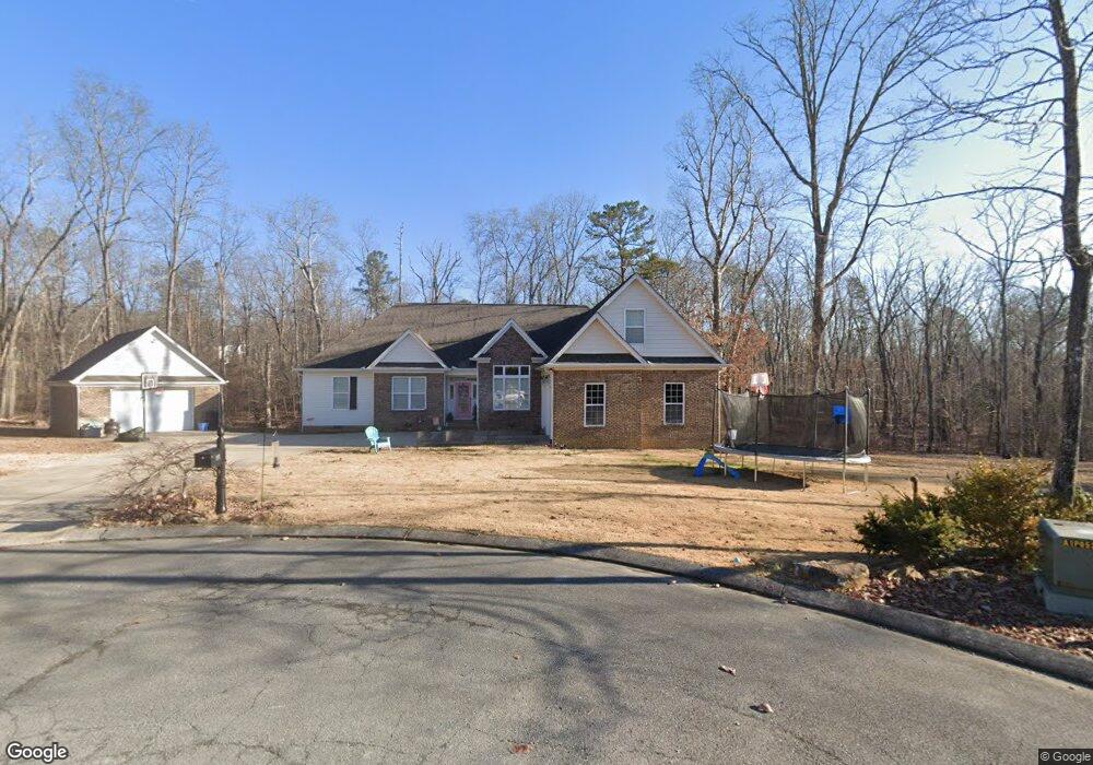
117 Wade Rd E Unit E Signal Mountain, TN 37377
Estimated Value: $573,216 - $715,000
Studio
4
Baths
2,892
Sq Ft
$230/Sq Ft
Est. Value
About This Home
This home is located at 117 Wade Rd E Unit E, Signal Mountain, TN 37377 and is currently estimated at $666,054, approximately $230 per square foot. 117 Wade Rd E Unit E is a home located in Sequatchie County with nearby schools including Griffith Elementary School, Sequatchie County Middle School, and Sequatchie County High School.
Ownership History
Date
Name
Owned For
Owner Type
Purchase Details
Closed on
Aug 19, 2016
Sold by
Hamilton Samuel Lloyd
Bought by
Barnett Gayla L
Current Estimated Value
Home Financials for this Owner
Home Financials are based on the most recent Mortgage that was taken out on this home.
Original Mortgage
$284,525
Outstanding Balance
$225,561
Interest Rate
3.45%
Mortgage Type
New Conventional
Estimated Equity
$440,493
Purchase Details
Closed on
Apr 5, 2010
Sold by
Hamilton Samuel Lloyd
Bought by
Greer Thomas Avery
Purchase Details
Closed on
Sep 11, 2009
Sold by
Martin Bryan
Bought by
Hamilton Samuel Lloyd
Purchase Details
Closed on
Aug 28, 2009
Sold by
Martin Bryan
Bought by
Greer Thomas Avery
Purchase Details
Closed on
May 3, 2006
Sold by
Parke Estes H and Parke Florence Parke
Bought by
Bryan Martin
Create a Home Valuation Report for This Property
The Home Valuation Report is an in-depth analysis detailing your home's value as well as a comparison with similar homes in the area
Home Values in the Area
Average Home Value in this Area
Purchase History
| Date | Buyer | Sale Price | Title Company |
|---|---|---|---|
| Barnett Gayla L | $299,500 | -- | |
| Greer Thomas Avery | -- | -- | |
| Hamilton Samuel Lloyd | $270,000 | -- | |
| Greer Thomas Avery | $1,500 | -- | |
| Bryan Martin | $12,000 | -- |
Source: Public Records
Mortgage History
| Date | Status | Borrower | Loan Amount |
|---|---|---|---|
| Open | Barnett Gayla L | $284,525 |
Source: Public Records
Tax History
| Year | Tax Paid | Tax Assessment Tax Assessment Total Assessment is a certain percentage of the fair market value that is determined by local assessors to be the total taxable value of land and additions on the property. | Land | Improvement |
|---|---|---|---|---|
| 2025 | $2,312 | $125,875 | $4,500 | $121,375 |
| 2024 | $2,312 | $125,875 | $4,500 | $121,375 |
| 2023 | $2,312 | $125,875 | $4,500 | $121,375 |
| 2022 | $1,823 | $74,650 | $3,900 | $70,750 |
| 2021 | $1,823 | $74,650 | $3,900 | $70,750 |
| 2020 | $1,823 | $74,650 | $3,900 | $70,750 |
| 2019 | $1,823 | $74,650 | $3,900 | $70,750 |
| 2018 | $1,823 | $74,650 | $3,900 | $70,750 |
| 2017 | $1,823 | $74,650 | $3,900 | $70,750 |
| 2016 | $1,587 | $61,775 | $3,900 | $57,875 |
| 2015 | $1,593 | $62,000 | $3,900 | $58,100 |
| 2014 | $1,593 | $62,000 | $3,900 | $58,100 |
Source: Public Records
Map
Nearby Homes
- 498 Hargis Rd
- 43 Miller Cove Cir
- 34 Miller Cove Cir
- 0 Dandy Rd Unit 1524756
- 763 U S 127
- 280 Pine Ridge Dr
- 361 Pine Ridge Dr
- 844 Miller Rd
- 28 Lynn Rd
- 435 County Line Rd
- 3014 Edgewood Dr
- 2922 Kell Rd
- 2819 Signal Farms Ln
- 2435 Blue Mist Dr
- 4805 Taft Hwy
- 967 Walden Dr
- Laurel Plan at The Sanctuary at Signal Forest
- Wellesley Plan at The Sanctuary at Signal Forest
- Chestnut Hill Plan at The Sanctuary at Signal Forest
- Stillwater Plan at The Sanctuary at Signal Forest
Your Personal Tour Guide
Ask me questions while you tour the home.